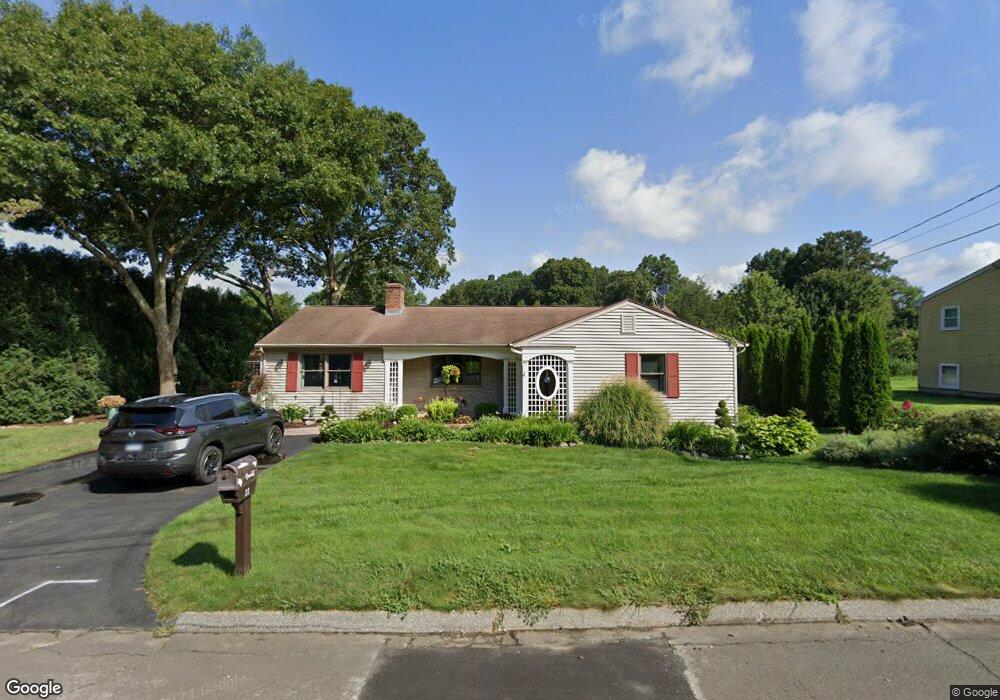
11 Wagonwheel Rd East Lyme, CT 06333
Estimated Value: $433,942 - $506,000
2
Beds
2
Baths
1,512
Sq Ft
$318/Sq Ft
Est. Value
About This Home
This home is located at 11 Wagonwheel Rd, East Lyme, CT 06333 and is currently estimated at $481,486, approximately $318 per square foot. 11 Wagonwheel Rd is a home located in New London County with nearby schools including East Lyme Middle School, East Lyme High School, and Carelot Children's Center - East Lyme.
Ownership History
Date
Name
Owned For
Owner Type
Purchase Details
Closed on
Sep 2, 1997
Sold by
Est Davis Bernard E and Sculco Cynthia D
Bought by
Foster Gilbert R
Current Estimated Value
Purchase Details
Closed on
May 12, 1988
Sold by
Oefinger James
Bought by
Brackett Paul
Purchase Details
Closed on
May 12, 1980
Bought by
Brackett Paul L and Brackett Kim A
Create a Home Valuation Report for This Property
The Home Valuation Report is an in-depth analysis detailing your home's value as well as a comparison with similar homes in the area
Home Values in the Area
Average Home Value in this Area
Purchase History
| Date | Buyer | Sale Price | Title Company |
|---|---|---|---|
| Foster Gilbert R | $135,000 | -- | |
| Brackett Paul | $154,500 | -- | |
| Brackett Paul L | -- | -- |
Source: Public Records
Mortgage History
| Date | Status | Borrower | Loan Amount |
|---|---|---|---|
| Open | Brackett Paul L | $55,000 | |
| Open | Brackett Paul L | $145,807 |
Source: Public Records
Tax History Compared to Growth
Tax History
| Year | Tax Paid | Tax Assessment Tax Assessment Total Assessment is a certain percentage of the fair market value that is determined by local assessors to be the total taxable value of land and additions on the property. | Land | Improvement |
|---|---|---|---|---|
| 2025 | $5,680 | $202,790 | $81,480 | $121,310 |
| 2024 | $5,344 | $202,790 | $81,480 | $121,310 |
| 2023 | $5,045 | $202,790 | $81,480 | $121,310 |
| 2022 | $4,835 | $202,790 | $81,480 | $121,310 |
| 2021 | $4,570 | $160,300 | $77,420 | $82,880 |
| 2020 | $4,504 | $158,830 | $77,420 | $81,410 |
| 2019 | $4,477 | $158,830 | $77,420 | $81,410 |
| 2018 | $4,344 | $158,830 | $77,420 | $81,410 |
| 2017 | $4,155 | $158,830 | $77,420 | $81,410 |
| 2016 | $3,973 | $156,660 | $73,290 | $83,370 |
| 2015 | $3,871 | $156,660 | $73,290 | $83,370 |
| 2014 | $3,765 | $156,660 | $73,290 | $83,370 |
Source: Public Records
Map
Nearby Homes
- 10 Filosi Rd
- 32 Upper Pattagansett Rd Unit 8
- 231 Boston Post Rd Unit 9
- 14 Irvingdell Place
- 138 Boston Post Rd Unit 10
- 138 Boston Post Rd Unit 11
- 138 Boston Post Rd Unit 16
- 138 Boston Post Rd Unit 17
- 138 Boston Post Rd Unit 3
- 20 Sunrise Trail
- 33 Arbor Crossing
- 18 Sandpiper Ln
- 1 Hathaway Rd
- 0 Cedarbrook Ln Unit 24110327
- 12 Brookfield Dr
- 43 Mayfield Terrace
- 11 Pumpkin Grove
- 14 Pumpkin Grove
- 5 Pumpkin Grove
- 48 Quailcrest Rd