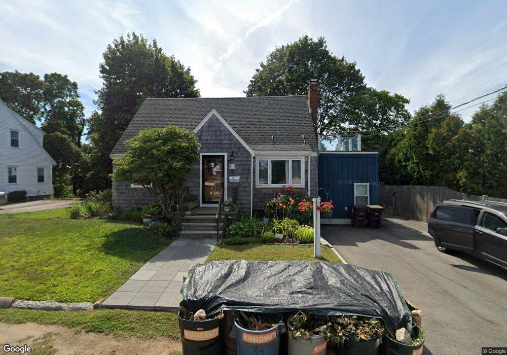
11 Walker St Weymouth, MA 02188
Weymouth Landing NeighborhoodEstimated Value: $657,000 - $740,000
2
Beds
1
Bath
1,360
Sq Ft
$511/Sq Ft
Est. Value
About This Home
This home is located at 11 Walker St, Weymouth, MA 02188 and is currently estimated at $695,422, approximately $511 per square foot. 11 Walker St is a home located in Norfolk County with nearby schools including Frederick C Murphy, Abigail Adams Middle School, and Weymouth Middle School Chapman.
Ownership History
Date
Name
Owned For
Owner Type
Purchase Details
Closed on
Nov 17, 2010
Sold by
Higgins Scott and Higgins Tammy
Bought by
Dobbins Lisa M
Current Estimated Value
Home Financials for this Owner
Home Financials are based on the most recent Mortgage that was taken out on this home.
Original Mortgage
$171,000
Outstanding Balance
$112,111
Interest Rate
4.3%
Mortgage Type
Purchase Money Mortgage
Estimated Equity
$583,311
Purchase Details
Closed on
Jun 30, 1999
Sold by
Coronite Thomas F and Coronite Patricia C
Bought by
Higgins Scott and Higgins Tammy
Home Financials for this Owner
Home Financials are based on the most recent Mortgage that was taken out on this home.
Original Mortgage
$169,888
Interest Rate
7.19%
Mortgage Type
Purchase Money Mortgage
Create a Home Valuation Report for This Property
The Home Valuation Report is an in-depth analysis detailing your home's value as well as a comparison with similar homes in the area
Home Values in the Area
Average Home Value in this Area
Purchase History
| Date | Buyer | Sale Price | Title Company |
|---|---|---|---|
| Dobbins Lisa M | $190,000 | -- | |
| Higgins Scott | $170,000 | -- |
Source: Public Records
Mortgage History
| Date | Status | Borrower | Loan Amount |
|---|---|---|---|
| Open | Dobbins Lisa M | $171,000 | |
| Previous Owner | Higgins Scott | $169,888 | |
| Previous Owner | Higgins Scott | $83,900 | |
| Previous Owner | Higgins Scott | $107,200 |
Source: Public Records
Tax History
| Year | Tax Paid | Tax Assessment Tax Assessment Total Assessment is a certain percentage of the fair market value that is determined by local assessors to be the total taxable value of land and additions on the property. | Land | Improvement |
|---|---|---|---|---|
| 2025 | $6,848 | $678,000 | $221,700 | $456,300 |
| 2024 | $6,632 | $645,800 | $211,100 | $434,700 |
| 2023 | $6,312 | $604,000 | $195,500 | $408,500 |
| 2022 | $5,763 | $502,900 | $181,000 | $321,900 |
| 2021 | $3,870 | $329,600 | $181,000 | $148,600 |
| 2020 | $3,704 | $310,700 | $181,000 | $129,700 |
| 2019 | $3,615 | $298,300 | $174,100 | $124,200 |
| 2018 | $3,513 | $281,000 | $165,800 | $115,200 |
| 2017 | $3,246 | $253,400 | $157,900 | $95,500 |
| 2016 | $3,172 | $247,800 | $151,800 | $96,000 |
| 2015 | $3,046 | $236,100 | $144,900 | $91,200 |
| 2014 | $2,918 | $219,400 | $134,900 | $84,500 |
Source: Public Records
Map
Nearby Homes
- 25 Richmond St
- 11 Richmond St
- 122 Washington St Unit Twenty-two
- 19 Vine St Unit 3
- 19 Vine St Unit 2
- 46 Roosevelt Rd
- 15 Summer St
- 37 Lantern Ln
- 41 Lantern Ln
- 33 Congress St
- 16 Beechwood Rd
- 211 Roosevelt Rd
- 54 Edgemont Rd
- 300 Commercial St Unit 23
- 70 Biscayne Ave
- 82 Lester Ln
- 312 Shaw St
- 26 Tingley Rd
- 49 Cornish St
- 29-31 Broad Street Place
Your Personal Tour Guide
Ask me questions while you tour the home.