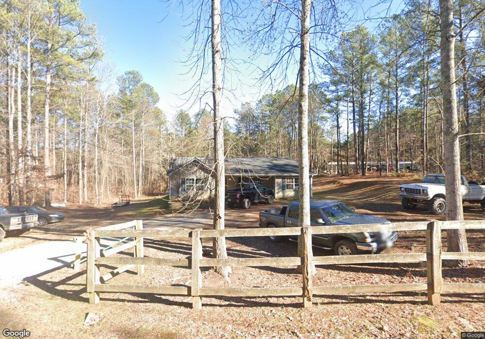
11 Walter Rd Buchanan, GA 30113
Estimated Value: $248,657 - $271,000
3
Beds
2
Baths
1,676
Sq Ft
$158/Sq Ft
Est. Value
About This Home
This home is located at 11 Walter Rd, Buchanan, GA 30113 and is currently estimated at $264,664, approximately $157 per square foot. 11 Walter Rd is a home located in Polk County with nearby schools including Cedartown High School.
Ownership History
Date
Name
Owned For
Owner Type
Purchase Details
Closed on
Jul 9, 2008
Sold by
Sec Of Houing & Ur
Bought by
Paro Rebekah
Current Estimated Value
Home Financials for this Owner
Home Financials are based on the most recent Mortgage that was taken out on this home.
Original Mortgage
$85,300
Outstanding Balance
$54,874
Interest Rate
6.27%
Mortgage Type
New Conventional
Estimated Equity
$209,791
Purchase Details
Closed on
Feb 21, 2008
Sold by
Us Bank
Bought by
Sec Of The Department Of
Purchase Details
Closed on
Feb 1, 2005
Sold by
J K Rentals Ltd
Bought by
Eastling Delmar
Home Financials for this Owner
Home Financials are based on the most recent Mortgage that was taken out on this home.
Original Mortgage
$86,600
Interest Rate
5.69%
Mortgage Type
New Conventional
Purchase Details
Closed on
Jul 20, 2004
Sold by
Hodapp Jo Anne
Bought by
J K Rentals Ltd
Purchase Details
Closed on
Mar 28, 2003
Sold by
Slaughter Slaughter E and Slaughter Major Z
Bought by
Hodapp Jo Anne
Create a Home Valuation Report for This Property
The Home Valuation Report is an in-depth analysis detailing your home's value as well as a comparison with similar homes in the area
Purchase History
We collect this data history from publicly available records. To have your information removed, we recommend requesting removal directly through your county’s website.
| Date | Buyer | Sale Price | Title Company |
|---|---|---|---|
| Paro Rebekah | $76,750 | -- | |
| Sec Of The Department Of | -- | -- | |
| Mtg Elctronic Registration Sys | -- | -- | |
| Eastling Delmar | $88,000 | -- | |
| J K Rentals Ltd | $8,900 | -- | |
| Hodapp Jo Anne | $6,000 | -- |
Source: Public Records
Mortgage History
We collect this data history from publicly available records. To have your information removed, we recommend requesting removal directly through your county’s website.
| Date | Status | Borrower | Loan Amount |
|---|---|---|---|
| Open | Paro Rebekah | $85,300 | |
| Previous Owner | Eastling Delmar | $86,600 |
Source: Public Records
Tax History
| Year | Tax Paid | Tax Assessment Tax Assessment Total Assessment is a certain percentage of the fair market value that is determined by local assessors to be the total taxable value of land and additions on the property. | Land | Improvement |
|---|---|---|---|---|
| 2025 | $1,807 | $91,350 | $3,233 | $88,117 |
| 2024 | $1,679 | $82,308 | $2,020 | $80,288 |
| 2023 | $1,158 | $50,791 | $2,020 | $48,771 |
| 2022 | $992 | $43,801 | $1,347 | $42,454 |
| 2021 | $1,005 | $43,801 | $1,347 | $42,454 |
| 2020 | $1,007 | $43,801 | $1,347 | $42,454 |
| 2019 | $911 | $35,912 | $1,132 | $34,780 |
| 2018 | $902 | $34,746 | $1,132 | $33,614 |
| 2017 | $891 | $34,746 | $1,132 | $33,614 |
| 2016 | $911 | $35,462 | $1,848 | $33,614 |
| 2015 | $968 | $37,455 | $1,848 | $35,607 |
| 2014 | $975 | $37,455 | $1,848 | $35,607 |
Source: Public Records
Map
Nearby Homes
- 300 Dugdown Rd
- 678 Wray Mine Rd
- 5159 Buchanan Hwy
- 508 Mckibben Rd
- 765 Addison Rd
- 4267 Buchanan Hwy
- 0 Ten Oaks Rd
- 0 Felton Rockmart Rd Unit 7745747
- 0 Felton Rockmart Rd Unit 10723383
- 22 Sutton Rd
- 3737 Buchanan Hwy
- 0 Youngs Farm Rd Unit 26490185
- 0 Buchanan Hwy Unit 10558945
- 102 acres Youngs Farm Rd
- 358 Youngs Farm Rd
- 1719 Tallapoosa Hwy
- 0 Carnes Rd Unit 147233
- 1217 Youngs Farm Rd
- 16 ACRES Gun Club Rd
- 45 York Cir
Your Personal Tour Guide
Ask me questions while you tour the home.