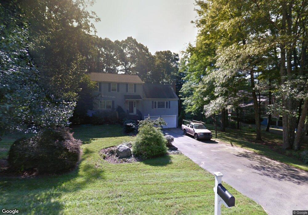
11 Wampanoag Ave Norfolk, MA 02056
Estimated Value: $759,358 - $986,000
4
Beds
3
Baths
2,578
Sq Ft
$350/Sq Ft
Est. Value
About This Home
This home is located at 11 Wampanoag Ave, Norfolk, MA 02056 and is currently estimated at $902,590, approximately $350 per square foot. 11 Wampanoag Ave is a home located in Norfolk County with nearby schools including H. Olive Day School, Freeman-Kennedy School, and Woodside Montessori Academy.
Ownership History
Date
Name
Owned For
Owner Type
Purchase Details
Closed on
Sep 17, 1991
Sold by
Callaway Thomas and Callaway Bonita F
Bought by
Walker William L and Walker Heidi A
Current Estimated Value
Home Financials for this Owner
Home Financials are based on the most recent Mortgage that was taken out on this home.
Original Mortgage
$150,800
Interest Rate
9.34%
Mortgage Type
Purchase Money Mortgage
Create a Home Valuation Report for This Property
The Home Valuation Report is an in-depth analysis detailing your home's value as well as a comparison with similar homes in the area
Home Values in the Area
Average Home Value in this Area
Purchase History
| Date | Buyer | Sale Price | Title Company |
|---|---|---|---|
| Walker William L | $190,000 | -- |
Source: Public Records
Mortgage History
| Date | Status | Borrower | Loan Amount |
|---|---|---|---|
| Open | Walker William L | $210,000 | |
| Closed | Walker William L | $150,800 |
Source: Public Records
Tax History Compared to Growth
Tax History
| Year | Tax Paid | Tax Assessment Tax Assessment Total Assessment is a certain percentage of the fair market value that is determined by local assessors to be the total taxable value of land and additions on the property. | Land | Improvement |
|---|---|---|---|---|
| 2025 | $9,175 | $574,500 | $190,300 | $384,200 |
| 2024 | $8,736 | $561,100 | $190,300 | $370,800 |
| 2023 | $8,400 | $511,900 | $190,300 | $321,600 |
| 2022 | $7,868 | $432,300 | $178,600 | $253,700 |
| 2021 | $7,863 | $437,100 | $184,600 | $252,500 |
| 2020 | $8,170 | $438,300 | $185,200 | $253,100 |
| 2019 | $7,878 | $430,700 | $185,200 | $245,500 |
| 2018 | $7,766 | $417,100 | $194,200 | $222,900 |
| 2017 | $7,656 | $420,200 | $194,200 | $226,000 |
| 2016 | $7,619 | $421,400 | $199,300 | $222,100 |
| 2015 | $7,212 | $408,400 | $190,000 | $218,400 |
| 2014 | $7,080 | $406,200 | $190,000 | $216,200 |
Source: Public Records
Map
Nearby Homes
- 14 Willow Place
- 33 Whichita Rd
- 26 Noon Hill Ave
- 1 Pueblo Rd
- 14 Onondaga Ln
- 14 Cleary Cir
- 14 Cleary Cir Unit 14
- 10 Stop River Rd
- 1 Old Mill Rd
- 4 Cleveland St
- 53 Thomas Mann Cir Unit 31
- 55 Thomas Mann Cir Unit 32
- 51 Thomas Mann Unit 30
- 13 Stop River Rd
- 56 Thomas Mann Cir Unit 43
- 54 Thomas Mann Unit Lot 42
- The Georgetown Grand R Plan at Lakeland Hills
- The Georgetown Grand L Plan at Lakeland Hills
- The Georgetown L Plan at Lakeland Hills
- The Georgetown R Plan at Lakeland Hills
- 9 Wampanoag Ave
- 4 Pennacook St
- 16 Chicatabut Ave
- 10 Wampanoag Ave
- 18 Chicatabut Ave
- 14 Chicatabut Ave
- 7 Wampanoag Ave
- 5 Pennacook St
- 8 Wampanoag Ave
- 8 Pennacook St
- 3 Pennacook St
- 12 Chicatabut Ave
- 1 Pennacook St
- 6 Wampanoag Ave
- 15 Chicatabut Ave
- 17 Chicatabut Ave
- 5 Wampanoag Ave
- 1 Pennacook St
- 19 Chicatabut Ave
- 4 Montauk Ave