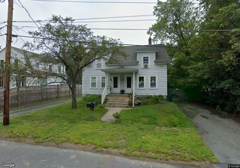
11 Warner St Unit 1 Concord, MA 01742
Estimated Value: $865,593 - $1,217,000
2
Beds
1
Bath
885
Sq Ft
$1,106/Sq Ft
Est. Value
About This Home
This home is located at 11 Warner St Unit 1, Concord, MA 01742 and is currently estimated at $978,398, approximately $1,105 per square foot. 11 Warner St Unit 1 is a home located in Middlesex County with nearby schools including Thoreau Elementary School, Concord Middle School, and Concord Carlisle High School.
Ownership History
Date
Name
Owned For
Owner Type
Purchase Details
Closed on
Feb 28, 2025
Sold by
Bent Anthony J
Bought by
Anthony J Bent Ret and Bent
Current Estimated Value
Purchase Details
Closed on
May 2, 2002
Sold by
Beckerdite Hal D
Bought by
Bent Antony J and Bent Cynthia
Home Financials for this Owner
Home Financials are based on the most recent Mortgage that was taken out on this home.
Original Mortgage
$416,700
Interest Rate
7.13%
Mortgage Type
Purchase Money Mortgage
Purchase Details
Closed on
Sep 22, 1995
Sold by
Matthei Kevin P and Matthei Debra C
Bought by
Beckerdite Hal D
Home Financials for this Owner
Home Financials are based on the most recent Mortgage that was taken out on this home.
Original Mortgage
$100,000
Interest Rate
7.81%
Mortgage Type
Purchase Money Mortgage
Create a Home Valuation Report for This Property
The Home Valuation Report is an in-depth analysis detailing your home's value as well as a comparison with similar homes in the area
Home Values in the Area
Average Home Value in this Area
Purchase History
| Date | Buyer | Sale Price | Title Company |
|---|---|---|---|
| Anthony J Bent Ret | -- | None Available | |
| Anthony J Bent Ret | -- | None Available | |
| Bent Antony J | $463,000 | -- | |
| Bent Antony J | $463,000 | -- | |
| Beckerdite Hal D | $179,900 | -- |
Source: Public Records
Mortgage History
| Date | Status | Borrower | Loan Amount |
|---|---|---|---|
| Previous Owner | Bent Antony J | $416,700 | |
| Previous Owner | Beckerdite Hal D | $170,000 | |
| Previous Owner | Beckerdite Hal D | $35,000 | |
| Previous Owner | Beckerdite Hal D | $100,000 |
Source: Public Records
Tax History
| Year | Tax Paid | Tax Assessment Tax Assessment Total Assessment is a certain percentage of the fair market value that is determined by local assessors to be the total taxable value of land and additions on the property. | Land | Improvement |
|---|---|---|---|---|
| 2025 | $8,301 | $626,000 | $396,200 | $229,800 |
| 2024 | $8,087 | $615,900 | $396,200 | $219,700 |
| 2023 | $7,516 | $579,900 | $360,200 | $219,700 |
| 2022 | $7,348 | $497,800 | $288,200 | $209,600 |
| 2021 | $6,812 | $462,800 | $288,200 | $174,600 |
| 2020 | $6,505 | $457,100 | $288,200 | $168,900 |
| 2019 | $6,542 | $461,000 | $297,700 | $163,300 |
| 2018 | $17,864 | $443,600 | $273,300 | $170,300 |
| 2017 | $5,967 | $424,100 | $253,800 | $170,300 |
| 2016 | $5,903 | $424,100 | $253,800 | $170,300 |
| 2015 | $5,590 | $391,200 | $235,000 | $156,200 |
Source: Public Records
Map
Nearby Homes
- 42 Sunnyside Ln
- 54 Maple St
- 95 Conant St Unit 320
- 22 Center Village Dr
- 70 McCallar Ln
- 66 Old Stow Rd
- 111 Central St
- 245 Oak Hill Cir
- 45 Millrun Ln Unit 45
- 1687 Main St
- 65 Summit St
- 27 Water St
- 37 Water St
- 60 Lawsbrook Rd
- 47 Bridgecourt Ln
- 16 Concord Greene Unit 5
- 79-81 Assabet Ave
- 100 Harrington Ave
- 1828 Main St
- 1844 Main St Unit 1844
- 11 Warner St Unit 13
- 36 Pond St
- 36 Pond St Unit 36
- 17 Warner St
- 46 Pond St
- 23/25 Warner St
- 23 Warner St
- 23 Warner St Unit 23
- 18 Warner St
- 24 Pond St
- 33 Warner St
- 43 Pond St
- 17 Pond St
- 49 Pond St
- 25 Warner St Unit 25
- 104 Laws Brook Rd
- 112 Laws Brook Rd
- 118 Laws Brook Rd
- 92 Laws Brook Rd
- 30 Sunnyside Ln
Your Personal Tour Guide
Ask me questions while you tour the home.