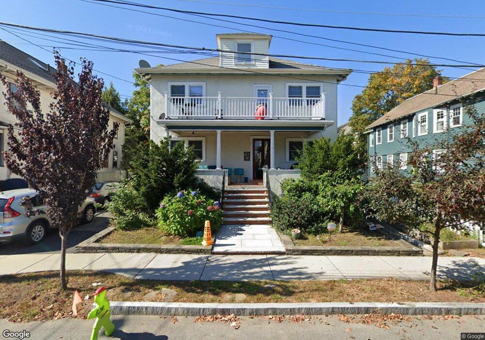
11 Westland Rd Unit 1 Watertown, MA 02472
East Watertown NeighborhoodEstimated Value: $672,539 - $781,000
2
Beds
1
Bath
1,220
Sq Ft
$587/Sq Ft
Est. Value
About This Home
This home is located at 11 Westland Rd Unit 1, Watertown, MA 02472 and is currently estimated at $715,885, approximately $586 per square foot. 11 Westland Rd Unit 1 is a home located in Middlesex County with nearby schools including Atrium School, The Kendall School, and St. Stephen's Armenian Elementary School.
Ownership History
Date
Name
Owned For
Owner Type
Purchase Details
Closed on
Oct 27, 2016
Sold by
Arzoumanian Nayiri
Bought by
Arzoumanian Sevag and Arzoumanian Razmig
Current Estimated Value
Purchase Details
Closed on
May 17, 2016
Sold by
Arzoumanian Hrair and Arzoumanian Arpi
Bought by
Arzoumanian Sevag and Arzoumanian Razmig
Purchase Details
Closed on
Apr 19, 2012
Sold by
Arzoumanian Hrair and Arzoumanian Arpi
Bought by
Arzoumanian Hrair and Arzoumanian Arpi
Purchase Details
Closed on
Dec 6, 2007
Sold by
Arzoumanian Arpi and Arzoumanian Hrair
Bought by
Arzoumanian Arpi and Arzoumanian Hrair
Create a Home Valuation Report for This Property
The Home Valuation Report is an in-depth analysis detailing your home's value as well as a comparison with similar homes in the area
Home Values in the Area
Average Home Value in this Area
Purchase History
| Date | Buyer | Sale Price | Title Company |
|---|---|---|---|
| Arzoumanian Sevag | -- | -- | |
| Arzoumanian Sevag | -- | -- | |
| Arzoumanian Hrair | -- | -- | |
| Arzoumanian Arpi | -- | -- |
Source: Public Records
Tax History Compared to Growth
Tax History
| Year | Tax Paid | Tax Assessment Tax Assessment Total Assessment is a certain percentage of the fair market value that is determined by local assessors to be the total taxable value of land and additions on the property. | Land | Improvement |
|---|---|---|---|---|
| 2025 | $6,486 | $555,300 | $0 | $555,300 |
| 2024 | $6,229 | $532,400 | $0 | $532,400 |
| 2023 | $6,953 | $512,000 | $0 | $512,000 |
| 2022 | $6,155 | $464,500 | $0 | $464,500 |
| 2021 | $5,509 | $449,700 | $0 | $449,700 |
| 2020 | $5,459 | $449,700 | $0 | $449,700 |
| 2019 | $5,238 | $406,700 | $0 | $406,700 |
| 2018 | $5,020 | $372,700 | $0 | $372,700 |
| 2017 | $4,964 | $357,400 | $0 | $357,400 |
| 2016 | $4,555 | $333,000 | $0 | $333,000 |
| 2015 | $4,775 | $317,700 | $0 | $317,700 |
| 2014 | $4,570 | $305,500 | $0 | $305,500 |
Source: Public Records
Map
Nearby Homes
- 133 Hillside Rd
- 276 Belmont St Unit 1
- 56-58 Edgecliff Rd
- 87 Templeton Pkwy Unit 3
- 10 Marlboro St Unit 1
- 73 Foster Rd Unit 2
- 30 Unity Ave Unit 30
- 81 Winsor Ave
- 163 Belmont St
- 43 Irma Ave Unit 43
- 1 Clayton St
- 16 Ericsson St
- 25 Francis St Unit 2
- 25 Francis St Unit 1
- 238 Arlington St Unit 238
- 161 Cushing St
- 66 Holworthy St
- 87 Holworthy St Unit 2
- 87 Holworthy St Unit 3
- 456 Belmont St Unit 10
- 11 Westland Rd Unit 2
- 15 Westland Rd Unit 17
- 9 Westland Rd Unit 2
- 9 Westland Rd Unit 1
- 9 Westland Rd Unit 9
- 161 Hillside Rd
- 159 Hillside Rd
- 163 Hillside Rd Unit 165
- 155 Hillside Rd Unit 2
- 155 Hillside Rd Unit 1
- 19 Westland Rd
- 240 Belmont St
- 8 Westland Rd Unit 10
- 8 Westland Rd Unit 2
- 12 Westland Rd Unit 14
- 151 Hillside Rd
- 4 Westland Rd Unit 2
- 4 Westland Rd Unit 4
- 16 Westland Rd Unit 18
- 232 Belmont St