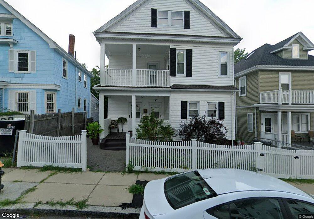
11 Westmore Rd Mattapan, MA 02126
Wellington Hill NeighborhoodEstimated Value: $653,000 - $864,000
4
Beds
2
Baths
2,470
Sq Ft
$307/Sq Ft
Est. Value
About This Home
This home is located at 11 Westmore Rd, Mattapan, MA 02126 and is currently estimated at $757,085, approximately $306 per square foot. 11 Westmore Rd is a home located in Suffolk County with nearby schools including KIPP Academy Boston Charter School and Berea Sda Academy.
Ownership History
Date
Name
Owned For
Owner Type
Purchase Details
Closed on
May 21, 2007
Sold by
Michel Daniel and Michel Kimberly L
Bought by
Michel Kimberly L
Current Estimated Value
Purchase Details
Closed on
Nov 10, 1998
Sold by
Lavaud Nicole E
Bought by
Michel Kimberly L and Michel Daniel
Home Financials for this Owner
Home Financials are based on the most recent Mortgage that was taken out on this home.
Original Mortgage
$92,400
Interest Rate
6.64%
Mortgage Type
Purchase Money Mortgage
Create a Home Valuation Report for This Property
The Home Valuation Report is an in-depth analysis detailing your home's value as well as a comparison with similar homes in the area
Home Values in the Area
Average Home Value in this Area
Purchase History
| Date | Buyer | Sale Price | Title Company |
|---|---|---|---|
| Michel Kimberly L | -- | -- | |
| Michel Kimberly L | $72,000 | -- |
Source: Public Records
Mortgage History
| Date | Status | Borrower | Loan Amount |
|---|---|---|---|
| Previous Owner | Michel Kimberly L | $92,400 |
Source: Public Records
Tax History
| Year | Tax Paid | Tax Assessment Tax Assessment Total Assessment is a certain percentage of the fair market value that is determined by local assessors to be the total taxable value of land and additions on the property. | Land | Improvement |
|---|---|---|---|---|
| 2025 | $7,137 | $616,300 | $243,000 | $373,300 |
| 2024 | $5,917 | $542,800 | $206,500 | $336,300 |
| 2023 | $5,449 | $507,400 | $193,000 | $314,400 |
| 2022 | $5,207 | $478,600 | $182,100 | $296,500 |
| 2021 | $4,729 | $443,200 | $168,600 | $274,600 |
| 2020 | $4,596 | $435,200 | $180,300 | $254,900 |
| 2019 | $4,058 | $385,000 | $129,500 | $255,500 |
| 2018 | $3,668 | $350,000 | $129,500 | $220,500 |
| 2017 | $3,707 | $350,000 | $129,500 | $220,500 |
| 2016 | $3,438 | $312,500 | $129,500 | $183,000 |
| 2015 | $3,201 | $264,300 | $96,900 | $167,400 |
| 2014 | $2,969 | $236,000 | $96,900 | $139,100 |
Source: Public Records
Map
Nearby Homes
- 95 Deering Rd
- 30-32 Westmore Rd
- 62 Westmore Rd
- 84 W Main St Unit 84
- 59 Wilcock St
- 55 Wilcock St
- 691-695 Morton St
- 4 Gilmer St
- 28 Hansborough St Unit 4
- 28 Hansborough St Unit Five
- 67 Wildwood St
- 16 Clarkwood St Unit 2
- 16 Clarkwood St Unit 3
- 21 Ashton St Unit 1
- 46 Theodore St
- 5 Sutton St
- 5 Sutton St Unit 3B
- 24 Marden Ave
- 58 Mattapan St
- 146 Woodrow Ave
- 9 Westmore Rd
- 15 Westmore Rd
- 7 Westmore Rd
- 17 Westmore Rd
- 570 Harvard St Unit 572
- 570 Harvard St Unit 1
- 574 Harvard St
- 19 Westmore Rd
- 566 Harvard St Unit 568
- 580 Harvard St
- 566 Harvard St Unit 2
- 566 Harvard St
- 14 Westmore Rd Unit 16
- 104 Deering Rd
- 102 Deering Rd
- 18 Westmore Rd Unit 20
- 10 Westmore Rd Unit 1
- 10 Westmore Rd Unit 12
- 10 Westmore Rd Unit 10 Westmore
- 106 Deering Rd
Your Personal Tour Guide
Ask me questions while you tour the home.