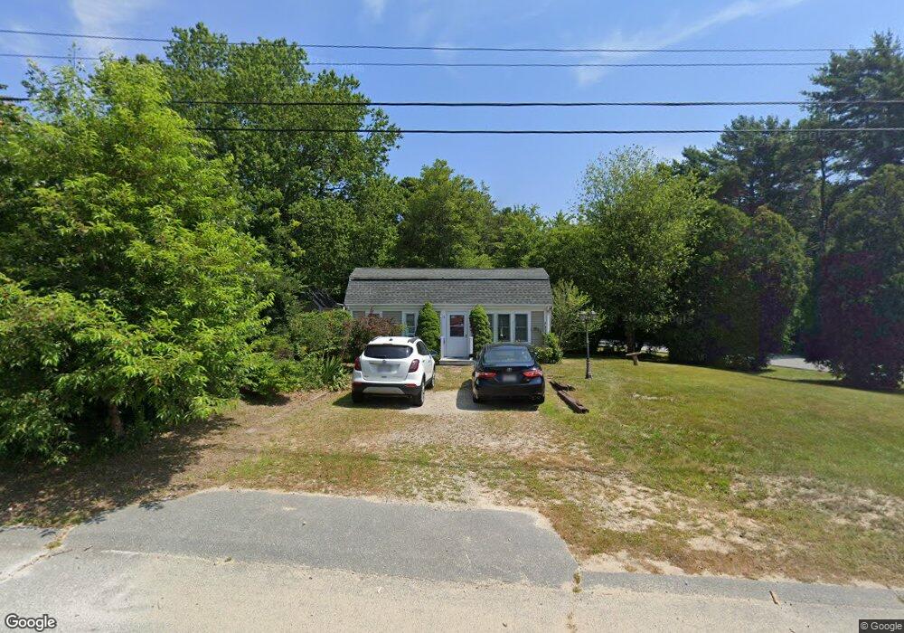
11 Whipoorwill Way Wareham, MA 02571
Estimated Value: $345,000 - $405,000
2
Beds
1
Bath
800
Sq Ft
$469/Sq Ft
Est. Value
About This Home
This home is located at 11 Whipoorwill Way, Wareham, MA 02571 and is currently estimated at $375,341, approximately $469 per square foot. 11 Whipoorwill Way is a home located in Plymouth County.
Ownership History
Date
Name
Owned For
Owner Type
Purchase Details
Closed on
Aug 22, 2025
Sold by
Rulison Susan M
Bought by
Susan M Rulison Lt and Rulison
Current Estimated Value
Purchase Details
Closed on
Nov 21, 2003
Sold by
Dandrea Matthew T
Bought by
Rulison Susan M
Home Financials for this Owner
Home Financials are based on the most recent Mortgage that was taken out on this home.
Original Mortgage
$124,900
Interest Rate
5.98%
Mortgage Type
Purchase Money Mortgage
Purchase Details
Closed on
Oct 7, 1999
Sold by
Macneill Craig D
Bought by
Dandrea Matthew T
Home Financials for this Owner
Home Financials are based on the most recent Mortgage that was taken out on this home.
Original Mortgage
$91,850
Interest Rate
7.81%
Mortgage Type
Purchase Money Mortgage
Purchase Details
Closed on
Aug 6, 1993
Sold by
Republic Bk For Svgs
Bought by
Macneil Craig D
Purchase Details
Closed on
Nov 25, 1992
Sold by
Anello Frank T
Bought by
Manhattan Sb
Create a Home Valuation Report for This Property
The Home Valuation Report is an in-depth analysis detailing your home's value as well as a comparison with similar homes in the area
Purchase History
| Date | Buyer | Sale Price | Title Company |
|---|---|---|---|
| Susan M Rulison Lt | -- | -- | |
| Susan M Rulison Lt | -- | -- | |
| Rulison Susan M | $183,900 | -- | |
| Rulison Susan M | $183,900 | -- | |
| Dandrea Matthew T | $105,000 | -- | |
| Dandrea Matthew T | $105,000 | -- | |
| Macneil Craig D | $60,000 | -- | |
| Macneil Craig D | $60,000 | -- | |
| Manhattan Sb | $70,000 | -- | |
| Manhattan Sb | $70,000 | -- |
Source: Public Records
Mortgage History
| Date | Status | Borrower | Loan Amount |
|---|---|---|---|
| Previous Owner | Manhattan Sb | $124,900 | |
| Previous Owner | Manhattan Sb | $91,850 |
Source: Public Records
Tax History
| Year | Tax Paid | Tax Assessment Tax Assessment Total Assessment is a certain percentage of the fair market value that is determined by local assessors to be the total taxable value of land and additions on the property. | Land | Improvement |
|---|---|---|---|---|
| 2025 | $3,249 | $311,800 | $110,800 | $201,000 |
| 2024 | $3,322 | $295,800 | $86,900 | $208,900 |
| 2023 | $3,189 | $265,100 | $78,900 | $186,200 |
| 2022 | $3,010 | $228,400 | $78,900 | $149,500 |
| 2021 | $2,981 | $221,600 | $78,900 | $142,700 |
| 2020 | $2,787 | $210,200 | $78,900 | $131,300 |
| 2019 | $2,699 | $203,100 | $77,100 | $126,000 |
| 2018 | $2,554 | $187,400 | $77,100 | $110,300 |
| 2017 | $2,369 | $176,100 | $77,100 | $99,000 |
| 2016 | $2,184 | $161,400 | $75,800 | $85,600 |
| 2015 | $2,109 | $161,400 | $75,800 | $85,600 |
| 2014 | $2,028 | $157,800 | $72,000 | $85,800 |
Source: Public Records
Map
Nearby Homes
- 2697 Cranberry Hwy Unit 23
- 2711 Cranberry Hwy
- 156 Sandwich Rd
- 103 Kimberly Ct
- 2783 Cranberry Hwy
- 2645 Cranberry Hwy Unit A
- 25 Linwood Ave
- 55 Minot Ave Unit 55
- 10 Oak St
- 110 Mayflower Ridge Dr
- 2838 Cranberry Hwy
- 124 Minot Ave Unit 1
- 0 Charge Pond Rd
- 7 Knowles Ave
- 9 Old Glen Charlie Rd
- 437 Main St
- 91 Agawam Lake Shore Dr
- 102 Maple Springs Rd
- 106 Circuit Ave
- 4 Ross Ave
- 11 Whipoorwill Way Unit o
- 11 Whippoorwill Way
- 13 Whipoorwill Way
- 13 Meadowlark Dr
- 10 Whipoorwill Way
- 10 Whippoorwill Way
- 15 Whipoorwill Way
- 15 Whippoorwill Way
- 7 Meadowlark Dr Unit B
- 7 Meadowlark Dr Unit A
- 7 Meadowlark Dr
- 7 Meadowlark Dr Unit 7
- 12 Whippoorwill Way
- 16 Meadowlark Dr
- 15 Meadowlark Dr
- 3 Partridge Path
- 17 Whipoorwill Way
- 18 Meadowlark Dr
- 20 Meadowlark Dr
- 4 Whipoorwill Way
Your Personal Tour Guide
Ask me questions while you tour the home.