Estimated Value: $1,096,000 - $1,369,000
4
Beds
2
Baths
1,248
Sq Ft
$984/Sq Ft
Est. Value
About This Home
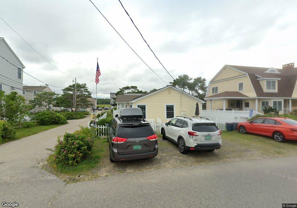
This home is located at 11 White Cap Ln, Wells, ME 04090 and is currently estimated at $1,227,848, approximately $983 per square foot. 11 White Cap Ln is a home located in York County with nearby schools including Wells Junior High School, Wells Elementary School, and Wells High School.
Ownership History
Date
Name
Owned For
Owner Type
Purchase Details
Closed on
Apr 1, 2021
Sold by
Connolly Barry R and Connolly Jennifer A
Bought by
Garnitz Andrew M and Garnitz Marybeth
Current Estimated Value
Home Financials for this Owner
Home Financials are based on the most recent Mortgage that was taken out on this home.
Original Mortgage
$698,000
Outstanding Balance
$625,357
Interest Rate
2.8%
Mortgage Type
Purchase Money Mortgage
Estimated Equity
$602,491
Purchase Details
Closed on
Aug 8, 2016
Sold by
Connolly Barry R
Bought by
Connolly Barry R and Connolly Jennifer A
Home Financials for this Owner
Home Financials are based on the most recent Mortgage that was taken out on this home.
Original Mortgage
$417,000
Interest Rate
2.83%
Mortgage Type
Purchase Money Mortgage
Create a Home Valuation Report for This Property
The Home Valuation Report is an in-depth analysis detailing your home's value as well as a comparison with similar homes in the area
Home Values in the Area
Average Home Value in this Area
Purchase History
| Date | Buyer | Sale Price | Title Company |
|---|---|---|---|
| Garnitz Andrew M | -- | None Available | |
| Garnitz Andrew M | -- | None Available | |
| Garnitz Andrew M | -- | None Available | |
| Connolly Barry R | -- | -- | |
| Connolly Barry R | -- | -- | |
| Connolly Barry R | -- | -- | |
| Connolly Barry R | -- | -- |
Source: Public Records
Mortgage History
| Date | Status | Borrower | Loan Amount |
|---|---|---|---|
| Open | Garnitz Andrew M | $698,000 | |
| Closed | Garnitz Andrew M | $698,000 | |
| Previous Owner | Connolly Barry R | $417,000 |
Source: Public Records
Tax History Compared to Growth
Tax History
| Year | Tax Paid | Tax Assessment Tax Assessment Total Assessment is a certain percentage of the fair market value that is determined by local assessors to be the total taxable value of land and additions on the property. | Land | Improvement |
|---|---|---|---|---|
| 2024 | $6,507 | $1,070,290 | $831,530 | $238,760 |
| 2023 | $6,379 | $1,070,290 | $831,530 | $238,760 |
| 2022 | $6,009 | $574,460 | $429,530 | $144,930 |
| 2021 | $6,029 | $573,140 | $429,530 | $143,610 |
| 2020 | $6,007 | $573,140 | $429,530 | $143,610 |
| 2019 | $5,972 | $573,140 | $429,530 | $143,610 |
| 2018 | $5,698 | $572,390 | $429,530 | $142,860 |
| 2017 | $5,815 | $572,390 | $429,530 | $142,860 |
| 2016 | $5,758 | $572,390 | $429,530 | $142,860 |
| 2015 | $5,695 | $572,390 | $429,530 | $142,860 |
| 2013 | $5,220 | $572,390 | $429,530 | $142,860 |
Source: Public Records
Map
Nearby Homes
- 168 Ocean Ave
- 718 Main St Unit A3
- 9 Bourne Ave Unit B6
- 9 Bourne Ave Unit P-22
- 32 Tatnic Rd
- 76 Post Rd Unit 17M &18M
- 314 Ocean Ave
- 32 Queens Way
- 56 Kings Hwy
- 12 Whiporwill Dr
- Lot 2 Maling Ln
- 64 Old Kings Hwy
- 31 Rebecca Rd
- 390 Ocean Ave
- 1 Old County Rd Unit 702
- 1 Old County Rd Unit 165
- 1 Old County Rd Unit 132
- 53 Spinnaker Ridge Dr Unit 8
- 404 Ocean Ave Unit 7
- 15 Blanchard St
- 15 White Cap Ln
- 14 Ocean Ave
- 17 White Cap Ln
- 24 White Cap Ln
- 14 White Cap Ln
- 10 White Cap Ln
- 6 Ocean Ave
- 20 Ocean Ave
- 2 Ocean Ave
- 25 White Cap Ln
- 00 Oceans Edge Unit 234
- 0 Oceans Edge Unit 305 760550
- 00 Oceans Edge Unit 118
- 00 Oceans Edge Unit 251
- 00 Oceans Edge
- 0 Oceans Edge Unit 219
- 00 Ocean
- 000 Ocean Ave
- 26 Ocean Ave
- 17 Ocean Ave