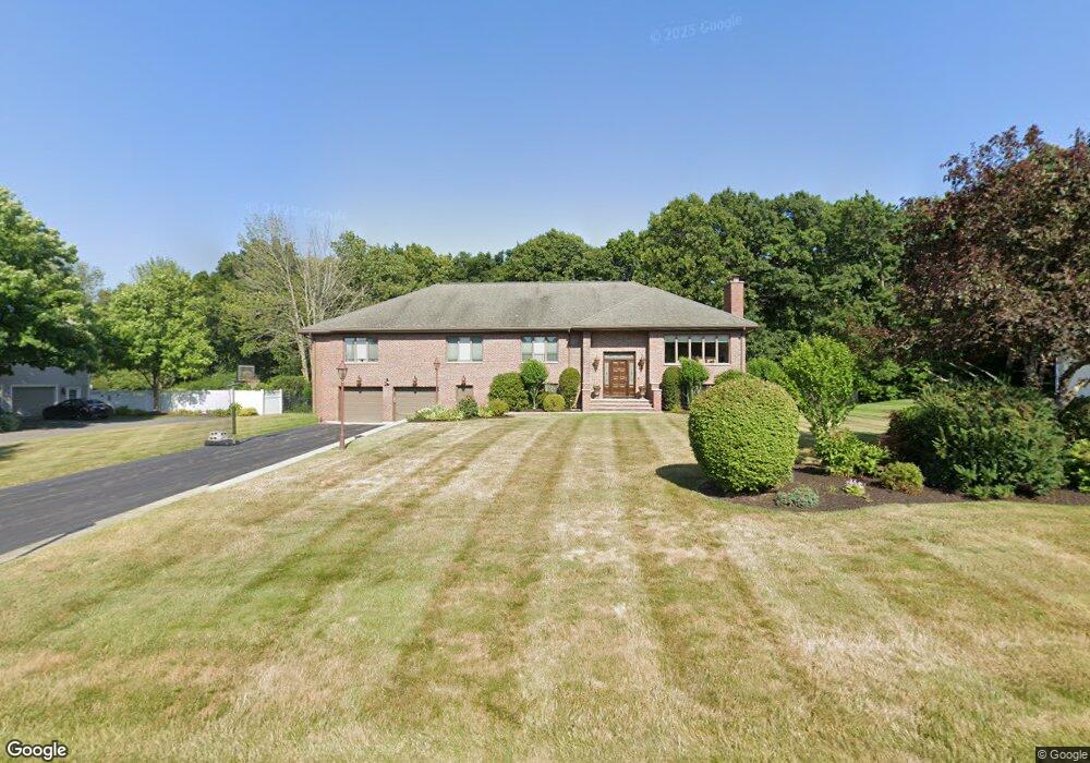
11 Whitridge Rd Natick, MA 01760
Estimated Value: $1,448,593 - $1,698,000
4
Beds
3
Baths
4,910
Sq Ft
$318/Sq Ft
Est. Value
About This Home
This home is located at 11 Whitridge Rd, Natick, MA 01760 and is currently estimated at $1,561,898, approximately $318 per square foot. 11 Whitridge Rd is a home located in Middlesex County with nearby schools including Natick High School, Memorial Elementary School, and J F Kennedy Middle School.
Ownership History
Date
Name
Owned For
Owner Type
Purchase Details
Closed on
May 25, 2011
Sold by
Colasacco Adrian E and Colasacco Lynda M
Bought by
Adrian E Colasacco Ft
Current Estimated Value
Purchase Details
Closed on
Aug 4, 2008
Sold by
Schultz Jami S
Bought by
Colasacco Adrian E and Colasacco Lynda M
Home Financials for this Owner
Home Financials are based on the most recent Mortgage that was taken out on this home.
Original Mortgage
$600,000
Interest Rate
6.47%
Mortgage Type
Purchase Money Mortgage
Purchase Details
Closed on
Jun 18, 2002
Sold by
Rufo Gerald L and Rufo Jean M
Bought by
Schultz Jami S and Schultz Derek M
Purchase Details
Closed on
Oct 5, 1992
Sold by
Jerry Montopoli Constr
Bought by
Rufo Gerald L
Create a Home Valuation Report for This Property
The Home Valuation Report is an in-depth analysis detailing your home's value as well as a comparison with similar homes in the area
Home Values in the Area
Average Home Value in this Area
Purchase History
| Date | Buyer | Sale Price | Title Company |
|---|---|---|---|
| Adrian E Colasacco Ft | -- | -- | |
| Colasacco Adrian E | $780,000 | -- | |
| Schultz Jami S | $700,000 | -- | |
| Rufo Gerald L | $189,000 | -- |
Source: Public Records
Mortgage History
| Date | Status | Borrower | Loan Amount |
|---|---|---|---|
| Previous Owner | Colasacco Adrian E | $600,000 |
Source: Public Records
Tax History Compared to Growth
Tax History
| Year | Tax Paid | Tax Assessment Tax Assessment Total Assessment is a certain percentage of the fair market value that is determined by local assessors to be the total taxable value of land and additions on the property. | Land | Improvement |
|---|---|---|---|---|
| 2025 | $14,505 | $1,212,800 | $548,100 | $664,700 |
| 2024 | $14,089 | $1,149,200 | $519,100 | $630,100 |
| 2023 | $13,386 | $1,059,000 | $478,100 | $580,900 |
| 2022 | $12,989 | $973,700 | $426,700 | $547,000 |
| 2021 | $12,434 | $913,600 | $404,300 | $509,300 |
| 2020 | $0 | $896,700 | $387,400 | $509,300 |
| 2019 | $8,215 | $896,700 | $387,400 | $509,300 |
| 2018 | $5,437 | $888,400 | $370,600 | $517,800 |
| 2017 | $11,847 | $878,200 | $369,700 | $508,500 |
| 2016 | $11,851 | $873,300 | $369,700 | $503,600 |
| 2015 | $11,415 | $826,000 | $369,700 | $456,300 |
Source: Public Records
Map
Nearby Homes
- 21 Harvest Moon Dr
- 15 Wyndemere Ln
- 48 Graystone Ln
- 5 Deer Path
- 16 Wayside Rd Unit 14
- 16 Wayside Rd
- 94 Woodland St
- 39 Davis Brook Dr
- 39 Indian Ridge Rd
- 25 Yorkshire Rd
- 10 Sundance Way
- 18 Phillips Pond Rd
- 91 Glen St
- 6 Ambler Ct
- 53 Yorkshire Rd
- 216-218 S Main St
- 104 Glen St
- 32 Lake St
- 8 Floral Ave Unit 8
- 47 High St
- 9 Whitridge Rd
- 15 Whitridge Rd
- 57 Eliot Hill Rd
- 7 Whitridge Rd
- 17 Whitridge Rd
- 12 Whitridge Rd
- 55 Eliot Hill Rd
- 10 Whitridge Rd
- 8 Whitridge Rd
- 14 Whitridge Rd
- 59 Eliot Hill Rd
- 53 Eliot Hill Rd
- 5 Whitridge Rd
- 19 Whitridge Rd
- 16 Whitridge Rd
- 6 Whitridge Rd
- 61 Eliot Hill Rd
- 51 Eliot Hill Rd
- 71 Whitridge Road-Lot 71
- 48 Eliot Hill Rd