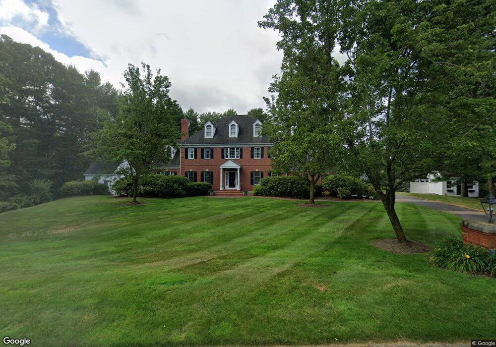
11 Wilkeson Way Foxboro, MA 02035
Estimated Value: $1,164,000 - $1,721,000
4
Beds
5
Baths
4,333
Sq Ft
$348/Sq Ft
Est. Value
About This Home
This home is located at 11 Wilkeson Way, Foxboro, MA 02035 and is currently estimated at $1,506,296, approximately $347 per square foot. 11 Wilkeson Way is a home located in Norfolk County with nearby schools including Foxborough High School, Foxborough Regional Charter School, and Cadence Academy Preschool - North Attleborough.
Ownership History
Date
Name
Owned For
Owner Type
Purchase Details
Closed on
Jul 17, 2012
Sold by
Whalen Edward F
Bought by
Whalen Edward F and Whalen Joanne M
Current Estimated Value
Purchase Details
Closed on
Jan 13, 1995
Sold by
D & M Inc
Bought by
Whalen Edward F
Home Financials for this Owner
Home Financials are based on the most recent Mortgage that was taken out on this home.
Original Mortgage
$410,000
Interest Rate
9.23%
Mortgage Type
Purchase Money Mortgage
Create a Home Valuation Report for This Property
The Home Valuation Report is an in-depth analysis detailing your home's value as well as a comparison with similar homes in the area
Home Values in the Area
Average Home Value in this Area
Purchase History
| Date | Buyer | Sale Price | Title Company |
|---|---|---|---|
| Whalen Edward F | -- | -- | |
| Whalen Edward F | $389,800 | -- |
Source: Public Records
Mortgage History
| Date | Status | Borrower | Loan Amount |
|---|---|---|---|
| Previous Owner | Whalen Edward F | $201,000 | |
| Previous Owner | Whalen Edward F | $330,000 | |
| Previous Owner | Whalen Edward F | $410,000 |
Source: Public Records
Tax History Compared to Growth
Tax History
| Year | Tax Paid | Tax Assessment Tax Assessment Total Assessment is a certain percentage of the fair market value that is determined by local assessors to be the total taxable value of land and additions on the property. | Land | Improvement |
|---|---|---|---|---|
| 2025 | $18,768 | $1,419,700 | $368,600 | $1,051,100 |
| 2024 | $17,529 | $1,297,500 | $337,800 | $959,700 |
| 2023 | $16,691 | $1,174,600 | $322,200 | $852,400 |
| 2022 | $16,653 | $1,146,900 | $339,600 | $807,300 |
| 2021 | $16,267 | $1,103,600 | $331,100 | $772,500 |
| 2020 | $15,704 | $1,077,800 | $331,100 | $746,700 |
| 2019 | $15,450 | $1,051,000 | $355,800 | $695,200 |
| 2018 | $15,230 | $1,045,300 | $369,400 | $675,900 |
| 2017 | $14,873 | $988,900 | $358,100 | $630,800 |
| 2016 | $13,974 | $942,900 | $298,800 | $644,100 |
| 2015 | $13,768 | $906,400 | $229,500 | $676,900 |
| 2014 | $13,391 | $893,300 | $229,500 | $663,800 |
Source: Public Records
Map
Nearby Homes
- 24 Maverick Dr
- 16 Treasure Island Rd
- 116 George St
- 9 Oak Dr
- 406 South St
- 28 Messenger St
- 10 Sleepy Hollow Cir
- 11 Landry Ave
- 5 Old Wood Rd
- 15 Old Wood Rd
- 126 Washington St
- 130 Washington St
- 124 Washington St
- 47 Old Farm Rd
- 158 Washington St
- 9 Sunnyside Dr Unit 9
- 196 Donald Tennant Cir
- 4 Buckskin Dr
- 150 Gilbert St
- 57 Vine St
- 13 Wilkeson Way
- 9 Wilkeson Way
- 10 Wilkeson Way
- 15 Wilkeson Way
- 8 Wilkeson Way
- 17 Wilkeson Way
- 17 Shepherd St
- 7 Wilkeson Way
- 23 Shepherd St
- 14 Shepherd St
- 18 Shepherd St
- 6 Wilkeson Way
- 5 Wilkeson Way
- 25 Shepherd St
- 13 Shepherd St
- 3 Wilkeson Way
- 10 Shepherd St
- 20 Shepherd St
- 29 Shepherd St
- 9 Shepherd St