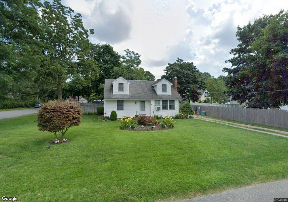
11 Woodland Ave Holtsville, NY 11742
Estimated Value: $531,069 - $592,000
4
Beds
1
Bath
1,268
Sq Ft
$444/Sq Ft
Est. Value
About This Home
This home is located at 11 Woodland Ave, Holtsville, NY 11742 and is currently estimated at $563,017, approximately $444 per square foot. 11 Woodland Ave is a home located in Suffolk County with nearby schools including Waverly Elementary School, Sachem High School East, and Long Island Baptist Academy.
Ownership History
Date
Name
Owned For
Owner Type
Purchase Details
Closed on
Feb 28, 2000
Sold by
Desposito Dan G
Bought by
Tunstall Michael A and Tunstall Brenda L
Current Estimated Value
Home Financials for this Owner
Home Financials are based on the most recent Mortgage that was taken out on this home.
Original Mortgage
$140,125
Outstanding Balance
$47,216
Interest Rate
8.21%
Mortgage Type
Unknown
Estimated Equity
$515,801
Purchase Details
Closed on
Apr 18, 1994
Sold by
Desposito Dominick
Bought by
Desposito Dan G
Create a Home Valuation Report for This Property
The Home Valuation Report is an in-depth analysis detailing your home's value as well as a comparison with similar homes in the area
Home Values in the Area
Average Home Value in this Area
Purchase History
| Date | Buyer | Sale Price | Title Company |
|---|---|---|---|
| Tunstall Michael A | $147,500 | Fidelity National Title Ins | |
| Desposito Dan G | $45,000 | Uslife Title Insurance Co |
Source: Public Records
Mortgage History
| Date | Status | Borrower | Loan Amount |
|---|---|---|---|
| Open | Tunstall Michael A | $140,125 |
Source: Public Records
Tax History Compared to Growth
Tax History
| Year | Tax Paid | Tax Assessment Tax Assessment Total Assessment is a certain percentage of the fair market value that is determined by local assessors to be the total taxable value of land and additions on the property. | Land | Improvement |
|---|---|---|---|---|
| 2024 | $5,208 | $1,600 | $200 | $1,400 |
| 2023 | $5,208 | $1,600 | $200 | $1,400 |
| 2022 | $4,464 | $1,600 | $200 | $1,400 |
| 2021 | $4,464 | $1,600 | $200 | $1,400 |
| 2020 | $4,655 | $1,600 | $200 | $1,400 |
| 2019 | $4,655 | $0 | $0 | $0 |
| 2018 | $4,309 | $1,600 | $200 | $1,400 |
| 2017 | $4,309 | $1,600 | $200 | $1,400 |
| 2016 | $4,304 | $1,600 | $200 | $1,400 |
| 2015 | -- | $1,600 | $200 | $1,400 |
| 2014 | -- | $1,600 | $200 | $1,400 |
Source: Public Records
Map
Nearby Homes
- 161-5 Long Island Ave
- 7 Albermarle Ave
- 1075 Waverly Ave
- 32 Williams Ave
- 1 Revlon Ct
- 47 Dayton Ave
- 19 Broadway
- 139 Storm Dr
- 141 Wendy Dr
- 119 Storm Dr
- 219 Storm Dr
- 220 Storm Dr
- 541 Blue Point Rd
- 89 Storm Dr
- 257 Storm Dr
- 15 Spurwoods Ln
- 5457 Expressway Dr N
- 109 Rexmere Ave
- 283 Storm Dr
- 76 Blueberry Ridge Dr
- 9 Woodland Ave
- 4 Vautrin Ln
- 15 Woodland Ave
- 10 Woodland Ave
- 7 Woodland Ave
- 8 Woodland Ave
- 12 Woodland Ave
- 6 Woodland Ave
- 17 Woodland Ave
- 4 Vautrin Ave
- 14 Woodland Ave
- 4 Woodland Ave
- 19 Woodland Ave
- 1 Vautrin Ave
- 16 Woodland Ave
- 6 Vautrin Ave
- 3 Vautrin Ave
- 18 Woodland Ave
- 21 Woodland Ave
- 5 Vautrin Ave