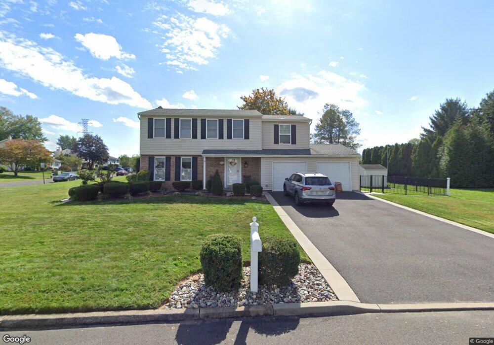
110 Algate Rd Langhorne, PA 19047
Estimated Value: $544,000 - $578,000
3
Beds
2
Baths
1,572
Sq Ft
$358/Sq Ft
Est. Value
About This Home
This home is located at 110 Algate Rd, Langhorne, PA 19047 and is currently estimated at $562,378, approximately $357 per square foot. 110 Algate Rd is a home located in Bucks County with nearby schools including Pearl S. Buck Elementary School, Maple Point Middle School, and Neshaminy High School.
Ownership History
Date
Name
Owned For
Owner Type
Purchase Details
Closed on
Oct 31, 1997
Sold by
Hawthorne James R and Hawthorne Susan L
Bought by
Rodgers Greg J and Rodgers Maria M
Current Estimated Value
Home Financials for this Owner
Home Financials are based on the most recent Mortgage that was taken out on this home.
Original Mortgage
$146,300
Interest Rate
7.23%
Create a Home Valuation Report for This Property
The Home Valuation Report is an in-depth analysis detailing your home's value as well as a comparison with similar homes in the area
Home Values in the Area
Average Home Value in this Area
Purchase History
| Date | Buyer | Sale Price | Title Company |
|---|---|---|---|
| Rodgers Greg J | $154,000 | T A Title Insurance Company |
Source: Public Records
Mortgage History
| Date | Status | Borrower | Loan Amount |
|---|---|---|---|
| Previous Owner | Rodgers Greg J | $146,300 |
Source: Public Records
Tax History Compared to Growth
Tax History
| Year | Tax Paid | Tax Assessment Tax Assessment Total Assessment is a certain percentage of the fair market value that is determined by local assessors to be the total taxable value of land and additions on the property. | Land | Improvement |
|---|---|---|---|---|
| 2025 | $6,862 | $31,520 | $6,200 | $25,320 |
| 2024 | $6,862 | $31,520 | $6,200 | $25,320 |
| 2023 | $6,753 | $31,520 | $6,200 | $25,320 |
| 2022 | $6,576 | $31,520 | $6,200 | $25,320 |
| 2021 | $6,576 | $31,520 | $6,200 | $25,320 |
| 2020 | $6,497 | $31,520 | $6,200 | $25,320 |
| 2019 | $6,352 | $31,520 | $6,200 | $25,320 |
| 2018 | $5,539 | $28,000 | $6,200 | $21,800 |
| 2017 | $5,398 | $28,000 | $6,200 | $21,800 |
| 2016 | $5,398 | $28,000 | $6,200 | $21,800 |
| 2015 | $5,587 | $28,000 | $6,200 | $21,800 |
| 2014 | $5,587 | $28,000 | $6,200 | $21,800 |
Source: Public Records
Map
Nearby Homes
- 273 Shady Brook Dr Unit 243
- 354 Shady Brook Dr Unit 180
- 120 Shady Brook Dr Unit 89
- 210 Shady Brook Dr
- 510 Pin Oak Dr
- 187 Shady Brook Dr Unit 129
- 175 Shady Brook Dr Unit 122
- 0 Route 413 Bypass Unit PABU2010042
- 462 Scott Ct
- 1988 Knight Cir
- 1102 Waterford Rd Unit 1
- 1835 Windflower Ln
- 1839 Windflower Ln
- 1819 Windflower Ln
- 1948 Satter Ct
- 770 Atkinson Ln
- 660 Bayberry Ln Unit T5
- 2904 Sterling Rd Unit 179
- 2908 Sterling Rd Unit 175
- 1707 Lynbrooke Dr Unit 120
- 168 Barnsbury Rd
- 76 Algate Rd
- 109 Algate Rd
- 181 Barnsbury Rd
- 156 Barnsbury Rd
- 193 Barnsbury Rd
- 169 Barnsbury Rd
- 66 Algate Rd
- 71 Algate Rd
- 205 Barnsbury Rd
- 157 Barnsbury Rd
- 216 Barnsbury Rd
- 144 Barnsbury Rd
- 69 Algate Rd
- 217 Barnsbury Rd
- 145 Barnsbury Rd
- 54 Algate Rd
- 237 Adeline Place
- 228 Barnsbury Rd
- 138 Barnsbury Rd