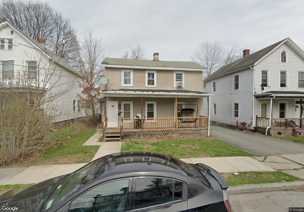
110 Ball St Unit 1 Port Jervis, NY 12771
Estimated Value: $223,087 - $290,000
6
Beds
2
Baths
1,588
Sq Ft
$166/Sq Ft
Est. Value
About This Home
This home is located at 110 Ball St Unit 1, Port Jervis, NY 12771 and is currently estimated at $263,022, approximately $165 per square foot. 110 Ball St Unit 1 is a home located in Orange County with nearby schools including Port Jervis High School and New Life Christian Day School.
Ownership History
Date
Name
Owned For
Owner Type
Purchase Details
Closed on
Nov 15, 2021
Sold by
Ball St Ams Llc
Bought by
Port Jervis Jb Llc
Current Estimated Value
Home Financials for this Owner
Home Financials are based on the most recent Mortgage that was taken out on this home.
Original Mortgage
$2,055,000
Outstanding Balance
$1,884,618
Interest Rate
3.05%
Mortgage Type
Commercial
Estimated Equity
-$1,621,596
Create a Home Valuation Report for This Property
The Home Valuation Report is an in-depth analysis detailing your home's value as well as a comparison with similar homes in the area
Home Values in the Area
Average Home Value in this Area
Purchase History
| Date | Buyer | Sale Price | Title Company |
|---|---|---|---|
| Port Jervis Jb Llc | $2,740,000 | Fidelity National Title (Aka |
Source: Public Records
Mortgage History
| Date | Status | Borrower | Loan Amount |
|---|---|---|---|
| Open | Port Jervis Jb Llc | $2,055,000 |
Source: Public Records
Tax History Compared to Growth
Tax History
| Year | Tax Paid | Tax Assessment Tax Assessment Total Assessment is a certain percentage of the fair market value that is determined by local assessors to be the total taxable value of land and additions on the property. | Land | Improvement |
|---|---|---|---|---|
| 2024 | $2,699 | $37,600 | $4,500 | $33,100 |
| 2023 | $2,699 | $37,600 | $4,500 | $33,100 |
| 2022 | $3,449 | $37,600 | $4,500 | $33,100 |
| 2021 | $2,986 | $37,600 | $4,500 | $33,100 |
| 2020 | $3,062 | $37,600 | $4,500 | $33,100 |
| 2019 | $374 | $37,600 | $4,500 | $33,100 |
| 2018 | $3,759 | $37,600 | $4,500 | $33,100 |
| 2017 | $2,958 | $37,600 | $4,500 | $33,100 |
| 2016 | $3,840 | $37,600 | $4,500 | $33,100 |
| 2015 | -- | $37,600 | $4,500 | $33,100 |
| 2014 | -- | $37,600 | $4,500 | $33,100 |
Source: Public Records
Map
Nearby Homes
- 115 Hammond St
- 33 Seward Ave
- 138 Front St Unit 140
- 131 Front St
- 120 Jersey Ave
- 141 Hammond St
- 142 Ball St
- 19 Barcelow St
- 92 Front St
- 165 Front St
- 39 Church St Unit 3
- 4 Elizabeth St
- 14 Division St
- 701 United States Route 209
- 189 E Main St
- 42 Sussex St
- 109 US Highway 6
- 40 King St
- 20 Kingston Ave
- 1 High St