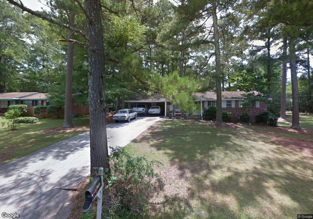
110 Carroll Cir Carrollton, GA 30117
Estimated Value: $205,000 - $237,250
3
Beds
2
Baths
1,150
Sq Ft
$191/Sq Ft
Est. Value
About This Home
This home is located at 110 Carroll Cir, Carrollton, GA 30117 and is currently estimated at $219,563, approximately $190 per square foot. 110 Carroll Cir is a home located in Carroll County with nearby schools including Carrollton Elementary School, Carrollton Upper Elementary School, and Carrollton Middle School.
Ownership History
Date
Name
Owned For
Owner Type
Purchase Details
Closed on
Aug 27, 2002
Sold by
Norton Patricia C R and Reeves Steve M
Bought by
Holland Michael L
Current Estimated Value
Purchase Details
Closed on
Jun 11, 2001
Sold by
Reeves Obera M
Bought by
Norton Patricia Cr and Reeves Steve M
Purchase Details
Closed on
Jul 19, 1974
Sold by
Brablet Harold and Jean Staggs
Bought by
Reeves Obera M
Purchase Details
Closed on
Mar 25, 1971
Sold by
Terry Homes Inc
Bought by
Brablet Harold and Jean Stamps
Create a Home Valuation Report for This Property
The Home Valuation Report is an in-depth analysis detailing your home's value as well as a comparison with similar homes in the area
Home Values in the Area
Average Home Value in this Area
Purchase History
| Date | Buyer | Sale Price | Title Company |
|---|---|---|---|
| Holland Michael L | $67,000 | -- | |
| Norton Patricia Cr | -- | -- | |
| Reeves Obera M | $23,000 | -- | |
| Brablet Harold | $19,500 | -- |
Source: Public Records
Tax History Compared to Growth
Tax History
| Year | Tax Paid | Tax Assessment Tax Assessment Total Assessment is a certain percentage of the fair market value that is determined by local assessors to be the total taxable value of land and additions on the property. | Land | Improvement |
|---|---|---|---|---|
| 2024 | $1,496 | $54,741 | $6,000 | $48,741 |
| 2023 | $1,496 | $50,408 | $6,000 | $44,408 |
| 2022 | $1,216 | $41,660 | $6,000 | $35,660 |
| 2021 | $1,072 | $36,710 | $6,000 | $30,710 |
| 2020 | $965 | $33,026 | $6,000 | $27,026 |
| 2019 | $915 | $31,018 | $6,000 | $25,018 |
| 2018 | $857 | $28,648 | $6,000 | $22,648 |
| 2017 | $818 | $27,198 | $6,000 | $21,198 |
| 2016 | $823 | $27,198 | $6,000 | $21,198 |
| 2015 | $755 | $24,438 | $6,000 | $18,438 |
| 2014 | $758 | $24,438 | $6,000 | $18,438 |
Source: Public Records
Map
Nearby Homes
- 0 Carroll Cir- Lots 4-8 Unit 148012
- 150 Cedar Park Way
- 204 Burns Rd
- 3 Burns Rd
- 2 Burns Rd
- 0 Carroll Cir Unit LOTS 4-8 10571562
- 403 Burns Rd
- 0 Burns Rd Unit LOT 2 10571612
- 0 Burns Rd Unit LOT 3 10571635
- 0 Burns Rd Unit LOT 1 10571595
- 0 Burns Rd Unit 148013
- 223 N Lakeshore Dr
- 231 N Lakeshore Dr
- 1711B Bankhead Hwy
- 114 Green Point Way
- 325 Almon Rd
- 115 N Lake Dr
- 123 Autumn Glen Dr
- 119 Oxford Square
- 8 Horsley Mill Rd
- 108 Carroll Cir
- 112 Carroll Cir
- 103 Shannon Dr
- 105 Shannon Dr
- 105 Shannon Dr
- 105 Shannon Dr
- 106 Carroll Cir
- 815 Bankhead Hwy Unit SUITE F
- 815 Bankhead Hwy Unit SUITE E
- 815 Bankhead Hwy Unit SUITE H
- 815 Bankhead Hwy Unit SUITE G
- 815 Bankhead Hwy Unit H
- 815 Bankhead Hwy
- 815 Bankhead Hwy Unit SUITE
- 815 Bankhead Hwy Unit G
- 815 Bankhead Hwy Unit E
- 815 Bankhead Hwy Unit F
- 45 Carroll Cir
- 207 Burns Rd
- 209 Burns Rd