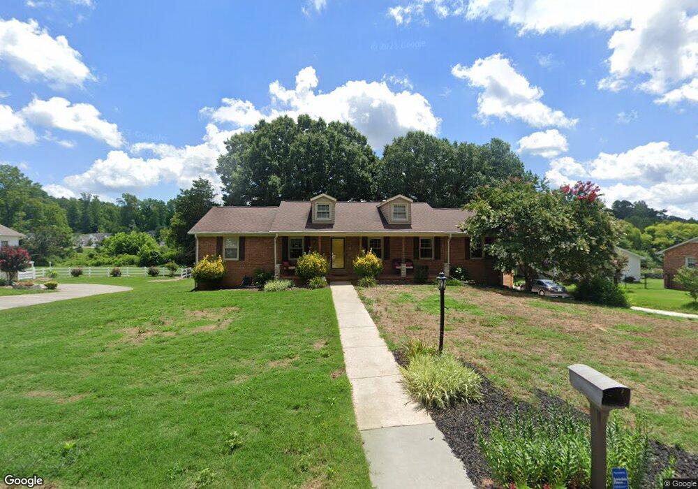
110 Cheviot Dr Kernersville, NC 27284
Yorktown NeighborhoodEstimated Value: $344,333 - $424,000
3
Beds
3
Baths
1,950
Sq Ft
$190/Sq Ft
Est. Value
About This Home
This home is located at 110 Cheviot Dr, Kernersville, NC 27284 and is currently estimated at $370,333, approximately $189 per square foot. 110 Cheviot Dr is a home located in Forsyth County with nearby schools including Caleb's Creek Elementary School, Southeast Middle School, and R.B. Glenn High School.
Ownership History
Date
Name
Owned For
Owner Type
Purchase Details
Closed on
Jul 5, 2024
Sold by
Donoghue Nelson Michele and Thomas Nelson Andy
Bought by
Donoghue Nelson Michele
Current Estimated Value
Purchase Details
Closed on
Mar 27, 2007
Sold by
Gibson Tommy L
Bought by
Nelson Andy Thomas and Nelson Michele Donoghue
Home Financials for this Owner
Home Financials are based on the most recent Mortgage that was taken out on this home.
Original Mortgage
$54,500
Interest Rate
6.27%
Mortgage Type
Unknown
Create a Home Valuation Report for This Property
The Home Valuation Report is an in-depth analysis detailing your home's value as well as a comparison with similar homes in the area
Home Values in the Area
Average Home Value in this Area
Purchase History
| Date | Buyer | Sale Price | Title Company |
|---|---|---|---|
| Donoghue Nelson Michele | -- | Chicago Title | |
| Nelson Andy Thomas | $218,000 | None Available |
Source: Public Records
Mortgage History
| Date | Status | Borrower | Loan Amount |
|---|---|---|---|
| Previous Owner | Nelson Andy Thomas | $54,500 | |
| Previous Owner | Nelson Andy Thomas | $163,500 |
Source: Public Records
Tax History Compared to Growth
Tax History
| Year | Tax Paid | Tax Assessment Tax Assessment Total Assessment is a certain percentage of the fair market value that is determined by local assessors to be the total taxable value of land and additions on the property. | Land | Improvement |
|---|---|---|---|---|
| 2025 | $2,971 | $348,700 | $49,000 | $299,700 |
| 2024 | $2,914 | $227,400 | $30,800 | $196,600 |
| 2023 | $2,914 | $227,400 | $30,800 | $196,600 |
| 2022 | $2,904 | $227,400 | $30,800 | $196,600 |
| 2021 | $2,904 | $227,400 | $30,800 | $196,600 |
| 2020 | $2,772 | $204,100 | $24,500 | $179,600 |
| 2019 | $2,793 | $204,100 | $24,500 | $179,600 |
| 2018 | $2,732 | $204,100 | $24,500 | $179,600 |
| 2016 | $2,535 | $189,344 | $28,000 | $161,344 |
| 2015 | $2,483 | $189,344 | $28,000 | $161,344 |
| 2014 | $2,456 | $210,213 | $36,000 | $174,213 |
Source: Public Records
Map
Nearby Homes
- 100 Wilchester Ln
- 1441 Cawdor Ln
- 1233 Salem Crossing Rd
- 1224 Salem Crossing Rd
- 1200 Salem Crossing Rd
- 1618 Haddington Point Dr
- 0 Glen Hollow Rd
- 1636 Haddington Point Dr
- 1712 Creekline Dr
- 1714 Creekline Dr
- 1715 Creekline Dr
- 1713 Creekline Dr
- 1898 Pheasant Trace Cir
- 1798 Mallard Dr
- 1896 Pheasant Trace Cir
- 1834 Pheasant Trace Cir
- 1838 Pheasant Trace Cir
- 1894 Pheasant Trace Cir
- 1795 Mallard Dr
- 1797 Mallard Dr
- 108 Cheviot Dr
- 112 Cheviot Dr
- 106 Cheviot Dr
- 114 Cheviot Dr
- 109 Cheviot Dr
- 111 Cheviot Dr
- 105 Cheviot Dr
- 113 Cheviot Dr
- 116 Cheviot Dr
- 102 Cheviot Dr
- 104 Ben Nevis Dr
- 1423 Cawdor Ln
- 1405 Culloden Ct
- 1299 Old Salem Rd
- 1795 Angus Ridge Dr
- 1787 Angus Ridge Dr
- 1427 Cawdor Ln
- 1779 Angus Ridge Dr
- 105 Ben Nevis Dr
- 1771 Angus Ridge Dr