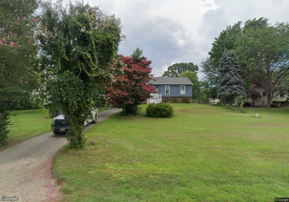
110 Congressional Dr Stevensville, MD 21666
Estimated Value: $521,790 - $642,000
2
Beds
2
Baths
1,184
Sq Ft
$493/Sq Ft
Est. Value
About This Home
This home is located at 110 Congressional Dr, Stevensville, MD 21666 and is currently estimated at $583,698, approximately $492 per square foot. 110 Congressional Dr is a home located in Queen Anne's County with nearby schools including Matapeake Elementary School, Matapeake Middle School, and Kent Island High School.
Ownership History
Date
Name
Owned For
Owner Type
Purchase Details
Closed on
Apr 15, 2011
Sold by
Cantrell George W
Bought by
Peters Erica and Peters David
Current Estimated Value
Home Financials for this Owner
Home Financials are based on the most recent Mortgage that was taken out on this home.
Original Mortgage
$207,200
Outstanding Balance
$143,549
Interest Rate
4.89%
Mortgage Type
New Conventional
Estimated Equity
$440,149
Purchase Details
Closed on
Mar 31, 2011
Sold by
Cantrell George W
Bought by
Peters Erica and Peters David
Home Financials for this Owner
Home Financials are based on the most recent Mortgage that was taken out on this home.
Original Mortgage
$207,200
Outstanding Balance
$143,549
Interest Rate
4.89%
Mortgage Type
New Conventional
Estimated Equity
$440,149
Purchase Details
Closed on
Sep 23, 1994
Sold by
Foley John J and Foley Anne L
Bought by
Cantrell George W and Cantrell Barbara I
Create a Home Valuation Report for This Property
The Home Valuation Report is an in-depth analysis detailing your home's value as well as a comparison with similar homes in the area
Home Values in the Area
Average Home Value in this Area
Purchase History
| Date | Buyer | Sale Price | Title Company |
|---|---|---|---|
| Peters Erica | $259,000 | -- | |
| Peters Erica | $259,000 | -- | |
| Cantrell George W | $165,475 | -- |
Source: Public Records
Mortgage History
| Date | Status | Borrower | Loan Amount |
|---|---|---|---|
| Open | Peters Erica | $207,200 | |
| Closed | Peters Erica | $207,200 | |
| Closed | Cantrell George W | -- |
Source: Public Records
Tax History Compared to Growth
Tax History
| Year | Tax Paid | Tax Assessment Tax Assessment Total Assessment is a certain percentage of the fair market value that is determined by local assessors to be the total taxable value of land and additions on the property. | Land | Improvement |
|---|---|---|---|---|
| 2025 | $3,820 | $456,867 | $0 | $0 |
| 2024 | $3,627 | $422,733 | $0 | $0 |
| 2023 | $3,441 | $388,600 | $192,100 | $196,500 |
| 2022 | $3,297 | $385,100 | $0 | $0 |
| 2021 | $3,068 | $381,600 | $0 | $0 |
| 2020 | $3,068 | $378,100 | $192,100 | $186,000 |
| 2019 | $2,907 | $344,000 | $0 | $0 |
| 2018 | $2,756 | $309,900 | $0 | $0 |
| 2017 | $2,613 | $275,800 | $0 | $0 |
| 2016 | -- | $260,133 | $0 | $0 |
| 2015 | $1,246 | $244,467 | $0 | $0 |
| 2014 | $1,246 | $228,800 | $0 | $0 |
Source: Public Records
Map
Nearby Homes
- 412 Five Farms Dr
- 312 Columbia Ln
- 410 5 Farms Dr
- 303 Queen Anne Club Dr
- 227 Queen Anne Club Dr
- 206 Columbia Ln
- 303 Queens Colony High Rd
- 312 Queens Colony High Rd
- 511 Chesapeake Ave
- 114 Queens Colony High Rd
- 0 Allen Ave
- 116 Mallard Dr
- 122 Mallard Dr
- 0 Reynolds Ave
- 321 Oregon Rd
- 101 Oak St
- 122 S Carolina Rd
- 116 Talbot Rd
- 306 N Lake Rd
- 224 Wicomico Rd
- 108 Congressional Dr
- 112 Congressional Dr
- 106 Congressional Dr
- 409 5 Farms Dr
- 411 Five Farms Dr
- 413 Five Farms Dr
- 113 Congressional Dr
- 409 Five Farms Dr
- 111 Congressional Dr
- 115 Congressional Dr
- 116 Congressional Dr
- 407 5 Farms Dr
- 407 Five Farms Dr
- 109 Congressional Dr
- 104 Congressional Dr
- 117 Congressional Dr
- 415 Five Farms Dr
- 107 Congressional Dr
- 119 Congressional Dr
- 405 Five Farms Dr