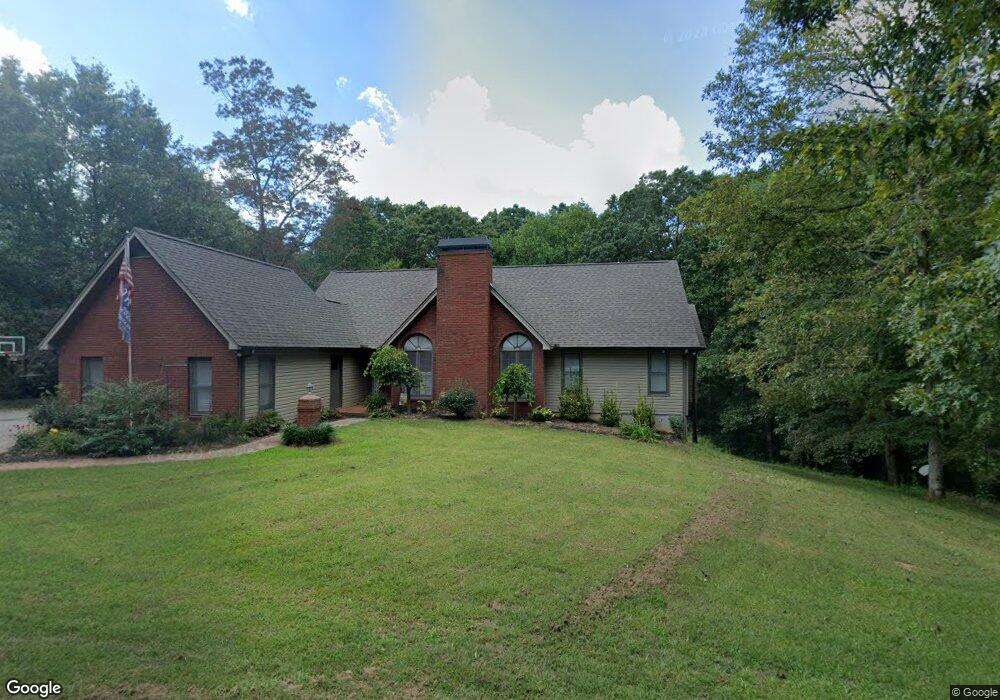
110 Foxwood Dr Cleveland, GA 30528
Estimated Value: $441,873 - $503,000
4
Beds
4
Baths
1,902
Sq Ft
$249/Sq Ft
Est. Value
About This Home
This home is located at 110 Foxwood Dr, Cleveland, GA 30528 and is currently estimated at $473,468, approximately $248 per square foot. 110 Foxwood Dr is a home located in White County with nearby schools including White County 9th Grade Academy, Tesnatee Gap Elementary (Old White County Intermediate), and Jack P. Nix Elementary School.
Ownership History
Date
Name
Owned For
Owner Type
Purchase Details
Closed on
Oct 30, 2017
Sold by
Bregante Louis
Bought by
Robinson Amanda Leigh and Robinson Galen Shane
Current Estimated Value
Home Financials for this Owner
Home Financials are based on the most recent Mortgage that was taken out on this home.
Original Mortgage
$226,816
Outstanding Balance
$192,805
Interest Rate
4.5%
Mortgage Type
FHA
Estimated Equity
$280,663
Purchase Details
Closed on
Oct 1, 2007
Sold by
Not Provided
Bought by
Bregante Louis
Create a Home Valuation Report for This Property
The Home Valuation Report is an in-depth analysis detailing your home's value as well as a comparison with similar homes in the area
Home Values in the Area
Average Home Value in this Area
Purchase History
| Date | Buyer | Sale Price | Title Company |
|---|---|---|---|
| Robinson Amanda Leigh | $231,000 | -- | |
| Bregante Louis | -- | -- |
Source: Public Records
Mortgage History
| Date | Status | Borrower | Loan Amount |
|---|---|---|---|
| Open | Robinson Amanda Leigh | $226,816 |
Source: Public Records
Tax History Compared to Growth
Tax History
| Year | Tax Paid | Tax Assessment Tax Assessment Total Assessment is a certain percentage of the fair market value that is determined by local assessors to be the total taxable value of land and additions on the property. | Land | Improvement |
|---|---|---|---|---|
| 2025 | $2,755 | $171,844 | $14,000 | $157,844 |
| 2024 | $2,755 | $171,844 | $14,000 | $157,844 |
| 2023 | $2,333 | $150,684 | $14,000 | $136,684 |
| 2022 | $2,558 | $126,884 | $8,000 | $118,884 |
| 2021 | $2,485 | $101,644 | $8,000 | $93,644 |
| 2020 | $2,452 | $92,140 | $8,000 | $84,140 |
| 2019 | $2,460 | $92,140 | $8,000 | $84,140 |
| 2018 | $2,460 | $92,140 | $8,000 | $84,140 |
| 2017 | $2,285 | $83,664 | $8,000 | $75,664 |
| 2016 | $2,285 | $83,664 | $8,000 | $75,664 |
| 2015 | $2,180 | $209,160 | $8,000 | $75,664 |
| 2014 | $1,883 | $180,970 | $0 | $0 |
Source: Public Records
Map
Nearby Homes
- 113 Stoddard Ln
- 266 Hunts Ridge Dr
- 197 Hunts Ridge Dr
- S. LACEOLA ROAD Lot 242
- 97 Hawks Ridge Ct
- 51 Hawks Ridge Ct
- 0 Freeman View Trail Unit LOT 2 10540144
- 50 Hawks Ridge Ct
- 96 Hawks Ridge Ct
- 0 Laurel Point Unit 10623374
- 96 Joyce Drive (Off Airport Road)
- 0 Jess Hunt Rd W
- 147 Jess Hunt Rd W
- 25 Caudell Dr
- 231 Doug Allison Heights
- 0 Appalachian Pkwy Unit 22327486
- 213 Jackson Heights
- 201 Jackson Heights
- 156 Brett Rd
- 189 Jackson Heights
- 93 Foxwood Dr
- 126 Foxwood Dr
- 55 Foxwood Dr
- 30 Foxwood Dr
- 1883 129 Hwy N
- 1883 Highway 129 N
- 44 Lindsey Dr
- 132 Lindsey Dr
- 0 Foxwood Dr Unit 5 7580389
- 0 Foxwood Dr Unit 4 7580382
- 0 Foxwood Dr Unit 8017328
- 0 Foxwood Dr Unit 8893635
- 0 Foxwood Dr Unit 7472639
- 0 Lindsey Dr Unit 7094907
- 0 Lindsey Dr
- 270 Lindsey Dr
- 129 Lindsey Dr
- 0 Hamik Hollow Rd Unit 10068478
- 0 Hamik Hollow Rd
- 77 Lindsey Dr