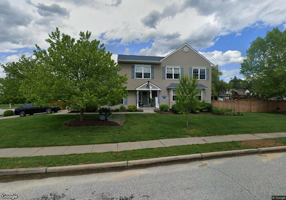
110 Horseshoe Dr Mantua, NJ 08051
Mantua Township NeighborhoodEstimated Value: $498,000 - $579,000
--
Bed
--
Bath
2,220
Sq Ft
$246/Sq Ft
Est. Value
About This Home
This home is located at 110 Horseshoe Dr, Mantua, NJ 08051 and is currently estimated at $546,518, approximately $246 per square foot. 110 Horseshoe Dr is a home located in Gloucester County with nearby schools including Centre City School, Clearview Regional Middle School, and Clearview Regional High School.
Ownership History
Date
Name
Owned For
Owner Type
Purchase Details
Closed on
Jun 30, 2004
Sold by
Prendergast Michael J and Prendergast Danielle C
Bought by
Castle Daniel G and Castle Marissa L
Current Estimated Value
Home Financials for this Owner
Home Financials are based on the most recent Mortgage that was taken out on this home.
Original Mortgage
$236,000
Outstanding Balance
$118,133
Interest Rate
6.25%
Mortgage Type
Purchase Money Mortgage
Estimated Equity
$428,385
Purchase Details
Closed on
Mar 26, 1999
Sold by
Jessup Associates Inc
Bought by
Prendergast Michael J and Prendergast Danielle C
Home Financials for this Owner
Home Financials are based on the most recent Mortgage that was taken out on this home.
Original Mortgage
$126,100
Interest Rate
6.83%
Create a Home Valuation Report for This Property
The Home Valuation Report is an in-depth analysis detailing your home's value as well as a comparison with similar homes in the area
Home Values in the Area
Average Home Value in this Area
Purchase History
| Date | Buyer | Sale Price | Title Company |
|---|---|---|---|
| Castle Daniel G | $326,000 | -- | |
| Prendergast Michael J | $157,700 | Title America Agency Corp |
Source: Public Records
Mortgage History
| Date | Status | Borrower | Loan Amount |
|---|---|---|---|
| Open | Castle Daniel G | $236,000 | |
| Previous Owner | Prendergast Michael J | $126,100 |
Source: Public Records
Tax History Compared to Growth
Tax History
| Year | Tax Paid | Tax Assessment Tax Assessment Total Assessment is a certain percentage of the fair market value that is determined by local assessors to be the total taxable value of land and additions on the property. | Land | Improvement |
|---|---|---|---|---|
| 2025 | $11,567 | $449,200 | $113,500 | $335,700 |
| 2024 | $11,446 | $449,200 | $113,500 | $335,700 |
| 2023 | $11,446 | $449,200 | $113,500 | $335,700 |
| 2022 | $9,623 | $275,100 | $63,100 | $212,000 |
| 2021 | $9,695 | $275,100 | $63,100 | $212,000 |
| 2020 | $9,618 | $275,100 | $63,100 | $212,000 |
| 2019 | $9,455 | $275,100 | $63,100 | $212,000 |
| 2018 | $9,320 | $275,100 | $63,100 | $212,000 |
| 2017 | $9,180 | $275,100 | $63,100 | $212,000 |
| 2016 | $9,076 | $275,100 | $63,100 | $212,000 |
| 2015 | $8,853 | $275,100 | $63,100 | $212,000 |
| 2014 | $8,556 | $252,400 | $63,100 | $189,300 |
Source: Public Records
Map
Nearby Homes
- 590 Bridgeton Pike
- 36 Bluebird Rd
- 155 Whippoorwill Way
- 190 Mockingbird Ln
- 485 Harrison Ave
- 204 W Landing Rd
- 26 Woodstream Ct
- 261 Tony Cir
- 284 Columbus Dr
- 131 Firth Dr
- 119 Monroe Ave
- 27 Kristen Ln
- 19 Marathon Dr
- 17 Oakton Dr
- 290 Montgomery Dr
- 325 Bridgeton Pike
- 41 Woodbrook Dr Unit C041
- 1433 Tristram Cir
- 106 Firth Dr
- 205 Redbud Ln Unit 205
- 130 Horseshoe Dr
- 112 Horseshoe Dr
- 128 Horseshoe Dr
- 111 Horseshoe Dr
- 636 Olympia St
- 634 Olympia St
- 638 Olympia St
- 114 Horseshoe Dr
- 113 Horseshoe Dr
- 133 Horseshoe Dr
- 632 Olympia St
- 126 Horseshoe Dr
- 641 Olympia St
- 131 Horseshoe Dr
- 640 Olympia St
- 115 Horseshoe Dr
- 630 Olympia St
- 129 Horseshoe Dr
- 643 Olympia St
- 129 Olympia Ct