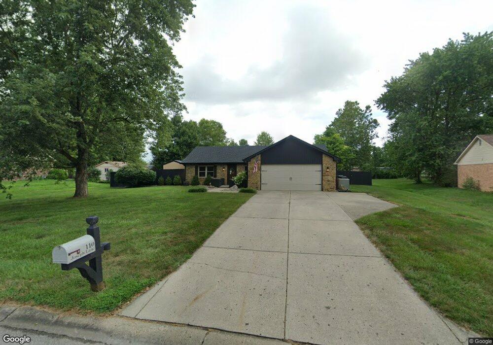
110 Joseph Ln Whiteland, IN 46184
Estimated Value: $279,000 - $299,000
3
Beds
2
Baths
1,289
Sq Ft
$223/Sq Ft
Est. Value
About This Home
This home is located at 110 Joseph Ln, Whiteland, IN 46184 and is currently estimated at $287,944, approximately $223 per square foot. 110 Joseph Ln is a home located in Johnson County with nearby schools including Whiteland Elementary School, Clark-Pleasant Middle School, and Whiteland Community High School.
Ownership History
Date
Name
Owned For
Owner Type
Purchase Details
Closed on
Mar 27, 2018
Sold by
Kirkpatrick Robert
Bought by
Kirkpatrick Robert and Kirkpatrick Aleena
Current Estimated Value
Purchase Details
Closed on
Aug 30, 2017
Sold by
Foerg Shane R and Foerg Sonia N
Bought by
Kirkpartrick Robert
Home Financials for this Owner
Home Financials are based on the most recent Mortgage that was taken out on this home.
Original Mortgage
$142,500
Outstanding Balance
$119,189
Interest Rate
3.96%
Mortgage Type
New Conventional
Estimated Equity
$168,755
Create a Home Valuation Report for This Property
The Home Valuation Report is an in-depth analysis detailing your home's value as well as a comparison with similar homes in the area
Home Values in the Area
Average Home Value in this Area
Purchase History
| Date | Buyer | Sale Price | Title Company |
|---|---|---|---|
| Kirkpatrick Robert | -- | -- | |
| Kirkpartrick Robert | -- | Security Title Services |
Source: Public Records
Mortgage History
| Date | Status | Borrower | Loan Amount |
|---|---|---|---|
| Open | Kirkpartrick Robert | $142,500 |
Source: Public Records
Tax History Compared to Growth
Tax History
| Year | Tax Paid | Tax Assessment Tax Assessment Total Assessment is a certain percentage of the fair market value that is determined by local assessors to be the total taxable value of land and additions on the property. | Land | Improvement |
|---|---|---|---|---|
| 2025 | $2,628 | $254,500 | $58,500 | $196,000 |
| 2024 | $2,628 | $251,500 | $58,500 | $193,000 |
| 2023 | $2,632 | $251,500 | $58,500 | $193,000 |
| 2022 | $2,018 | $193,000 | $58,500 | $134,500 |
| 2021 | $1,737 | $165,600 | $41,800 | $123,800 |
| 2020 | $1,722 | $165,700 | $41,800 | $123,900 |
| 2019 | $1,696 | $163,200 | $41,800 | $121,400 |
| 2018 | $1,461 | $144,700 | $38,700 | $106,000 |
| 2017 | $1,407 | $138,100 | $38,700 | $99,400 |
| 2016 | $1,399 | $138,100 | $38,700 | $99,400 |
| 2014 | $1,212 | $119,300 | $38,700 | $80,600 |
| 2013 | $1,212 | $112,600 | $32,600 | $80,000 |
Source: Public Records
Map
Nearby Homes
- 8 Marys Ct
- 241 Deborah Ln
- 254 Halldale Dr
- 83 Palmetto Dr
- 372 Wert Ln
- 272 Mcnair Rd
- 288 Mcnair Rd
- 661 Woodview Dr
- 800 Beechwood Ct
- 818 Beechwood Ct
- 1139 Beechwood Ct
- 836 Beechwood Ct
- 1047 Beechwood Ct
- 807 Beechwood Ct
- 752 Beechwood Ct
- 899 Beechwood Ct
- 835 Beechwood Ct
- 867 Beechwood Ct
- 338 Mcnair Rd
- 1521 Cottonwood Dr