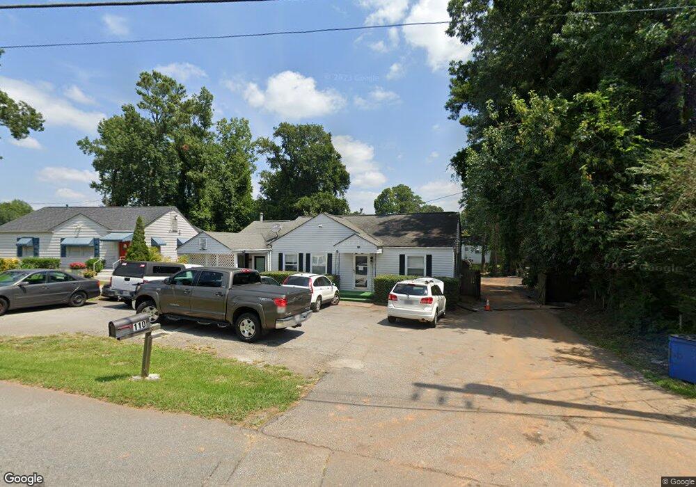
110 Kipling Dr Marietta, GA 30068
Eastern Marietta NeighborhoodEstimated Value: $176,988
2
Beds
1
Bath
1,545
Sq Ft
$115/Sq Ft
Est. Value
About This Home
This home is located at 110 Kipling Dr, Marietta, GA 30068 and is currently estimated at $176,988, approximately $114 per square foot. 110 Kipling Dr is a home located in Cobb County with nearby schools including Marietta Sixth Grade Academy, Lockheed Elementary School, and Marietta Middle School.
Ownership History
Date
Name
Owned For
Owner Type
Purchase Details
Closed on
Dec 20, 2022
Sold by
Danesh Roshan
Bought by
Bahman R Property Group Llc
Current Estimated Value
Purchase Details
Closed on
Nov 20, 2020
Sold by
Roshan Danesh
Bought by
Bohman Llc
Purchase Details
Closed on
May 31, 2016
Sold by
Obrien Hedwig
Bought by
Roshan Danesh
Purchase Details
Closed on
May 21, 2015
Sold by
Kinderart N
Bought by
Obrien Hedwig
Purchase Details
Closed on
Apr 25, 2006
Sold by
Obrien Hedwig
Bought by
Kinderartn Inc
Create a Home Valuation Report for This Property
The Home Valuation Report is an in-depth analysis detailing your home's value as well as a comparison with similar homes in the area
Home Values in the Area
Average Home Value in this Area
Purchase History
| Date | Buyer | Sale Price | Title Company |
|---|---|---|---|
| Bahman R Property Group Llc | -- | -- | |
| Bohman Llc | -- | None Available | |
| Roshan Danesh | $110,000 | -- | |
| Obrien Hedwig | -- | -- | |
| Kinderartn Inc | -- | -- |
Source: Public Records
Tax History
| Year | Tax Paid | Tax Assessment Tax Assessment Total Assessment is a certain percentage of the fair market value that is determined by local assessors to be the total taxable value of land and additions on the property. | Land | Improvement |
|---|---|---|---|---|
| 2025 | $656 | $77,568 | $30,528 | $47,040 |
| 2024 | $650 | $76,888 | $30,528 | $46,360 |
| 2023 | $571 | $67,548 | $26,548 | $41,000 |
| 2022 | $553 | $65,380 | $25,620 | $39,760 |
| 2021 | $435 | $50,652 | $25,620 | $25,032 |
| 2020 | $378 | $43,976 | $22,276 | $21,700 |
| 2019 | $339 | $39,468 | $22,276 | $17,192 |
| 2018 | $339 | $39,468 | $22,276 | $17,192 |
| 2017 | $272 | $39,468 | $22,276 | $17,192 |
| 2016 | $238 | $34,608 | $18,564 | $16,044 |
| 2015 | $260 | $34,608 | $18,564 | $16,044 |
| 2014 | -- | $34,076 | $18,564 | $15,512 |
Source: Public Records
Map
Nearby Homes
- 1716 Nekoma St
- 392 Hamilton Trace Unit III
- 1466 Varner Rd
- 1821 Clearwater Dr SE
- 0 Shadowbrook Dr Unit 10506866
- 0 Shadowbrook Dr Unit 7564152
- 1670 Wildwood Rd
- 1424 Shadowbrook Dr
- 1486 Blanche Dr SE
- 347 Scott Dr SE
- 57 Sewell Ln
- 1664 Crestridge Dr SE
- 349 Virginia Place SE
- 1972 Clearwater Dr SE
- 369 Virginia Place SE
- 1306 Kasandra Dr SE
- 413 Virginia Place SE
- 1249 Kasandra Dr SE
- 2164 Pawnee Dr SE Unit 1
- 33 Old Farm Rd
- 1663 Lower Roswell Rd
- 1675 Lower Roswell Rd
- 89 Gable Rd
- 1685 Lower Roswell Rd
- 106 Kipling Dr
- 189 Kipling Dr
- 1653 Lower Roswell Rd
- 99 Gable Rd
- 1647 Lower Roswell Rd
- 193 Kipling Dr
- 1639 Lower Roswell Rd
- 1694 Lower Roswell Rd
- 1616 Roswell Rd
- 1642 Roswell Rd
- 39 Harris Dr SE
- 1646 Roswell Rd
- 1723 Nekoma St
- 40 Harris Dr SE
- 40 Harris Dr SE Unit 110
- 40 Harris Dr SE Unit 100
Your Personal Tour Guide
Ask me questions while you tour the home.