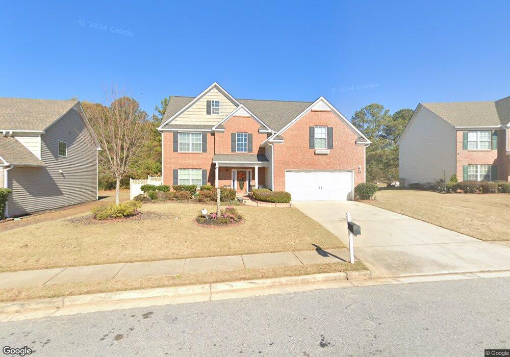
110 Landon Way Covington, GA 30016
Estimated Value: $325,057 - $382,000
--
Bed
2
Baths
2,911
Sq Ft
$119/Sq Ft
Est. Value
About This Home
This home is located at 110 Landon Way, Covington, GA 30016 and is currently estimated at $346,014, approximately $118 per square foot. 110 Landon Way is a home located in Newton County with nearby schools including Live Oak Elementary School, Clements Middle School, and Newton High School.
Ownership History
Date
Name
Owned For
Owner Type
Purchase Details
Closed on
Dec 20, 2006
Sold by
Stubbs Martin C
Bought by
Stubbs Martin C and Stubbs Phyllis C
Current Estimated Value
Home Financials for this Owner
Home Financials are based on the most recent Mortgage that was taken out on this home.
Original Mortgage
$129,400
Outstanding Balance
$76,461
Interest Rate
6.1%
Mortgage Type
New Conventional
Estimated Equity
$269,553
Create a Home Valuation Report for This Property
The Home Valuation Report is an in-depth analysis detailing your home's value as well as a comparison with similar homes in the area
Home Values in the Area
Average Home Value in this Area
Purchase History
| Date | Buyer | Sale Price | Title Company |
|---|---|---|---|
| Stubbs Martin C | -- | -- | |
| Stubbs Martin C | $199,400 | -- |
Source: Public Records
Mortgage History
| Date | Status | Borrower | Loan Amount |
|---|---|---|---|
| Open | Stubbs Martin C | $129,400 |
Source: Public Records
Tax History Compared to Growth
Tax History
| Year | Tax Paid | Tax Assessment Tax Assessment Total Assessment is a certain percentage of the fair market value that is determined by local assessors to be the total taxable value of land and additions on the property. | Land | Improvement |
|---|---|---|---|---|
| 2024 | $3,186 | $123,520 | $20,000 | $103,520 |
| 2023 | $3,680 | $133,520 | $9,600 | $123,920 |
| 2022 | $3,211 | $116,240 | $9,600 | $106,640 |
| 2021 | $3,045 | $98,520 | $9,600 | $88,920 |
| 2020 | $2,952 | $86,200 | $9,600 | $76,600 |
| 2019 | $2,834 | $81,440 | $9,600 | $71,840 |
| 2018 | $2,743 | $78,280 | $9,600 | $68,680 |
| 2017 | $2,706 | $77,200 | $9,600 | $67,600 |
| 2016 | $2,226 | $63,200 | $7,600 | $55,600 |
| 2015 | $1,769 | $49,920 | $7,600 | $42,320 |
| 2014 | $1,296 | $36,280 | $0 | $0 |
Source: Public Records
Map
Nearby Homes
- 280 Hoglen Dr
- 200 Syracuse Ln
- 90 Brookstone Ct
- 60 Brookstone Ct
- 65 Rosewood Cir
- 260 Rosewood Cir
- 40 Princeton Ct
- 105 Queensland Ln
- 50 Evelyn Rd
- 190 Silver Ridge Rd
- 814 Jack Neely Rd
- 155 Oak Terrace Dr
- 245 Camerons Way
- 210 Silver Ridge Rd
- 60 Silver Peak Dr
- 115 Tanners Ct
- 90 Streamside Dr
- 15 Joe Ewing Dr
- 120 Landon Way
- 0 Landon Way Unit 7121582
- 0 Landon Way Unit 8029839
- 0 Landon Way Unit 7208256
- 0 Landon Way Unit 9056705
- 0 Landon Way Unit 8867618
- 0 Landon Way Unit 3209579
- 0 Landon Way Unit 7343389
- 100 Landon Way
- 0 Hoglen Dr
- 130 Landon Way
- 135 Landon Way
- 125 Landon Way
- 90 Landon Way
- 145 Landon Way
- 140 Landon Way
- 80 Hoglen Dr
- 115 Landon Way
- 80 Landon Way
- 80 Sammy Ct