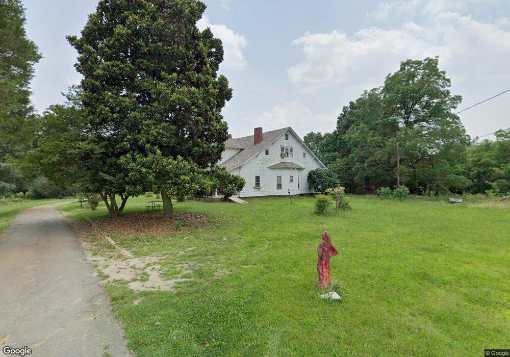
110 Latham Dr Kings Mountain, NC 28086
Estimated Value: $230,000 - $434,000
--
Bed
--
Bath
3,324
Sq Ft
$91/Sq Ft
Est. Value
About This Home
This home is located at 110 Latham Dr, Kings Mountain, NC 28086 and is currently estimated at $302,237, approximately $90 per square foot. 110 Latham Dr is a home located in Cleveland County with nearby schools including North Elementary School, Kings Mountain Intermediate School, and Kings Mountain Middle.
Ownership History
Date
Name
Owned For
Owner Type
Purchase Details
Closed on
Aug 7, 2012
Sold by
Logan William Benjamin
Bought by
Logan Robert Carl
Current Estimated Value
Purchase Details
Closed on
Jun 29, 2012
Sold by
Logan William B
Bought by
Logan Robert Carl
Purchase Details
Closed on
Apr 20, 2012
Sold by
Latham Vicki L
Bought by
Allen Jerry Lee
Create a Home Valuation Report for This Property
The Home Valuation Report is an in-depth analysis detailing your home's value as well as a comparison with similar homes in the area
Home Values in the Area
Average Home Value in this Area
Purchase History
| Date | Buyer | Sale Price | Title Company |
|---|---|---|---|
| Logan Robert Carl | -- | None Available | |
| Logan Robert Carl | -- | None Available | |
| Allen Jerry Lee | $80,000 | None Available |
Source: Public Records
Tax History Compared to Growth
Tax History
| Year | Tax Paid | Tax Assessment Tax Assessment Total Assessment is a certain percentage of the fair market value that is determined by local assessors to be the total taxable value of land and additions on the property. | Land | Improvement |
|---|---|---|---|---|
| 2025 | $1,520 | $148,310 | $80,704 | $67,606 |
| 2024 | $1,093 | $91,450 | $55,503 | $35,947 |
| 2023 | $1,087 | $91,450 | $55,503 | $35,947 |
| 2022 | $1,042 | $91,450 | $55,503 | $35,947 |
| 2021 | $1,047 | $91,450 | $55,503 | $35,947 |
| 2020 | $618 | $53,713 | $49,578 | $4,135 |
| 2019 | $618 | $53,713 | $49,578 | $4,135 |
| 2018 | $618 | $53,713 | $49,578 | $4,135 |
| 2017 | $615 | $53,713 | $49,578 | $4,135 |
| 2016 | $618 | $53,713 | $49,578 | $4,135 |
| 2015 | $1,465 | $129,172 | $58,488 | $70,684 |
| 2014 | $1,590 | $140,314 | $69,630 | $70,684 |
Source: Public Records
Map
Nearby Homes
- 1610 Shelby Rd
- 106 Cameron Dr
- Plan 2338 at Cottages at Clovis Point
- Plan 2723 at Cottages at Clovis Point
- Plan 2539 at Cottages at Clovis Point
- Plan 1844 at Cottages at Clovis Point
- Plan 1445 at Cottages at Clovis Point
- Plan 1582 at Cottages at Clovis Point
- 125 Country Creek Dr
- 1500 Shelby Rd
- 110 Kimberly Ln
- 202 Cameron Dr
- 129 Country Creek Dr
- 145 Crown Ct
- 117 Sir Lancelot Ln
- 1301 Shelby Rd
- 117 Parker Claire Ln
- 111 Parker Claire Ln
- 213 Parker Claire Ln
- 262 Frank Burns Way
- 113 Butternut Dr
- 107 Latham Dr
- 115 Butternut Dr
- 111 Butternut Dr
- 117 Butternut Dr
- 1715 Shelby Rd
- 109 Butternut Dr
- 110 Butternut Dr
- 1717 Shelby Rd
- 1703 Shelby Rd
- 114 Butternut Dr
- 1719 Shelby Rd
- 108 Butternut Dr
- 1723 Shelby Rd
- 121 Butternut Dr
- 116 Butternut Dr
- 107 Butternut Dr
- 118 Butternut Dr
- 123 Butternut Dr
- 1701 Shelby Rd