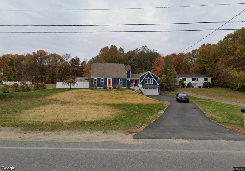
110 Laurel St West Boylston, MA 01583
Estimated Value: $546,000 - $865,000
2
Beds
2
Baths
2,008
Sq Ft
$324/Sq Ft
Est. Value
About This Home
This home is located at 110 Laurel St, West Boylston, MA 01583 and is currently estimated at $650,955, approximately $324 per square foot. 110 Laurel St is a home located in Worcester County with nearby schools including Major Edwards Elementary School and West Boylston Junior/Senior High School.
Ownership History
Date
Name
Owned For
Owner Type
Purchase Details
Closed on
Nov 24, 2010
Sold by
Mcaffrey-Bishop Margo H
Bought by
Mcaffrey-Bishop Margo H and Bishop Steven T
Current Estimated Value
Home Financials for this Owner
Home Financials are based on the most recent Mortgage that was taken out on this home.
Original Mortgage
$223,008
Outstanding Balance
$147,562
Interest Rate
4.25%
Mortgage Type
FHA
Estimated Equity
$503,393
Purchase Details
Closed on
Nov 30, 1993
Sold by
Johnson Ronald
Bought by
Kowaleski Michael P
Home Financials for this Owner
Home Financials are based on the most recent Mortgage that was taken out on this home.
Original Mortgage
$60,000
Interest Rate
6.72%
Mortgage Type
Purchase Money Mortgage
Create a Home Valuation Report for This Property
The Home Valuation Report is an in-depth analysis detailing your home's value as well as a comparison with similar homes in the area
Home Values in the Area
Average Home Value in this Area
Purchase History
| Date | Buyer | Sale Price | Title Company |
|---|---|---|---|
| Mcaffrey-Bishop Margo H | -- | -- | |
| Mcaffrey-Bishop Margo H | -- | -- | |
| Kowaleski Michael P | $89,000 | -- |
Source: Public Records
Mortgage History
| Date | Status | Borrower | Loan Amount |
|---|---|---|---|
| Open | Mcaffrey-Bishop Margo H | $223,008 | |
| Closed | Mcaffrey-Bishop Margo H | $223,008 | |
| Previous Owner | Kowaleski Michael P | $85,000 | |
| Previous Owner | Kowaleski Michael P | $60,000 |
Source: Public Records
Tax History Compared to Growth
Tax History
| Year | Tax Paid | Tax Assessment Tax Assessment Total Assessment is a certain percentage of the fair market value that is determined by local assessors to be the total taxable value of land and additions on the property. | Land | Improvement |
|---|---|---|---|---|
| 2025 | $77 | $557,300 | $126,900 | $430,400 |
| 2024 | $7,248 | $490,400 | $127,400 | $363,000 |
| 2023 | $7,324 | $470,100 | $125,300 | $344,800 |
| 2022 | $6,710 | $379,500 | $125,300 | $254,200 |
| 2021 | $6,489 | $351,500 | $108,000 | $243,500 |
| 2020 | $6,319 | $340,100 | $108,000 | $232,100 |
| 2019 | $6,072 | $322,100 | $108,000 | $214,100 |
| 2018 | $4,996 | $266,900 | $108,000 | $158,900 |
| 2017 | $4,999 | $265,900 | $108,000 | $157,900 |
| 2016 | $4,742 | $257,000 | $100,400 | $156,600 |
| 2015 | $4,537 | $247,400 | $99,600 | $147,800 |
Source: Public Records
Map
Nearby Homes
- 16 N Main St
- 287 Laurel St
- 26 Townsend Dr
- 20 Winthrop St
- 0 North St
- 136 Sterling St Unit A3
- Lot 1 Manning St
- 0 Boutelle Rd
- 61 Boutelle Rd
- 156 Prospect St
- 2 Lakeview Ave
- 18 Laurel Ave
- 223 Worcester Rd
- 21 Myrtle Ave
- 152 Worcester St Unit 8
- 4 Jewett Rd Unit B
- 4 Jewett Rd Unit A
- 54 Maple St
- 62 Maple St
- 751 Mason Rd