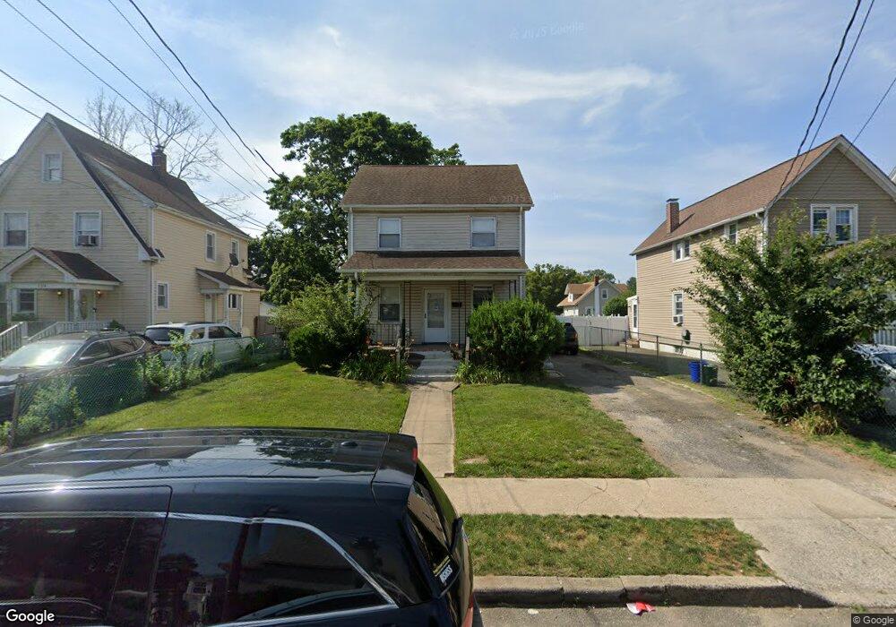
110 Leonard Ave Unit 1 Freeport, NY 11520
Estimated Value: $421,000 - $619,349
1
Bed
1
Bath
1,408
Sq Ft
$369/Sq Ft
Est. Value
About This Home
This home is located at 110 Leonard Ave Unit 1, Freeport, NY 11520 and is currently estimated at $520,175, approximately $369 per square foot. 110 Leonard Ave Unit 1 is a home located in Nassau County with nearby schools including Columbus Avenue School, Caroline G. Atkinson Intermediate School, and John W Dodd Middle School.
Ownership History
Date
Name
Owned For
Owner Type
Purchase Details
Closed on
May 2, 2024
Sold by
Bryant Raymond and Bryant Virginia
Bought by
110 Leonard Buying Group Llc
Current Estimated Value
Home Financials for this Owner
Home Financials are based on the most recent Mortgage that was taken out on this home.
Original Mortgage
$363,750
Outstanding Balance
$358,591
Interest Rate
6.82%
Mortgage Type
Construction
Estimated Equity
$161,584
Create a Home Valuation Report for This Property
The Home Valuation Report is an in-depth analysis detailing your home's value as well as a comparison with similar homes in the area
Home Values in the Area
Average Home Value in this Area
Purchase History
| Date | Buyer | Sale Price | Title Company |
|---|---|---|---|
| 110 Leonard Buying Group Llc | $485,000 | Judicial Title | |
| 110 Leonard Buying Group Llc | $485,000 | Judicial Title |
Source: Public Records
Mortgage History
| Date | Status | Borrower | Loan Amount |
|---|---|---|---|
| Open | 110 Leonard Buying Group Llc | $363,750 | |
| Closed | 110 Leonard Buying Group Llc | $363,750 |
Source: Public Records
Tax History Compared to Growth
Tax History
| Year | Tax Paid | Tax Assessment Tax Assessment Total Assessment is a certain percentage of the fair market value that is determined by local assessors to be the total taxable value of land and additions on the property. | Land | Improvement |
|---|---|---|---|---|
| 2025 | $8,366 | $388 | $128 | $260 |
| 2024 | $863 | $388 | $128 | $260 |
| 2023 | $8,219 | $381 | $126 | $255 |
| 2022 | $8,219 | $388 | $128 | $260 |
| 2021 | $12,503 | $372 | $123 | $249 |
| 2020 | $12,310 | $557 | $287 | $270 |
| 2019 | $8,197 | $557 | $287 | $270 |
| 2018 | $8,065 | $557 | $0 | $0 |
| 2017 | $6,703 | $557 | $287 | $270 |
| 2016 | $7,539 | $557 | $287 | $270 |
| 2015 | $805 | $557 | $287 | $270 |
| 2014 | $805 | $557 | $287 | $270 |
| 2013 | $760 | $557 | $287 | $270 |
Source: Public Records
Map
Nearby Homes
- 92 Leonard Ave
- 259 N Columbus Ave
- 112 E Seaman Ave
- 272 N Columbus Ave
- 101 Harris Ave
- 173 E Seaman Ave
- 261 Rutland Rd
- 110 Woodside Ave
- 238 Babylon Turnpike
- 67 E Dean St
- 271 Babylon Turnpike
- 93 Woodside Ave
- 400 N Columbus Ave
- 451 Babylon Turnpike
- 221 E Dean St
- 45 Dehnhoff Ave
- 28 Cumberland Ave
- 161 Grand Ave
- 251 Grand Ave
- 182 Grand Ave
- 110 Leonard Ave
- 96 Leonard Ave
- 114 Leonard Ave
- 114 Leonard Ave Unit Main
- 94 Leonard Ave
- 120 Leonard Ave
- 115 Lillian Ave
- 93 Leonard Ave
- 117 Lillian Ave
- 111 Lillian Ave
- 124 Leonard Ave
- 2 Lafayette Place
- 121 Lillian Ave
- 4 Rogers Place
- 88 Leonard Ave
- 95 Lillian Ave
- 4 Lafayette Place
- 126 Leonard Ave
- 127 Lillian Ave
- 87 Leonard Ave