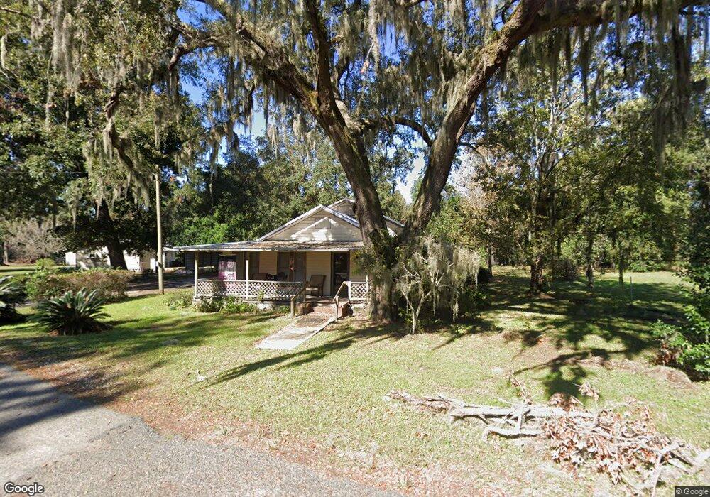
110 Manning St Brunswick, GA 31520
Estimated Value: $155,000 - $195,000
3
Beds
1
Bath
1,345
Sq Ft
$127/Sq Ft
Est. Value
About This Home
This home is located at 110 Manning St, Brunswick, GA 31520 and is currently estimated at $171,403, approximately $127 per square foot. 110 Manning St is a home located in Glynn County with nearby schools including Glyndale Elementary School, Glynn Middle School, and Glynn Academy.
Ownership History
Date
Name
Owned For
Owner Type
Purchase Details
Closed on
Aug 23, 2021
Sold by
Bradburn John M
Bought by
Waters Phyllis H and Waters Jeffrey T
Current Estimated Value
Purchase Details
Closed on
Jul 16, 2018
Sold by
Cobb Jeffrey D
Bought by
Bradburn John M and Bradburn Pamela A
Home Financials for this Owner
Home Financials are based on the most recent Mortgage that was taken out on this home.
Original Mortgage
$38,250
Interest Rate
4.6%
Mortgage Type
New Conventional
Purchase Details
Closed on
Nov 21, 2017
Sold by
Cobb Joan Ricks
Bought by
Cobb Jeffrey D and Salter Felicia C
Purchase Details
Closed on
Sep 5, 2014
Sold by
Cobb Donald E
Bought by
Cobb Joan R
Create a Home Valuation Report for This Property
The Home Valuation Report is an in-depth analysis detailing your home's value as well as a comparison with similar homes in the area
Home Values in the Area
Average Home Value in this Area
Purchase History
| Date | Buyer | Sale Price | Title Company |
|---|---|---|---|
| Waters Phyllis H | $45,000 | -- | |
| Bradburn John M | $45,000 | -- | |
| Cobb Jeffrey D | $30,000 | -- | |
| Cobb Joan R | -- | -- |
Source: Public Records
Mortgage History
| Date | Status | Borrower | Loan Amount |
|---|---|---|---|
| Previous Owner | Bradburn John M | $38,250 |
Source: Public Records
Tax History Compared to Growth
Tax History
| Year | Tax Paid | Tax Assessment Tax Assessment Total Assessment is a certain percentage of the fair market value that is determined by local assessors to be the total taxable value of land and additions on the property. | Land | Improvement |
|---|---|---|---|---|
| 2025 | $1,136 | $45,280 | $9,560 | $35,720 |
| 2024 | $1,141 | $45,480 | $9,560 | $35,920 |
| 2023 | $1,243 | $45,480 | $9,560 | $35,920 |
| 2022 | $565 | $17,560 | $4,120 | $13,440 |
| 2021 | $545 | $16,240 | $4,120 | $12,120 |
| 2020 | $549 | $16,240 | $4,120 | $12,120 |
| 2019 | $549 | $16,240 | $4,120 | $12,120 |
| 2018 | $498 | $14,280 | $4,120 | $10,160 |
| 2017 | $125 | $14,280 | $4,120 | $10,160 |
| 2016 | $188 | $14,280 | $4,120 | $10,160 |
| 2015 | $172 | $14,280 | $4,120 | $10,160 |
| 2014 | $172 | $13,320 | $3,160 | $10,160 |
Source: Public Records
Map
Nearby Homes
- 4166 Southern Rd
- 6111 New Jesup Hwy
- 6839 New Jesup Hwy
- 2111 Clairmont Ln
- 1022 Lake Dr
- 1030 Lake Dr
- 1046 Lake Dr
- 1037 Lake Dr
- 1013 Lake Dr
- 138 Picket Run
- 287 & 289 Windridge Dr
- 279 & 281 Windridge Dr
- 147 Picket Run
- 207 Lantana Ct
- 165 Pine Cir
- 1800 Townsend St
- BLK 14 LOT 11 Red Bud Ct
- 104 Windridge Dr
- 108 Manning St
- 125 Deloach St
- 135 Deloach St
- 121 Deloach St
- 111 Manning St
- 111 Manning St Unit 1
- 117 Deloach St
- 112 Manning St
- 109 Manning St
- 143 Deloach St
- 107 Manning St
- 105 Manning St
- 149 Deloach St
- 124 Deloach St
- 113 Manning St
- 119 Fader Ln
- 142 Deloach St
- 109 Deloach St
- 121 Fader Ln
- 155 Deloach St