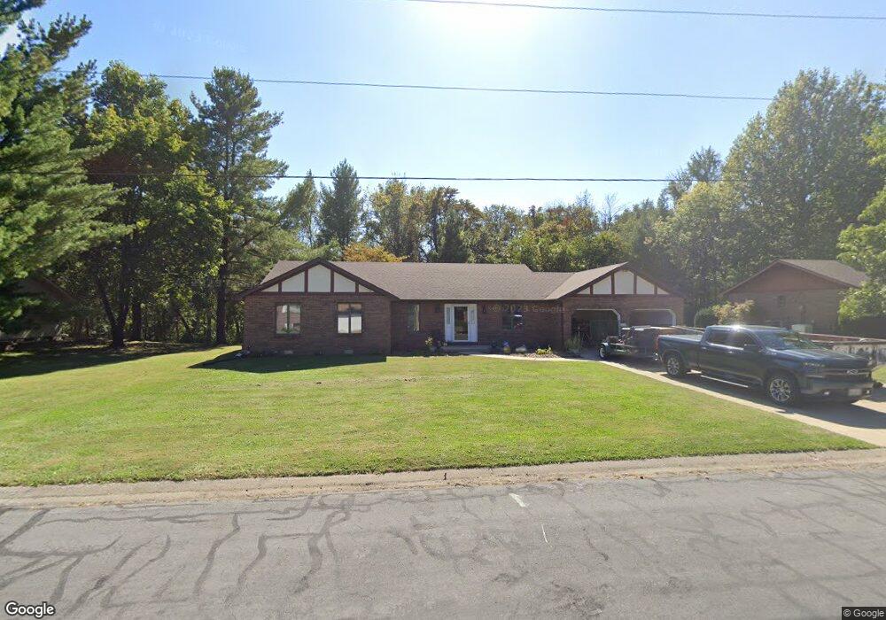
110 Melanie Ln Collinsville, IL 62234
Estimated Value: $253,000 - $299,000
3
Beds
4
Baths
2,041
Sq Ft
$135/Sq Ft
Est. Value
About This Home
This home is located at 110 Melanie Ln, Collinsville, IL 62234 and is currently estimated at $275,513, approximately $134 per square foot. 110 Melanie Ln is a home located in Madison County with nearby schools including Silver Creek Elementary School, Triad Middle School, and Triad High School.
Ownership History
Date
Name
Owned For
Owner Type
Purchase Details
Closed on
Sep 19, 2023
Sold by
Cohan Sheilby
Bought by
Stemm Carl J and Stemm Cynthia
Current Estimated Value
Home Financials for this Owner
Home Financials are based on the most recent Mortgage that was taken out on this home.
Original Mortgage
$218,500
Outstanding Balance
$214,011
Interest Rate
7.13%
Mortgage Type
New Conventional
Estimated Equity
$61,502
Purchase Details
Closed on
Aug 17, 2017
Sold by
Gray Cindy J and Gray Brian K
Bought by
Gray Cindy J
Create a Home Valuation Report for This Property
The Home Valuation Report is an in-depth analysis detailing your home's value as well as a comparison with similar homes in the area
Home Values in the Area
Average Home Value in this Area
Purchase History
| Date | Buyer | Sale Price | Title Company |
|---|---|---|---|
| Stemm Carl J | $230,000 | Metro Title & Escrow Co | |
| Gray Cindy J | -- | -- |
Source: Public Records
Mortgage History
| Date | Status | Borrower | Loan Amount |
|---|---|---|---|
| Open | Stemm Carl J | $218,500 |
Source: Public Records
Tax History Compared to Growth
Tax History
| Year | Tax Paid | Tax Assessment Tax Assessment Total Assessment is a certain percentage of the fair market value that is determined by local assessors to be the total taxable value of land and additions on the property. | Land | Improvement |
|---|---|---|---|---|
| 2024 | $3,904 | $67,710 | $11,420 | $56,290 |
| 2023 | $3,904 | $61,640 | $10,390 | $51,250 |
| 2022 | $3,754 | $57,000 | $9,610 | $47,390 |
| 2021 | $3,327 | $53,550 | $9,030 | $44,520 |
| 2020 | $3,253 | $51,100 | $8,620 | $42,480 |
| 2019 | $3,480 | $53,650 | $8,460 | $45,190 |
| 2018 | $3,513 | $52,020 | $8,200 | $43,820 |
| 2017 | $3,602 | $50,990 | $8,040 | $42,950 |
| 2016 | $4,201 | $60,520 | $8,040 | $52,480 |
| 2015 | $3,715 | $58,950 | $7,830 | $51,120 |
| 2014 | $3,715 | $58,950 | $7,830 | $51,120 |
| 2013 | $3,715 | $58,950 | $7,830 | $51,120 |
Source: Public Records
Map
Nearby Homes
- 7 Keiths Ct
- 189 Meyer Dr
- 226 Woodridge Ct
- 130 Hilltop Place
- 7302 W Kirsch Rd
- 1815 Robins Mill Ct
- 1819 Robin Mills Ct
- 1826 Robin Mills Ct
- 1830 Robin Mills Ct
- 1831 Crimson Oak Dr
- 1844 Crimson Oak Dr
- 963 Long Branch Rd
- 961 Weathervane Ln
- 2033 Mapleleaf Dr
- 131 E Country Ln
- 201 S Lange Ave
- 908 Long Branch Rd
- 2009 Buttonwood Ct
- 919 Carla Dr
- 1205 Antler Dr
- 104 Melanie Ln
- 108 Melanie Ln
- 107 Melanie Ln
- 102 Melanie Ln
- 103 Melanie Ln
- 112 Melanie Ln
- 109 Melanie Ln
- 132 David Dr
- 100 Melanie Ln
- 111 S Wilson Heights Rd
- 109 S Wilson Heights Rd
- 107 S Wilson Heights Rd
- 301 S Wilson Heights Rd
- 126 David Dr
- 305 S Wilson Heights Rd
- 100 Rebecca Ct
- 105 S Wilson Heights Rd
- 131 David Dr
- 1212 Ridge Prairie Ln
- 1206 Ridge Prairie Ln