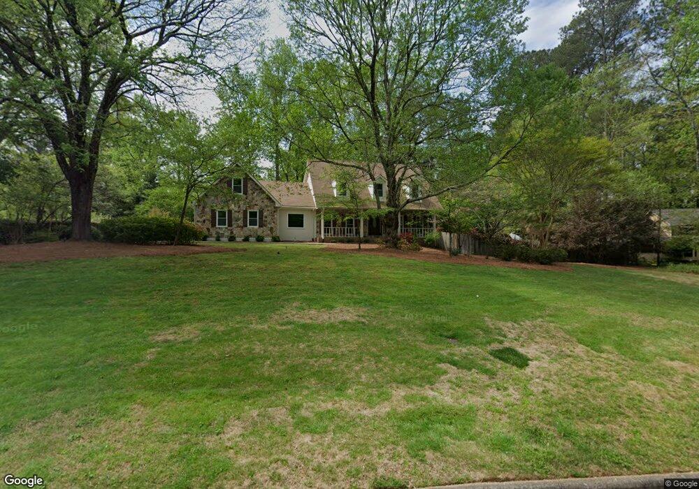
110 Nesbit Ferry Place Unit 2 Atlanta, GA 30350
Dunwoody Panhandle NeighborhoodEstimated Value: $655,000 - $892,000
3
Beds
3
Baths
3,963
Sq Ft
$193/Sq Ft
Est. Value
About This Home
This home is located at 110 Nesbit Ferry Place Unit 2, Atlanta, GA 30350 and is currently estimated at $765,943, approximately $193 per square foot. 110 Nesbit Ferry Place Unit 2 is a home located in Fulton County with nearby schools including Dunwoody Springs Elementary School, Sandy Springs Middle School, and North Springs High School.
Ownership History
Date
Name
Owned For
Owner Type
Purchase Details
Closed on
Dec 5, 2001
Sold by
Lentz George W
Bought by
Lentz George W and Lentz Anita E
Current Estimated Value
Home Financials for this Owner
Home Financials are based on the most recent Mortgage that was taken out on this home.
Original Mortgage
$235,000
Interest Rate
6.42%
Mortgage Type
New Conventional
Purchase Details
Closed on
Dec 30, 1998
Sold by
Crestar Mtg Corp
Bought by
Lentz George W and Lentz Anta E
Home Financials for this Owner
Home Financials are based on the most recent Mortgage that was taken out on this home.
Original Mortgage
$183,900
Interest Rate
6.72%
Mortgage Type
New Conventional
Create a Home Valuation Report for This Property
The Home Valuation Report is an in-depth analysis detailing your home's value as well as a comparison with similar homes in the area
Home Values in the Area
Average Home Value in this Area
Purchase History
| Date | Buyer | Sale Price | Title Company |
|---|---|---|---|
| Lentz George W | -- | -- | |
| Lentz George W | $229,900 | -- |
Source: Public Records
Mortgage History
| Date | Status | Borrower | Loan Amount |
|---|---|---|---|
| Previous Owner | Lentz George W | $235,000 | |
| Previous Owner | Lentz George W | $183,900 |
Source: Public Records
Tax History Compared to Growth
Tax History
| Year | Tax Paid | Tax Assessment Tax Assessment Total Assessment is a certain percentage of the fair market value that is determined by local assessors to be the total taxable value of land and additions on the property. | Land | Improvement |
|---|---|---|---|---|
| 2025 | $1,811 | $212,560 | $35,240 | $177,320 |
| 2023 | $1,811 | $233,920 | $35,240 | $198,680 |
| 2022 | $5,491 | $194,520 | $59,240 | $135,280 |
| 2021 | $5,417 | $194,440 | $37,160 | $157,280 |
| 2020 | $3,469 | $191,920 | $32,160 | $159,760 |
| 2019 | $3,407 | $185,920 | $31,600 | $154,320 |
| 2018 | $4,136 | $143,160 | $33,160 | $110,000 |
| 2017 | $3,225 | $107,480 | $24,920 | $82,560 |
| 2016 | $3,224 | $107,480 | $24,920 | $82,560 |
| 2015 | $3,230 | $107,480 | $24,920 | $82,560 |
| 2014 | $2,687 | $107,480 | $24,920 | $82,560 |
Source: Public Records
Map
Nearby Homes
- 6010 Spalding Dr
- 3906 Town Farms Dr
- Ashley Plan at Town Farms
- Abbey Plan at Town Farms
- 3846 Town Farms Dr
- 3845 Town Farms Dr
- 7611 Regency Cir
- 7611 Regency Cir
- 160 Savannah Estates Dr
- 2810 Harwick Dr
- 6509 Deerings Ln
- 6530 Deerings Ln
- 2975 Coles Way
- 6538 Deerings Ln
- 7300 Chattahoochee Bluff Dr
- 3865 Vic Ar Ct
- 4019 Deerings Dr Unit 42
- 6550 Deerings Ln
- 7850 Fawndale Way
- 5030 Nesbit Ferry Ln
- 5040 Nesbit Ferry Ln
- 120 Nesbit Ferry Place
- 115 Nesbit Ferry Place
- 115 Nesbit Ferry Place
- 5020 Nesbit Ferry Ln
- 125 Nesbit Ferry Place
- 130 Nesbit Ferry Place Unit 2
- 105 Nesbit Ferry Place Unit 2
- 135 Nesbit Ferry Place
- 5035 Nesbit Ferry Ln
- 5025 Nesbit Ferry Ln
- 0 Nesbit Ferry Ln Unit 7517670
- 0 Nesbit Ferry Ln Unit 7357611
- 0 Nesbit Ferry Ln Unit 8800379
- 0 Nesbit Ferry Ln Unit 8776383
- 0 Nesbit Ferry Ln Unit 8774691
- 0 Nesbit Ferry Ln Unit 8273851
- 0 Nesbit Ferry Ln Unit 8209228
- 0 Nesbit Ferry Ln Unit 8174755