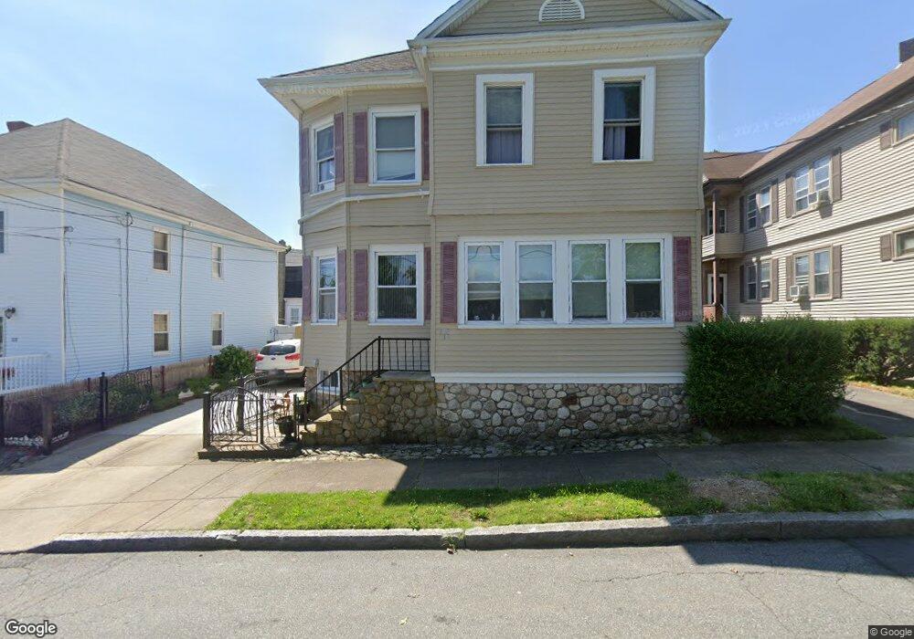
110 Norman St Unit 112 New Bedford, MA 02744
The South End NeighborhoodEstimated Value: $560,731 - $652,000
6
Beds
3
Baths
2,886
Sq Ft
$211/Sq Ft
Est. Value
About This Home
This home is located at 110 Norman St Unit 112, New Bedford, MA 02744 and is currently estimated at $609,183, approximately $211 per square foot. 110 Norman St Unit 112 is a home located in Bristol County with nearby schools including William H. Taylor Elementary School, Roosevelt Middle School, and New Bedford High School.
Ownership History
Date
Name
Owned For
Owner Type
Purchase Details
Closed on
Oct 22, 1993
Sold by
Kijak Richard J and Kijak Joanna M
Bought by
Carreiro Carlos F and Carreiro Maria F
Current Estimated Value
Home Financials for this Owner
Home Financials are based on the most recent Mortgage that was taken out on this home.
Original Mortgage
$72,100
Interest Rate
6.73%
Mortgage Type
Purchase Money Mortgage
Create a Home Valuation Report for This Property
The Home Valuation Report is an in-depth analysis detailing your home's value as well as a comparison with similar homes in the area
Home Values in the Area
Average Home Value in this Area
Purchase History
| Date | Buyer | Sale Price | Title Company |
|---|---|---|---|
| Carreiro Carlos F | $112,000 | -- | |
| Carreiro Carlos F | $112,000 | -- |
Source: Public Records
Mortgage History
| Date | Status | Borrower | Loan Amount |
|---|---|---|---|
| Open | Carreiro Carlos F | $100,000 | |
| Closed | Carreiro Carlos F | $46,500 | |
| Closed | Carreiro Carlos F | $10,000 | |
| Closed | Carreiro Carlos F | $72,100 |
Source: Public Records
Tax History Compared to Growth
Tax History
| Year | Tax Paid | Tax Assessment Tax Assessment Total Assessment is a certain percentage of the fair market value that is determined by local assessors to be the total taxable value of land and additions on the property. | Land | Improvement |
|---|---|---|---|---|
| 2025 | $6,166 | $545,200 | $109,000 | $436,200 |
| 2024 | $5,491 | $457,600 | $102,200 | $355,400 |
| 2023 | $5,369 | $375,700 | $88,600 | $287,100 |
| 2022 | $4,789 | $308,200 | $81,700 | $226,500 |
| 2021 | $4,805 | $308,200 | $81,700 | $226,500 |
| 2020 | $4,544 | $281,200 | $76,600 | $204,600 |
| 2019 | $4,439 | $269,500 | $76,600 | $192,900 |
| 2018 | $3,996 | $240,300 | $74,900 | $165,400 |
| 2017 | $3,590 | $215,100 | $74,900 | $140,200 |
| 2016 | $3,423 | $207,600 | $73,200 | $134,400 |
| 2015 | $3,196 | $203,200 | $73,200 | $130,000 |
| 2014 | $3,117 | $205,600 | $74,900 | $130,700 |
Source: Public Records
Map
Nearby Homes
- 106 Norman St Unit 108
- 114-116 Norman St
- 114 Norman St Unit 116
- 135-137 Clara St
- 135 Clara St Unit 137
- 273 Cleveland St
- 143 Clara St Unit 145
- 118 Norman St
- 118 Norman St Unit 3
- 147 Clara St Unit 149
- 147-149 Clara St Unit 1
- 147-149 Clara St Unit Room 3
- 147-149 Clara St Unit Room 1
- 147-149 Clara St Unit Room 2
- 147 Clara St Unit 2
- 147 Clara St
- 100 Norman St
- 122 Norman St Unit 124
- 272 Cleveland St Unit 274
- 151 Clara St Unit 153