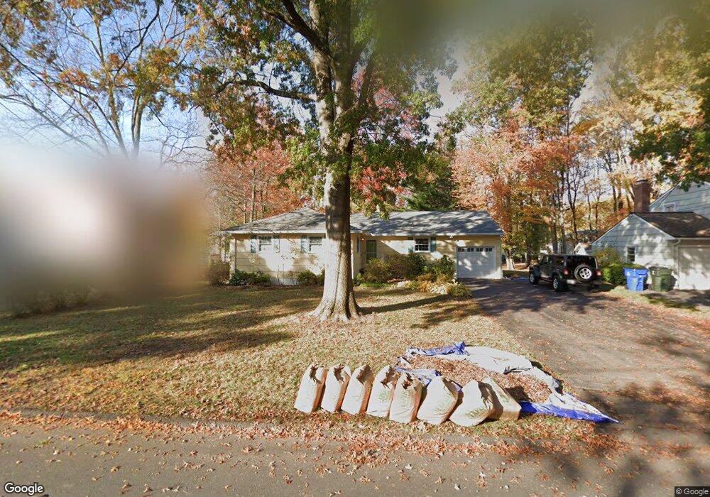
110 Northbrook Dr West Hartford, CT 06117
Estimated Value: $410,000 - $470,000
3
Beds
2
Baths
1,779
Sq Ft
$247/Sq Ft
Est. Value
About This Home
This home is located at 110 Northbrook Dr, West Hartford, CT 06117 and is currently estimated at $440,001, approximately $247 per square foot. 110 Northbrook Dr is a home located in Hartford County with nearby schools including Aiken School, King Philip Middle School, and Delta High School.
Ownership History
Date
Name
Owned For
Owner Type
Purchase Details
Closed on
Feb 10, 2022
Sold by
Zetoff Richard M
Bought by
Richard M Zetoff T
Current Estimated Value
Purchase Details
Closed on
Sep 25, 2017
Sold by
Richard M Zetoff Ret
Bought by
Zetoff Richard M and Zetoff Rosalie S
Purchase Details
Closed on
Nov 2, 1999
Sold by
Green David
Bought by
Zetoff Richard M
Purchase Details
Closed on
Aug 11, 1994
Sold by
Congregation Beth Isra
Bought by
Green David
Home Financials for this Owner
Home Financials are based on the most recent Mortgage that was taken out on this home.
Original Mortgage
$144,000
Interest Rate
8.52%
Mortgage Type
Unknown
Purchase Details
Closed on
Jun 15, 1989
Sold by
Goldberg Howard
Bought by
The Congr Beth Israel
Create a Home Valuation Report for This Property
The Home Valuation Report is an in-depth analysis detailing your home's value as well as a comparison with similar homes in the area
Home Values in the Area
Average Home Value in this Area
Purchase History
| Date | Buyer | Sale Price | Title Company |
|---|---|---|---|
| Richard M Zetoff T | -- | None Available | |
| Richard M Zetoff T M | -- | None Available | |
| Zetoff Richard M | -- | -- | |
| Zetoff Richard M | -- | -- | |
| Zetoff Richard M | $147,500 | -- | |
| Zetoff Richard M | $147,500 | -- | |
| Green David | $160,000 | -- | |
| Green David | $160,000 | -- | |
| The Congr Beth Israel | $190,000 | -- |
Source: Public Records
Mortgage History
| Date | Status | Borrower | Loan Amount |
|---|---|---|---|
| Previous Owner | The Congr Beth Israel | $144,000 |
Source: Public Records
Tax History Compared to Growth
Tax History
| Year | Tax Paid | Tax Assessment Tax Assessment Total Assessment is a certain percentage of the fair market value that is determined by local assessors to be the total taxable value of land and additions on the property. | Land | Improvement |
|---|---|---|---|---|
| 2025 | $8,200 | $183,120 | $63,910 | $119,210 |
| 2024 | $7,755 | $183,120 | $63,910 | $119,210 |
| 2023 | $7,493 | $183,120 | $63,910 | $119,210 |
| 2022 | $7,449 | $183,120 | $63,910 | $119,210 |
| 2021 | $6,726 | $158,550 | $55,090 | $103,460 |
| 2020 | $6,402 | $153,160 | $49,560 | $103,600 |
| 2019 | $6,402 | $153,160 | $49,560 | $103,600 |
| 2018 | $6,280 | $153,160 | $49,560 | $103,600 |
| 2017 | $6,286 | $153,160 | $49,560 | $103,600 |
| 2016 | $6,524 | $165,130 | $54,600 | $110,530 |
| 2015 | $6,326 | $165,130 | $54,600 | $110,530 |
| 2014 | $6,171 | $165,130 | $54,600 | $110,530 |
Source: Public Records
Map
Nearby Homes
- 115 Northbrook Dr
- 2 Croydon Dr
- 15 Sunny Reach Dr
- 9 Timberwood Rd
- 171 N Canaan St
- 12 Haviland Rd
- 165 Bloomfield Ave
- 645 Bloomfield Ave
- 180 Brookline Ave
- 537 Bloomfield Ave
- 67 Simpson St
- 147 Morningside St W
- 111 Bloomfield Ave
- 179 Manchester St
- 181 Westminster St
- 53 Hillcrest Ave
- 86 Hartland St
- 77 Harold St
- 70 Burnham St Unit 72
- 7 Emerson St
- 112 Northbrook Dr
- 106 Northbrook Dr
- 38 Alderwood Dr
- 116 Northbrook Dr
- 104 Northbrook Dr
- 36 Alderwood Dr
- 42 Alderwood Dr
- 107 Northbrook Dr
- 111 Northbrook Dr
- 32 Alderwood Dr
- 44 Alderwood Dr
- 105 Northbrook Dr
- 118 Northbrook Dr
- 100 Northbrook Dr
- 101 Northbrook Dr
- 48 Alderwood Dr
- 30 Alderwood Dr
- 117 Northbrook Dr
- 98 Northbrook Dr
- 122 Northbrook Dr