Estimated Value: $110,637 - $169,000
--
Bed
1
Bath
1,290
Sq Ft
$109/Sq Ft
Est. Value
About This Home
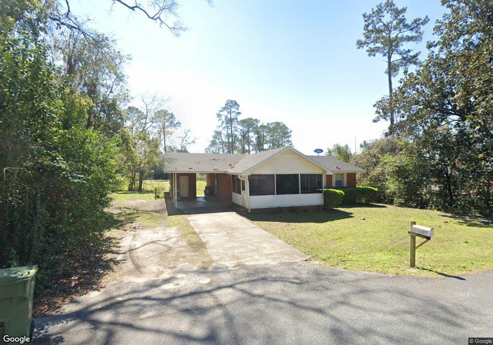
This home is located at 110 Phillips St, Adel, GA 31620 and is currently estimated at $140,159, approximately $108 per square foot. 110 Phillips St is a home located in Cook County with nearby schools including Cook Primary School, Cook Elementary School, and Cook County Middle School.
Ownership History
Date
Name
Owned For
Owner Type
Purchase Details
Closed on
Oct 17, 2011
Sold by
Buchanan Arthur W
Bought by
Buchanan Kelly L
Current Estimated Value
Home Financials for this Owner
Home Financials are based on the most recent Mortgage that was taken out on this home.
Original Mortgage
$69,185
Outstanding Balance
$6,662
Interest Rate
4.4%
Mortgage Type
FHA
Estimated Equity
$133,497
Purchase Details
Closed on
Aug 5, 2005
Sold by
Buchanan Arthur William
Bought by
Buchanan Aruthur William and Buchanan Kelly Leet
Create a Home Valuation Report for This Property
The Home Valuation Report is an in-depth analysis detailing your home's value as well as a comparison with similar homes in the area
Home Values in the Area
Average Home Value in this Area
Purchase History
| Date | Buyer | Sale Price | Title Company |
|---|---|---|---|
| Buchanan Kelly L | -- | -- | |
| Buchanan Aruthur William | -- | -- |
Source: Public Records
Mortgage History
| Date | Status | Borrower | Loan Amount |
|---|---|---|---|
| Open | Buchanan Kelly L | $69,185 |
Source: Public Records
Tax History Compared to Growth
Tax History
| Year | Tax Paid | Tax Assessment Tax Assessment Total Assessment is a certain percentage of the fair market value that is determined by local assessors to be the total taxable value of land and additions on the property. | Land | Improvement |
|---|---|---|---|---|
| 2024 | $1,148 | $36,488 | $5,600 | $30,888 |
| 2023 | $981 | $31,424 | $5,000 | $26,424 |
| 2022 | $981 | $31,424 | $5,000 | $26,424 |
| 2021 | $877 | $26,456 | $5,000 | $21,456 |
| 2020 | $877 | $26,456 | $5,000 | $21,456 |
| 2019 | $878 | $26,456 | $5,000 | $21,456 |
| 2018 | $934 | $26,456 | $5,000 | $21,456 |
| 2017 | $879 | $26,456 | $5,000 | $21,456 |
| 2016 | $880 | $26,456 | $5,000 | $21,456 |
| 2015 | $881 | $26,456 | $5,000 | $21,456 |
| 2014 | $882 | $26,456 | $5,000 | $21,456 |
| 2013 | -- | $26,456 | $5,000 | $21,456 |
Source: Public Records
Map
Nearby Homes
- 808 Laurel Ave
- 808 S Laurel Ave
- 806 S Forrest Ave
- 321 Spanish Moss Ln
- 804 S Forrest Ave
- 201 E 8th St
- 415 E 8th St
- 507 S Poplar St
- 211 S Gordon Ave
- 322 Magnolia Dr
- 729 W 7th St
- 304 E 3rd St
- 418 E 3rd St
- 901 E 4th St
- 11 Antioch Rd
- 315 Newton Dr
- 7051 Antioch Rd
- 8792 Val Del Rd
- 701 Gloria St
- 4.23AC Jm Dr