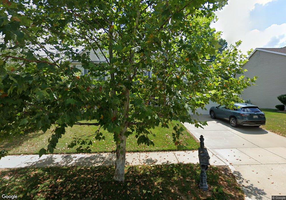
110 Red Baron Dr Lake Saint Louis, MO 63367
Estimated Value: $483,880 - $551,000
4
Beds
3
Baths
3,027
Sq Ft
$168/Sq Ft
Est. Value
About This Home
This home is located at 110 Red Baron Dr, Lake Saint Louis, MO 63367 and is currently estimated at $508,220, approximately $167 per square foot. 110 Red Baron Dr is a home located in St. Charles County with nearby schools including Prairie View Elementary School, Frontier Middle School, and Liberty High School.
Ownership History
Date
Name
Owned For
Owner Type
Purchase Details
Closed on
Oct 14, 2003
Sold by
The Jones Co Homes Llc
Bought by
Johnston James A and Johnston Carolyn M
Current Estimated Value
Home Financials for this Owner
Home Financials are based on the most recent Mortgage that was taken out on this home.
Original Mortgage
$155,000
Outstanding Balance
$73,372
Interest Rate
6.42%
Mortgage Type
Purchase Money Mortgage
Estimated Equity
$434,848
Create a Home Valuation Report for This Property
The Home Valuation Report is an in-depth analysis detailing your home's value as well as a comparison with similar homes in the area
Home Values in the Area
Average Home Value in this Area
Purchase History
| Date | Buyer | Sale Price | Title Company |
|---|---|---|---|
| Johnston James A | $234,700 | -- |
Source: Public Records
Mortgage History
| Date | Status | Borrower | Loan Amount |
|---|---|---|---|
| Open | Johnston James A | $155,000 |
Source: Public Records
Tax History Compared to Growth
Tax History
| Year | Tax Paid | Tax Assessment Tax Assessment Total Assessment is a certain percentage of the fair market value that is determined by local assessors to be the total taxable value of land and additions on the property. | Land | Improvement |
|---|---|---|---|---|
| 2025 | $5,065 | $82,760 | -- | -- |
| 2023 | $5,065 | $74,659 | $0 | $0 |
| 2022 | $4,107 | $60,459 | $0 | $0 |
| 2021 | $4,111 | $60,459 | $0 | $0 |
| 2020 | $4,010 | $56,574 | $0 | $0 |
| 2019 | $3,722 | $56,574 | $0 | $0 |
| 2018 | $3,360 | $48,671 | $0 | $0 |
| 2017 | $3,884 | $48,671 | $0 | $0 |
| 2016 | $3,342 | $46,388 | $0 | $0 |
| 2015 | $3,298 | $46,388 | $0 | $0 |
| 2014 | $2,763 | $41,701 | $0 | $0 |
Source: Public Records
Map
Nearby Homes
- 355 Countryshire Dr
- 506 Country Landing Dr
- 618 Country Heights Dr
- 1009 Carpathian Dr
- 320 Briarchase Cir
- 223 Countryshire Dr
- 191 Noahs Mill Dr
- 823 Waler Dr
- 650 Country Village Dr
- 109 Sommers Creek Ct
- 1 Westbrook @ Creekside Sommers
- 1 Barkley @ Creekside Sommers
- 1 Rockport @ Creekside Sommers
- 1 Savannah @ Creekside Sommers
- 1
- 1 Canterbury @ Creekside Sommers
- 1 Princeton @ Creekside Sommers
- 2340 Oak Dr
- 0 Lancaster @ Montage at Hawk Ridge Unit MIS25059636
- Pierce Plan at Montage at Hawk Ridge - Montage At Hawk Ridge
- 108 Red Baron Dr
- 112 Red Baron Dr
- 1032 Landing Place Dr
- 114 Red Baron Dr
- 1030 Landing Place Dr
- 111 Red Baron Dr
- 109 Red Baron Dr
- 115 Red Baron Dr
- 1035 Landing Place Dr
- 116 Red Baron Dr
- 1033 Landing Place Dr
- 1028 Landing Place Dr
- 1031 Landing Place Dr
- 117 Red Baron Dr
- 1101 Landing Place Dr
- 1029 Landing Place Dr
- 44 Charterview Ct
- 1026 Landing Place Dr
- 503 Country Landing Dr
- 1027 Landing Place Dr