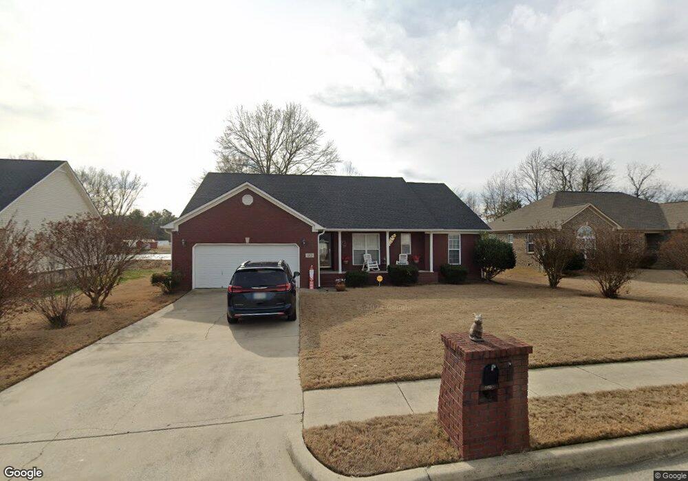
110 Red Sunset Cir Owens Cross Roads, AL 35763
Estimated Value: $270,000 - $295,000
3
Beds
2
Baths
1,730
Sq Ft
$166/Sq Ft
Est. Value
About This Home
This home is located at 110 Red Sunset Cir, Owens Cross Roads, AL 35763 and is currently estimated at $286,459, approximately $165 per square foot. 110 Red Sunset Cir is a home located in Madison County with nearby schools including Owens Cross Roads Elementary School and New Hope High School.
Ownership History
Date
Name
Owned For
Owner Type
Purchase Details
Closed on
Dec 16, 2024
Sold by
Copeland Mary Frances
Bought by
Mary Frances Copeland Living Trust and Copeland
Current Estimated Value
Purchase Details
Closed on
Nov 30, 2005
Sold by
Wilbourn Gary
Bought by
Copeland Arnold Eugene and Copeland Mary Frances
Home Financials for this Owner
Home Financials are based on the most recent Mortgage that was taken out on this home.
Original Mortgage
$90,500
Interest Rate
6.04%
Mortgage Type
New Conventional
Create a Home Valuation Report for This Property
The Home Valuation Report is an in-depth analysis detailing your home's value as well as a comparison with similar homes in the area
Home Values in the Area
Average Home Value in this Area
Purchase History
| Date | Buyer | Sale Price | Title Company |
|---|---|---|---|
| Mary Frances Copeland Living Trust | $194,500 | None Listed On Document | |
| Mary Frances Copeland Living Trust | $194,500 | None Listed On Document | |
| Copeland Arnold Eugene | -- | -- |
Source: Public Records
Mortgage History
| Date | Status | Borrower | Loan Amount |
|---|---|---|---|
| Previous Owner | Copeland Arnold Eugene | $90,500 |
Source: Public Records
Tax History Compared to Growth
Tax History
| Year | Tax Paid | Tax Assessment Tax Assessment Total Assessment is a certain percentage of the fair market value that is determined by local assessors to be the total taxable value of land and additions on the property. | Land | Improvement |
|---|---|---|---|---|
| 2024 | -- | $19,420 | $2,500 | $16,920 |
| 2023 | $0 | $18,900 | $2,500 | $16,400 |
| 2022 | $0 | $17,500 | $2,500 | $15,000 |
| 2021 | $0 | $16,240 | $2,500 | $13,740 |
| 2020 | $0 | $15,490 | $2,500 | $12,990 |
| 2019 | $0 | $14,990 | $2,500 | $12,490 |
| 2018 | $0 | $14,880 | $0 | $0 |
| 2017 | $0 | $14,880 | $0 | $0 |
| 2016 | $0 | $14,880 | $0 | $0 |
| 2015 | -- | $14,880 | $0 | $0 |
| 2014 | -- | $15,160 | $0 | $0 |
Source: Public Records
Map
Nearby Homes
- 237 Chestnut Oak Cir
- 5 U S 431
- 24 Acres U S 431
- 257 Dudley Ln
- 156 Dudley Ln Unit A1-4, B
- 3 acres Highway 431 S
- 128 Vulcan St
- 126 Vulcan St
- 124 Vulcan St
- 986 Cave Spring Rd
- 11 Acres Cave Spring Rd
- The Butler Plan at Ramsay Cove
- The Franklin Plan at Ramsay Cove
- The Shelby A Plan at Ramsay Cove
- The Chelsea A Plan at Ramsay Cove
- The Daphne Plan at Ramsay Cove
- The Everett Plan at Ramsay Cove
- DUPONT Plan at Ramsay Cove
- Woodruff Plan at Ramsay Cove
- ESSEX Plan at Ramsay Cove
- 108 Red Sunset Cir
- 112 Red Sunset Cir
- 106 Red Sunset Cir
- 109 Red Sunset Cir
- 114 Red Sunset Cir
- 111 Red Sunset Cir
- 107 Red Sunset Cir
- 113 Red Sunset Cir
- 104 Red Sunset Cir
- 105 Red Sunset Cir
- 116 Red Sunset Cir
- 103 Red Sunset Cir
- 115 Red Sunset Cir
- 117 Red Sunset Cir
- 108 Nathan Dr
- 106 Nathan Dr
- 101 Red Sunset Cir
- 104 Nathan Dr
- 102 Nathan Dr
- 114 Nathan Dr