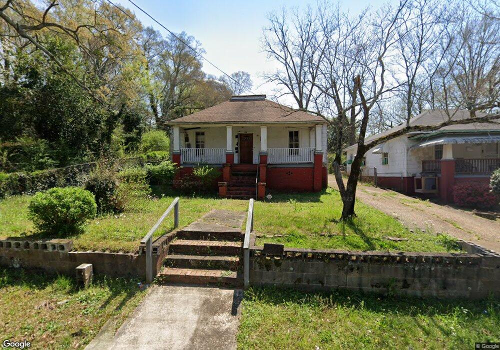
110 Revis St Lagrange, GA 30241
Estimated Value: $69,015 - $90,000
3
Beds
2
Baths
1,451
Sq Ft
$55/Sq Ft
Est. Value
About This Home
This home is located at 110 Revis St, Lagrange, GA 30241 and is currently estimated at $79,504, approximately $54 per square foot. 110 Revis St is a home located in Troup County with nearby schools including Hollis Hand Elementary School, Franklin Forest Elementary School, and Ethel W. Kight Elementary School.
Ownership History
Date
Name
Owned For
Owner Type
Purchase Details
Closed on
Apr 15, 2013
Sold by
Williams Virgil
Bought by
Brown Jarvis W and Williams Janice E
Current Estimated Value
Purchase Details
Closed on
Oct 18, 1974
Sold by
Nellie Thomas Wheat Etal
Bought by
Williams Virgil and Mattie Kate
Purchase Details
Closed on
Oct 14, 1974
Sold by
Will Thomas
Bought by
Nellie Thomas Wheat Etal
Purchase Details
Closed on
Nov 1, 1922
Bought by
Will Thomas
Create a Home Valuation Report for This Property
The Home Valuation Report is an in-depth analysis detailing your home's value as well as a comparison with similar homes in the area
Purchase History
| Date | Buyer | Sale Price | Title Company |
|---|---|---|---|
| Brown Jarvis W | -- | -- | |
| Williams Virgil | $6,000 | -- | |
| Nellie Thomas Wheat Etal | -- | -- | |
| Will Thomas | -- | -- |
Source: Public Records
Tax History
| Year | Tax Paid | Tax Assessment Tax Assessment Total Assessment is a certain percentage of the fair market value that is determined by local assessors to be the total taxable value of land and additions on the property. | Land | Improvement |
|---|---|---|---|---|
| 2025 | $530 | $19,440 | $3,720 | $15,720 |
| 2024 | $487 | $17,840 | $3,720 | $14,120 |
| 2023 | $418 | $15,320 | $3,720 | $11,600 |
| 2022 | $394 | $14,120 | $3,720 | $10,400 |
| 2021 | $346 | $11,480 | $2,120 | $9,360 |
| 2020 | $378 | $12,520 | $2,120 | $10,400 |
| 2019 | $348 | $11,532 | $2,132 | $9,400 |
| 2018 | $348 | $11,532 | $2,132 | $9,400 |
| 2017 | $348 | $11,532 | $2,132 | $9,400 |
| 2016 | $335 | $11,091 | $2,132 | $8,959 |
| 2015 | $335 | $11,091 | $2,132 | $8,959 |
| 2014 | $321 | $10,620 | $2,132 | $8,488 |
| 2013 | -- | $14,765 | $2,132 | $12,633 |
Source: Public Records
Map
Nearby Homes
Your Personal Tour Guide
Ask me questions while you tour the home.