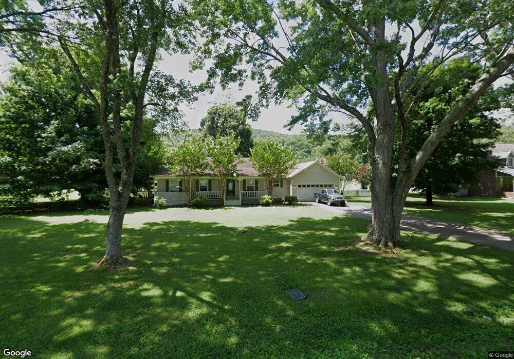
110 Rich Dr Gurley, AL 35748
Estimated Value: $242,000 - $344,000
3
Beds
2
Baths
1,550
Sq Ft
$181/Sq Ft
Est. Value
About This Home
This home is located at 110 Rich Dr, Gurley, AL 35748 and is currently estimated at $281,208, approximately $181 per square foot. 110 Rich Dr is a home located in Madison County with nearby schools including Central School and Madison County High School.
Ownership History
Date
Name
Owned For
Owner Type
Purchase Details
Closed on
Jan 18, 2017
Sold by
Maynard Gordon E and Maynard Annalie
Bought by
Maynard Gordon Brantley
Current Estimated Value
Purchase Details
Closed on
Jun 27, 2007
Sold by
Deutsche Bank National Trust Co
Bought by
Maynard Gordon E and Maynard Annalie
Purchase Details
Closed on
May 3, 2007
Sold by
Pettie Daniel
Bought by
Deutsche Bank National Trust Co
Create a Home Valuation Report for This Property
The Home Valuation Report is an in-depth analysis detailing your home's value as well as a comparison with similar homes in the area
Home Values in the Area
Average Home Value in this Area
Purchase History
| Date | Buyer | Sale Price | Title Company |
|---|---|---|---|
| Maynard Gordon Brantley | $124,500 | None Available | |
| Maynard Gordon E | $124,900 | -- | |
| Deutsche Bank National Trust Co | $106,250 | -- |
Source: Public Records
Mortgage History
| Date | Status | Borrower | Loan Amount |
|---|---|---|---|
| Closed | Maynard Gordon Brantley | $0 |
Source: Public Records
Tax History Compared to Growth
Tax History
| Year | Tax Paid | Tax Assessment Tax Assessment Total Assessment is a certain percentage of the fair market value that is determined by local assessors to be the total taxable value of land and additions on the property. | Land | Improvement |
|---|---|---|---|---|
| 2024 | $1,435 | $38,760 | $7,000 | $31,760 |
| 2023 | $1,394 | $38,760 | $7,000 | $31,760 |
| 2022 | $1,190 | $33,000 | $5,000 | $28,000 |
| 2021 | $1,069 | $29,700 | $5,000 | $24,700 |
| 2020 | $979 | $27,240 | $5,000 | $22,240 |
| 2019 | $949 | $26,420 | $5,000 | $21,420 |
| 2018 | $916 | $25,500 | $0 | $0 |
| 2017 | $893 | $24,880 | $0 | $0 |
| 2016 | $893 | $24,880 | $0 | $0 |
| 2015 | $893 | $24,880 | $0 | $0 |
| 2014 | $886 | $24,680 | $0 | $0 |
Source: Public Records
Map
Nearby Homes
- 2906 Gurley Pike
- 102 Peyton Cir
- 107 Nolan Dr
- 211 Powell St
- 218 Powell St
- 172 Day Dr
- 216 Grasslands Rd
- 221 Grasslands Rd
- 235 Grasslands Rd
- 1519 Ryland Pike
- 309 Gilliam Rd
- 0 Gilliam Rd
- 3608 Maysville Rd NE
- 111 Cool Cir
- 483 Moontown Rd
- PPin#507136 Moontown Rd
- 477 Moontown Rd
- 506 Moontown Rd
- 233 Oakland View Dr
- 362 Moontown Rd
- 106 Rich Dr
- 112 Rich Dr
- 117 Elvis Presley Blvd
- 109 Rich Dr
- 111 Rich Dr
- 104 Rich Dr
- 119 Elvis Presley Blvd
- 114 Rich Dr
- 107 Rich Dr
- 121 Elvis Presley Blvd
- 102 Rich Dr
- 113 Rich Dr
- 111 Elvis Presley Blvd
- 105 Rich Dr
- 123 Elvis Presley Blvd
- 305 Powell St
- 116 Elvis Presley Blvd
- 120 Elvis Presley Blvd
- 2834 Gurley Pike
- 2870 Gurley Pike