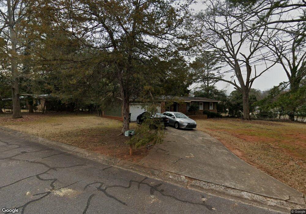
110 Rumson Rd Athens, GA 30605
Estimated Value: $257,529 - $288,000
3
Beds
2
Baths
1,350
Sq Ft
$203/Sq Ft
Est. Value
About This Home
This home is located at 110 Rumson Rd, Athens, GA 30605 and is currently estimated at $273,382, approximately $202 per square foot. 110 Rumson Rd is a home located in Clarke County with nearby schools including Barnett Shoals Elementary School, Hilsman Middle School, and Cedar Shoals High School.
Ownership History
Date
Name
Owned For
Owner Type
Purchase Details
Closed on
Jun 19, 2025
Sold by
Zehna Frank Joseph
Bought by
Zehna Frank Joseph Sr Tr and Zehna Stephanie Brown Tr
Current Estimated Value
Purchase Details
Closed on
Dec 8, 2015
Sold by
Clover Street Properties L
Bought by
Zehna Frank Joseph and Zehna Stephanie B
Home Financials for this Owner
Home Financials are based on the most recent Mortgage that was taken out on this home.
Original Mortgage
$72,000
Interest Rate
4.01%
Mortgage Type
New Conventional
Purchase Details
Closed on
May 21, 1997
Sold by
Reynolds Alan
Bought by
Zehna Frank J and Zehna Stephanie H
Purchase Details
Closed on
Jul 16, 1993
Sold by
Hwang Huey-Min and Chiang Lee L Hwang
Bought by
Reynolds Alan
Create a Home Valuation Report for This Property
The Home Valuation Report is an in-depth analysis detailing your home's value as well as a comparison with similar homes in the area
Purchase History
| Date | Buyer | Sale Price | Title Company |
|---|---|---|---|
| Zehna Frank Joseph Sr Tr | -- | -- | |
| Zehna Frank Joseph | -- | -- | |
| Zehna Frank J | $63,300 | -- | |
| Reynolds Alan | $57,800 | -- |
Source: Public Records
Mortgage History
| Date | Status | Borrower | Loan Amount |
|---|---|---|---|
| Previous Owner | Zehna Frank Joseph | $72,000 |
Source: Public Records
Tax History
| Year | Tax Paid | Tax Assessment Tax Assessment Total Assessment is a certain percentage of the fair market value that is determined by local assessors to be the total taxable value of land and additions on the property. | Land | Improvement |
|---|---|---|---|---|
| 2025 | $3,057 | $98,449 | $12,000 | $86,449 |
| 2024 | $3,057 | $93,250 | $12,000 | $81,250 |
| 2023 | $2,914 | $83,748 | $12,000 | $71,748 |
| 2022 | $2,184 | $68,473 | $10,400 | $58,073 |
| 2021 | $1,390 | $41,254 | $10,400 | $30,854 |
| 2020 | $1,364 | $40,462 | $10,400 | $30,062 |
| 2019 | $1,349 | $39,723 | $10,400 | $29,323 |
| 2018 | $1,242 | $36,595 | $10,400 | $26,195 |
| 2017 | $1,085 | $31,973 | $10,400 | $21,573 |
| 2016 | $1,041 | $30,654 | $10,400 | $20,254 |
| 2015 | $1,078 | $31,701 | $10,400 | $21,301 |
| 2014 | $1,105 | $32,462 | $10,400 | $22,062 |
Source: Public Records
Map
Nearby Homes
- 150 Rumson Rd
- 189 Ashbrook Dr
- 2535 Barnett Shoals Rd
- 140 Ashbrook Dr
- 331 Greencrest Dr
- 352 Greencrest Dr
- 109 Layla Ct
- 0 Barnett Shoals Rd Unit Lot 1
- 148 Warren Way
- 140 Whitehall Rd
- 625 Forest Rd
- 256 Scandia Cir
- 119 Pine Ridge Trace
- 400 Ansley Dr
- 135 Mcduffie Dr
- 431 College Cir
- 325 Segrest Cir
- 337 Georgetown Dr
- 1305 Cedar Shoals Dr Unit 500
- 100 Ansonborough Ln
- 120 Rumson Rd
- 265 Brentwood Dr
- 290 Brentwood Dr
- 280 Brentwood Dr
- 105 Rumson Rd
- 290 Clarke Dr
- 115 Rumson Rd
- 204 Clarke Dr
- 245 Brentwood Dr
- 260 Brentwood Dr
- 125 Rumson Rd
- 298 Brentwood Dr
- 280 Clarke Dr
- 225 Brentwood Dr
- 240 Brentwood Dr
- 175 Ashbrook Dr
- 173 Ashbrook Dr
- 240 Greencrest Dr
- 270 Clarke Dr
- 230 Greencrest Dr
Your Personal Tour Guide
Ask me questions while you tour the home.