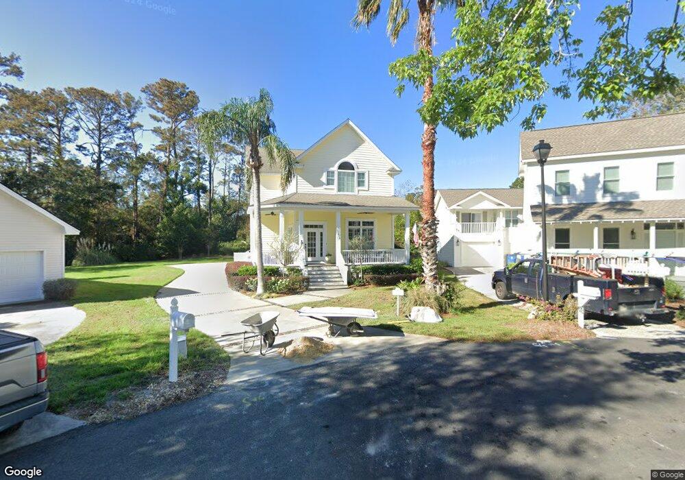
110 Seaside Cir Saint Simons Island, GA 31522
Estimated Value: $1,279,178 - $2,691,000
4
Beds
4
Baths
2,450
Sq Ft
$745/Sq Ft
Est. Value
About This Home
This home is located at 110 Seaside Cir, Saint Simons Island, GA 31522 and is currently estimated at $1,826,295, approximately $745 per square foot. 110 Seaside Cir is a home located in Glynn County with nearby schools including St. Simons Elementary School, Glynn Middle School, and Glynn Academy.
Ownership History
Date
Name
Owned For
Owner Type
Purchase Details
Closed on
Apr 16, 2024
Sold by
Gerhart Christopher E
Bought by
Gerhart Christopher Trust and Gerhart Janet B Tr
Current Estimated Value
Purchase Details
Closed on
Nov 3, 2008
Sold by
Hartridge Earle Trace
Bought by
Gerhart Christopher E
Home Financials for this Owner
Home Financials are based on the most recent Mortgage that was taken out on this home.
Original Mortgage
$290,000
Interest Rate
5.88%
Mortgage Type
New Conventional
Create a Home Valuation Report for This Property
The Home Valuation Report is an in-depth analysis detailing your home's value as well as a comparison with similar homes in the area
Home Values in the Area
Average Home Value in this Area
Purchase History
| Date | Buyer | Sale Price | Title Company |
|---|---|---|---|
| Gerhart Christopher Trust | -- | -- | |
| Gerhart Christopher E | $652,000 | -- |
Source: Public Records
Mortgage History
| Date | Status | Borrower | Loan Amount |
|---|---|---|---|
| Previous Owner | Gerhart Christopher E | $290,000 |
Source: Public Records
Tax History Compared to Growth
Tax History
| Year | Tax Paid | Tax Assessment Tax Assessment Total Assessment is a certain percentage of the fair market value that is determined by local assessors to be the total taxable value of land and additions on the property. | Land | Improvement |
|---|---|---|---|---|
| 2025 | $9,447 | $376,680 | $199,680 | $177,000 |
| 2024 | $9,426 | $375,840 | $199,680 | $176,160 |
| 2023 | $9,361 | $375,840 | $199,680 | $176,160 |
| 2022 | $6,416 | $250,840 | $99,840 | $151,000 |
| 2021 | $6,524 | $247,440 | $99,840 | $147,600 |
| 2020 | $6,586 | $247,440 | $99,840 | $147,600 |
| 2019 | $6,586 | $247,440 | $99,840 | $147,600 |
| 2018 | $5,715 | $214,080 | $83,200 | $130,880 |
| 2017 | $5,280 | $197,440 | $66,560 | $130,880 |
| 2016 | $4,864 | $197,440 | $66,560 | $130,880 |
| 2015 | $4,883 | $197,440 | $66,560 | $130,880 |
| 2014 | $4,883 | $197,440 | $66,560 | $130,880 |
Source: Public Records
Map
Nearby Homes
- 105 Seaside Cir
- 115 Seaside Cir
- 638 Dellwood Ave
- 1106 George Lotson Ave
- 125 Tiffany Ln
- 30 Admirals Cove
- 625 May Joe St
- 1017 Ocean View Ave
- 553 Magnolia Ave
- 1104 Sherman Ave
- 1055 College St
- 800 Ocean Blvd Unit 204
- 800 Ocean Blvd Unit 108
- 800 Mallery St Unit 52
- 800 Mallery St Unit 90
- 800 Mallery St Unit C-30
- 800 Mallery St Unit J-89
- 200 Salt Air Dr Unit 152
- 200 Salt Air Dr Unit 154
- 200 Salt Air Dr Unit 139
- 111 Seaside Cir
- 111 Seaside Cir
- 510 Barbour Oaks Dr
- 109 Seaside Cir
- 112 Seaside Cir
- 509 Harbour Oaks Dr
- 510 Harbour Oaks Dr
- 4 Seaside Cir
- 508 Harbour Oaks Dr
- 507 Harbour Oaks Dr
- 108 Seaside Cir
- 511 Harbour Oaks Dr
- 629 Dellwood Ave
- 633 Dellwood Ave
- 113 Seaside Cir
- 107 Seaside Cir
- 637 Dellwood Ave
- 625 Dellwood Ave
- 505 Harbour Oaks Dr
- 506 Harbour Oaks Dr