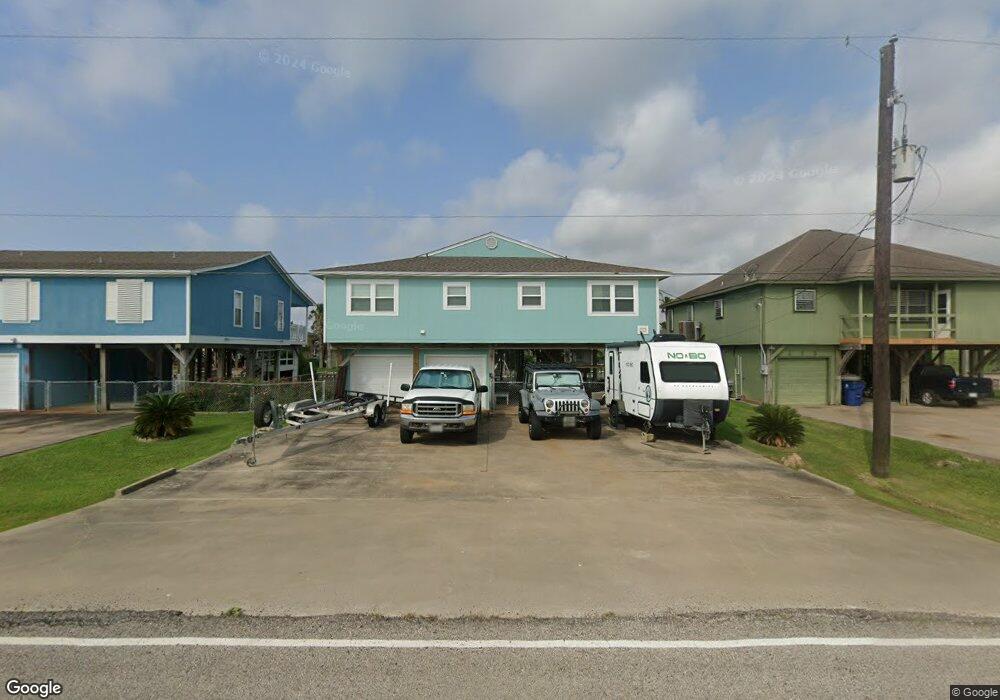
110 Sky Sail Rd Freeport, TX 77541
Estimated Value: $377,000 - $395,000
3
Beds
2
Baths
1,480
Sq Ft
$262/Sq Ft
Est. Value
About This Home
This home is located at 110 Sky Sail Rd, Freeport, TX 77541 and is currently estimated at $387,793, approximately $262 per square foot. 110 Sky Sail Rd is a home located in Brazoria County with nearby schools including Velasco Elementary School, O'Hara Lanier Middle School, and Freeport Intermediate School.
Ownership History
Date
Name
Owned For
Owner Type
Purchase Details
Closed on
Jun 29, 2018
Sold by
Tiano Robert and Tiano Anita
Bought by
Gillespie David E and Gillespie Dona L
Current Estimated Value
Home Financials for this Owner
Home Financials are based on the most recent Mortgage that was taken out on this home.
Original Mortgage
$216,000
Outstanding Balance
$131,083
Interest Rate
4.6%
Mortgage Type
New Conventional
Estimated Equity
$256,710
Purchase Details
Closed on
Apr 28, 2005
Sold by
The Westcap Corp Of Delaware
Bought by
Tiano Robert and Tiano Anita
Home Financials for this Owner
Home Financials are based on the most recent Mortgage that was taken out on this home.
Original Mortgage
$122,640
Interest Rate
5.93%
Mortgage Type
Fannie Mae Freddie Mac
Create a Home Valuation Report for This Property
The Home Valuation Report is an in-depth analysis detailing your home's value as well as a comparison with similar homes in the area
Home Values in the Area
Average Home Value in this Area
Purchase History
| Date | Buyer | Sale Price | Title Company |
|---|---|---|---|
| Gillespie David E | -- | Stewart Title | |
| Tiano Robert | -- | Alamo Title Company |
Source: Public Records
Mortgage History
| Date | Status | Borrower | Loan Amount |
|---|---|---|---|
| Open | Gillespie David E | $216,000 | |
| Previous Owner | Tiano Robert | $122,640 |
Source: Public Records
Tax History Compared to Growth
Tax History
| Year | Tax Paid | Tax Assessment Tax Assessment Total Assessment is a certain percentage of the fair market value that is determined by local assessors to be the total taxable value of land and additions on the property. | Land | Improvement |
|---|---|---|---|---|
| 2025 | $6,579 | $377,950 | $80,170 | $297,780 |
| 2023 | $6,579 | $381,880 | $80,170 | $301,710 |
| 2022 | $7,252 | $358,190 | $80,170 | $278,020 |
| 2021 | $5,606 | $255,840 | $53,130 | $202,710 |
| 2020 | $5,241 | $235,280 | $53,130 | $182,150 |
| 2019 | $5,137 | $222,000 | $44,960 | $177,040 |
| 2018 | $5,574 | $239,410 | $40,870 | $198,540 |
| 2017 | $5,399 | $231,170 | $40,870 | $190,300 |
| 2016 | $5,063 | $233,230 | $40,870 | $192,360 |
| 2014 | $3,865 | $179,170 | $31,440 | $147,730 |
Source: Public Records
Map
Nearby Homes
- 111 Sand Shoals Rd
- 119 Sand Shoals Rd
- 122 Four Master Rd
- 122 Driftwood Rd
- 174 Sand Shoals Rd
- 107 Crows Nest Rd
- 1571 Blue Water Dr
- 106 Jolly Boat Ln
- 108 Treasure Ln
- 1682 Blue Water Dr
- 122 Jolly Boat Ln
- 000 Jolly Boat Ln
- 1503 Blue Water Dr
- 154 Poop Deck Ln
- TBD Marine Way
- 310 Marine Way
- 223 Leeward Way
- 219 Leeward Way
- 205 Marine Way
- 1738 Duncan Dr
- 114 Sky Sail Rd
- 106 Sky Sail Rd
- 106 Sky Sail Rd
- 118 Sky Sail Rd
- 115 Sand Shoals Rd
- 107 Sand Shoals Rd
- 122 Sky Sail Rd
- 126 Sky Sail Rd
- 160 Sand Shoals Rd
- 123 Sand Shoals Rd
- 130 Sky Sail Rd
- 54 Sand Shoals Rd
- 0 Sand Shoals Rd
- 114 Sand Shoals Rd
- 134 Sky Sail Rd
- 131 Sand Shoals Rd
- 110 Sand Shoals Rd
- 118 Sand Shoals Rd
- 116 Sand Shoals Rd
- 122 Sand Shoals Rd