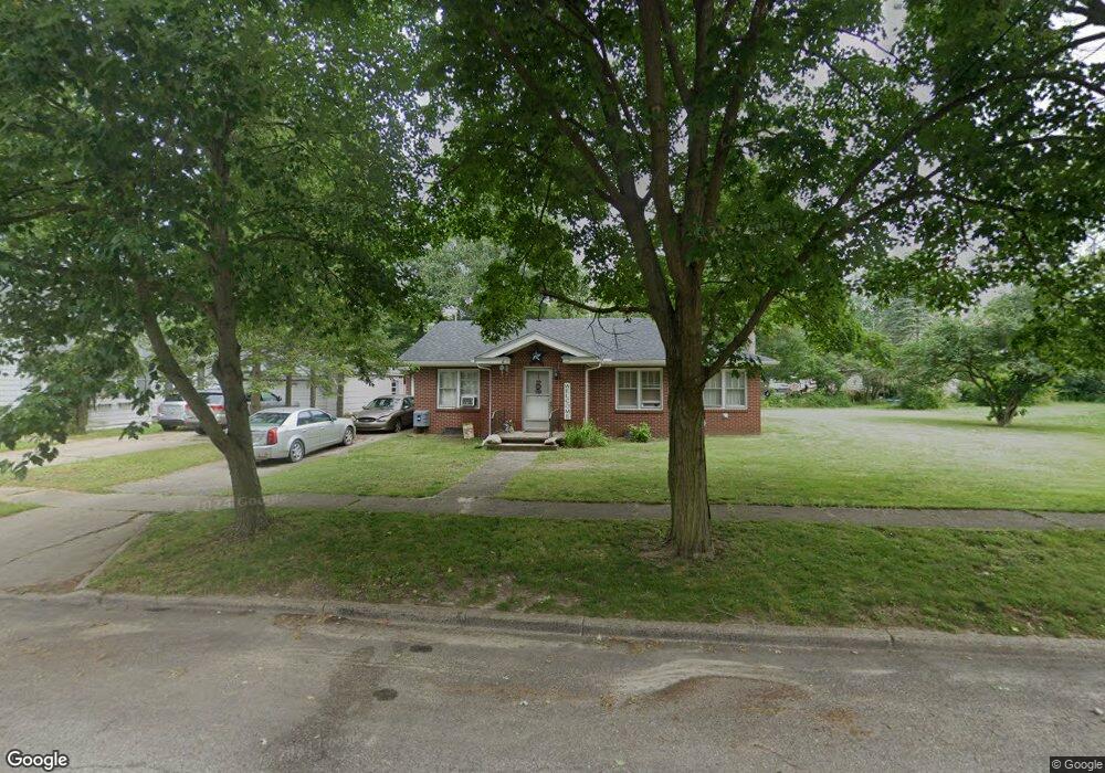
110 Tyrrell St Clinton, MI 49236
Estimated Value: $212,000 - $244,000
3
Beds
2
Baths
1,075
Sq Ft
$212/Sq Ft
Est. Value
About This Home
This home is located at 110 Tyrrell St, Clinton, MI 49236 and is currently estimated at $227,810, approximately $211 per square foot. 110 Tyrrell St is a home located in Lenawee County with nearby schools including Clinton Elementary School, Clinton Middle School, and Clinton High School.
Ownership History
Date
Name
Owned For
Owner Type
Purchase Details
Closed on
Feb 11, 2013
Sold by
Faust Larry and Faust Diana
Bought by
Hahn Brian A and Hahn Michelle
Current Estimated Value
Purchase Details
Closed on
Apr 15, 2011
Sold by
Federal National Mortgage Association
Bought by
Doutre Vickie D and Doutre Marshall
Purchase Details
Closed on
Sep 2, 2010
Sold by
Houghton Steven C and Houghton Laurie A
Bought by
Federal National Mortgage Association
Purchase Details
Closed on
Feb 3, 2006
Sold by
Proctor Virginia C
Bought by
Proctor Virginia C and Habrick Carl
Create a Home Valuation Report for This Property
The Home Valuation Report is an in-depth analysis detailing your home's value as well as a comparison with similar homes in the area
Home Values in the Area
Average Home Value in this Area
Purchase History
| Date | Buyer | Sale Price | Title Company |
|---|---|---|---|
| Hahn Brian A | $42,900 | None Available | |
| Doutre Vickie D | $31,000 | None Available | |
| Federal National Mortgage Association | $101,645 | None Available | |
| Proctor Virginia C | -- | None Available |
Source: Public Records
Tax History
| Year | Tax Paid | Tax Assessment Tax Assessment Total Assessment is a certain percentage of the fair market value that is determined by local assessors to be the total taxable value of land and additions on the property. | Land | Improvement |
|---|---|---|---|---|
| 2025 | $2,954 | $106,900 | $0 | $0 |
| 2024 | $16 | $100,600 | $0 | $0 |
| 2023 | $2,562 | $91,700 | $0 | $0 |
| 2022 | $5,039 | $84,800 | $0 | $0 |
| 2021 | $3,285 | $79,300 | $0 | $0 |
| 2020 | $3,236 | $74,500 | $0 | $0 |
| 2019 | $147,340 | $57,700 | $0 | $0 |
| 2018 | $3,035 | $71,964 | $0 | $0 |
| 2017 | $2,734 | $64,311 | $0 | $0 |
| 2016 | $2,858 | $63,335 | $0 | $0 |
| 2014 | -- | $69,923 | $0 | $0 |
Source: Public Records
Map
Nearby Homes
- 317 Clark St Unit B
- 128 W Church St
- 108 Burton St
- V/L Post Oak Dr
- 11100 Murphy Hwy
- 10000 Meads Hwy
- 9000 Matthews Hwy
- 3888 Kaiser Rd
- 9655 Tecumseh Clinton Hwy
- 100 BLK Pleasant Dr
- 20664 Allen Rd
- 9103 N Union St Unit LOT 46
- 9103 N Union St Unit Lot 93
- 9103 N Union Lot #116 St Unit 116
- 607 Red Maple Dr
- 919 Pontiac Trail
- 618 Nokomis St
- 19740 Lemm Rd
- 766 Eagle View Point
- 765 Eagle View Point
- 110 Tyrrell St Unit TYRELL ST
- 114 Tyrrell St
- 114 Tyrrell St Unit TYRRELL ST
- 118 Tyrrell St
- 102 Tyrrell St
- 122 Tyrrell St
- 115 Tyrrell St
- 117 Tyrrell St
- 100 Tyrrell St Unit BLK
- 509 Tecumseh Rd
- 704 Tecumseh Rd
- 602 Tecumseh Rd
- 706 Tecumseh Rd
- 608 Tecumseh Rd
- 510 Tecumseh Rd
- 111 Locust St
- 115 Locust St
- 119 Locust St Unit LOCUST
- 504 Tecumseh Rd
- 507 Tecumseh Rd
Your Personal Tour Guide
Ask me questions while you tour the home.