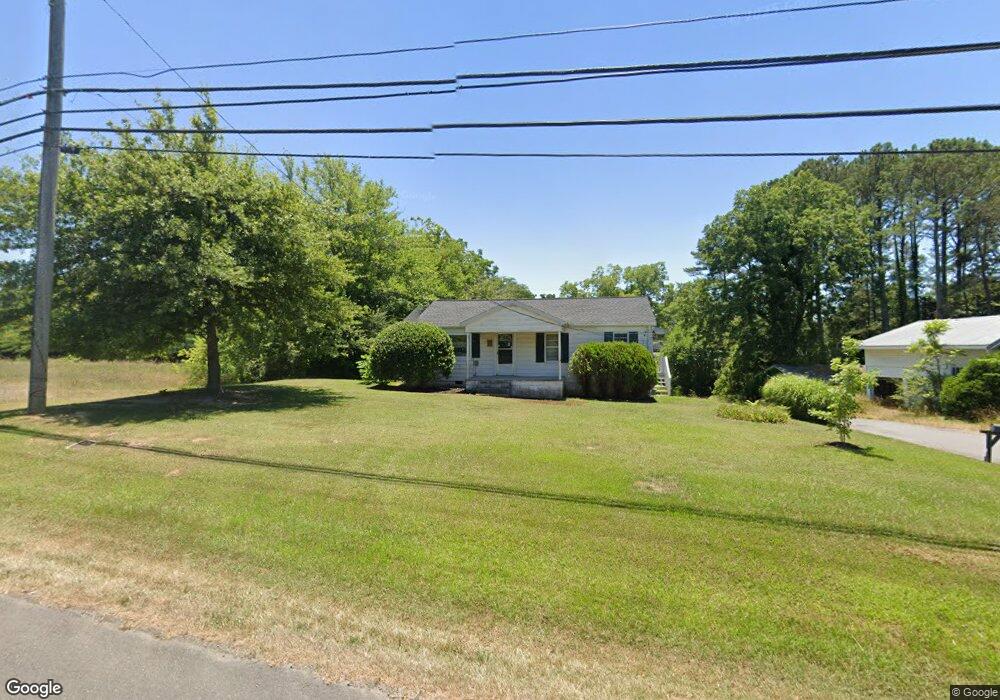
110 Us Highway 278 E Cullman, AL 35055
Estimated Value: $148,589 - $181,000
--
Bed
--
Bath
975
Sq Ft
$175/Sq Ft
Est. Value
About This Home
This home is located at 110 Us Highway 278 E, Cullman, AL 35055 and is currently estimated at $170,647, approximately $175 per square foot. 110 Us Highway 278 E is a home with nearby schools including Cullman City Primary School, Cullman Middle School, and Cullman High School.
Ownership History
Date
Name
Owned For
Owner Type
Purchase Details
Closed on
Feb 8, 2022
Sold by
Neal Maxfield Larry
Bought by
Ima Holding Llc
Current Estimated Value
Create a Home Valuation Report for This Property
The Home Valuation Report is an in-depth analysis detailing your home's value as well as a comparison with similar homes in the area
Home Values in the Area
Average Home Value in this Area
Purchase History
| Date | Buyer | Sale Price | Title Company |
|---|---|---|---|
| Ima Holding Llc | $339,000 | Law Firm Of Sandra K Watts Llc | |
| Maxfield Larry Neal | $500 | Law Firm Of Sandra K Watts Llc |
Source: Public Records
Tax History Compared to Growth
Tax History
| Year | Tax Paid | Tax Assessment Tax Assessment Total Assessment is a certain percentage of the fair market value that is determined by local assessors to be the total taxable value of land and additions on the property. | Land | Improvement |
|---|---|---|---|---|
| 2024 | $866 | $22,500 | $0 | $0 |
| 2023 | $866 | $21,440 | $0 | $0 |
| 2022 | $758 | $19,680 | $0 | $0 |
| 2021 | $656 | $17,040 | $0 | $0 |
| 2020 | $656 | $17,040 | $0 | $0 |
| 2019 | $653 | $16,960 | $0 | $0 |
| 2018 | $653 | $16,960 | $0 | $0 |
| 2017 | $0 | $17,600 | $0 | $0 |
| 2016 | $458 | $17,600 | $0 | $0 |
| 2014 | $458 | $17,600 | $0 | $0 |
Source: Public Records
Map
Nearby Homes
- 27 U S 278
- 157 County Road 701
- 288 County Road 1462
- LOT 45 Eastern Shores Dr
- 1014 Larkwood Dr NE
- Lot 31 County Road 1462
- 54 County Road 1679
- 1465 Orchard Dr NE
- 637 County Road 1462
- 1439 Longbrook Dr NE
- 1000 Brentwood Dr NE
- 106 County Road 1471
- 00 Longbrook Dr NE
- 1620 Convent Rd NE
- 1473 Stonewater Dr NE
- 1502 Bailey Ct NE
- 0 County Road 1466
- 0 Sharpton Rd NE Unit 523207
- LOT 13 Loch Dr
- 1809 Loch Ave
- 92 U S 278
- 92 Us Highway 278 E
- 74 County Road 701
- 198 U S Highway 278 E
- 94 County Road 701
- 24 Us Highway 278 E
- 171 County Road 701
- 27 U S Highway 278 W
- 27 U S 278 Unit 1
- 27 U S 278 Unit 3
- 27 U S 278 Unit 7
- 27 Us Highway 278 E
- 27 Us Highway 278 E Unit 1
- 1814 3rd St SE
- 119 County Road 701
- 119 County Road 701
- 105 County Road 701
- 0 Us Hwy 278 E Unit 1811831
- 256 Alabama 74
- 256 U S Highway 278 W