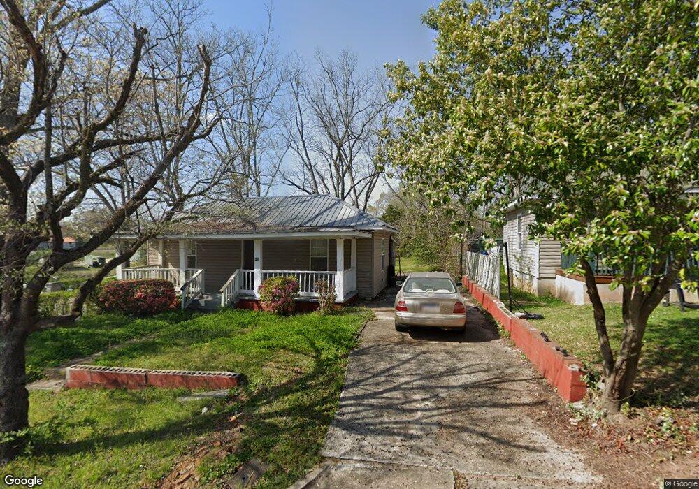
110 W Cannon St Lagrange, GA 30240
Estimated Value: $88,023 - $159,000
2
Beds
1
Bath
1,150
Sq Ft
$100/Sq Ft
Est. Value
About This Home
This home is located at 110 W Cannon St, Lagrange, GA 30240 and is currently estimated at $115,256, approximately $100 per square foot. 110 W Cannon St is a home located in Troup County with nearby schools including Ethel W. Kight Elementary School, Hollis Hand Elementary School, and Franklin Forest Elementary School.
Ownership History
Date
Name
Owned For
Owner Type
Purchase Details
Closed on
Jun 30, 1993
Sold by
Sec Of Veterans Affairs
Bought by
Burrow Mark A and Burrow Belinda V
Current Estimated Value
Purchase Details
Closed on
Aug 5, 1992
Sold by
Nationsbanc Mortgage Corp
Bought by
Sec Of Veterans Affairs
Purchase Details
Closed on
Aug 4, 1992
Sold by
Hollie Floyd W
Bought by
Nationsbanc Mortgage Corp
Purchase Details
Closed on
Aug 24, 1989
Sold by
Jabaley Raymond P
Bought by
Hollie Floyd W
Purchase Details
Closed on
Jan 24, 1989
Sold by
Jabaley Richard P
Bought by
Jabaley Raymond P
Purchase Details
Closed on
May 2, 1985
Sold by
Murphy Ralph Harold
Bought by
Jabaley Richard P
Purchase Details
Closed on
Nov 17, 1983
Sold by
Murphy Robert H
Bought by
Murphy Ralph Harold
Purchase Details
Closed on
Jan 1, 1901
Sold by
No Date On Card
Bought by
Murphy Robert H
Create a Home Valuation Report for This Property
The Home Valuation Report is an in-depth analysis detailing your home's value as well as a comparison with similar homes in the area
Purchase History
| Date | Buyer | Sale Price | Title Company |
|---|---|---|---|
| Burrow Mark A | $18,000 | -- | |
| Sec Of Veterans Affairs | -- | -- | |
| Nationsbanc Mortgage Corp | -- | -- | |
| Hollie Floyd W | $27,500 | -- | |
| Jabaley Raymond P | $4,900 | -- | |
| Jabaley Richard P | $21,000 | -- | |
| Murphy Ralph Harold | -- | -- | |
| Murphy Robert H | -- | -- |
Source: Public Records
Tax History
| Year | Tax Paid | Tax Assessment Tax Assessment Total Assessment is a certain percentage of the fair market value that is determined by local assessors to be the total taxable value of land and additions on the property. | Land | Improvement |
|---|---|---|---|---|
| 2025 | $783 | $28,720 | $1,800 | $26,920 |
| 2024 | $777 | $28,480 | $1,800 | $26,680 |
| 2023 | $686 | $25,160 | $1,800 | $23,360 |
| 2022 | $662 | $23,720 | $1,800 | $21,920 |
| 2021 | $574 | $19,040 | $1,800 | $17,240 |
| 2020 | $574 | $19,040 | $1,800 | $17,240 |
| 2019 | $522 | $17,300 | $1,820 | $15,480 |
| 2018 | $522 | $17,300 | $1,820 | $15,480 |
| 2017 | $522 | $17,300 | $1,820 | $15,480 |
| 2016 | $506 | $16,777 | $1,820 | $14,957 |
| 2015 | $507 | $16,777 | $1,820 | $14,957 |
| 2014 | $484 | $15,990 | $1,820 | $14,170 |
| 2013 | -- | $17,120 | $1,820 | $15,300 |
Source: Public Records
Map
Nearby Homes
- 501 Milam St
- 303 E Mulberry St
- 203 Fannin St
- 103 Cedar St
- 109 Bell St
- 509 S Lewis St
- 112 Cedar St
- 505 S Lewis St
- 0 Bagley St
- 0 Boggs St Unit 10550243
- 0 Boggs St Unit 10550231
- 0 Boggs St Unit 10550239
- 0 Boggs St Unit 10550250
- 914 Todd St
- 304 Butler St
- 207 Wilkes St
- 1186 Lindsey St
- 0 E Fendig St
- 113 E Fendig St
- 901 Whiteline St
- 108 W Cannon St
- 106 W Cannon St
- 414 Milam St
- 104 W Cannon St
- 409 Milam St
- 500 Milam St
- 109 W Cannon St
- 107 W Cannon St
- 105 W Cannon St
- 401 Milam St
- 502 Milam St
- 103 W Cannon St
- 101 W Cannon St
- 410 Whitesville St
- 506 Milam St
- 414 Whitesville St
- 404 Whitesville St
- 508 Milam St
- 213 W Mulberry St
- 502 Whitesville St Unit 6,7
Your Personal Tour Guide
Ask me questions while you tour the home.