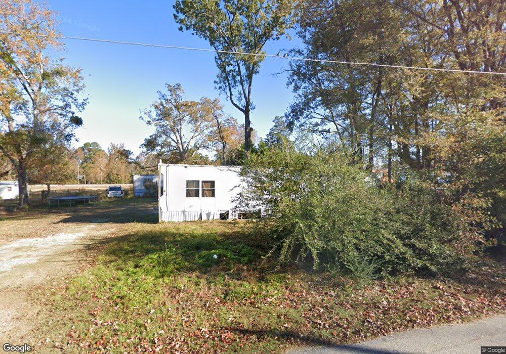
110 W Hester St Clarkton, NC 28433
Estimated Value: $49,915 - $111,000
--
Bed
--
Bath
--
Sq Ft
0.29
Acres
About This Home
This home is located at 110 W Hester St, Clarkton, NC 28433 and is currently estimated at $84,479. 110 W Hester St is a home with nearby schools including B T Washington Primary, Clarkton School of Discovery, and West Bladen High School.
Ownership History
Date
Name
Owned For
Owner Type
Purchase Details
Closed on
Jun 27, 2022
Sold by
Guy Auger
Bought by
Cruz Rafael Maldonado De
Current Estimated Value
Purchase Details
Closed on
Mar 21, 2022
Sold by
Faye Phillips and Faye Glenda
Bought by
Auger Guy and Benya Sheri
Purchase Details
Closed on
Aug 7, 2020
Sold by
Ward Bobby Dale and Archibald Miranda Jayne
Bought by
Phillips Glenda Faye
Purchase Details
Closed on
Mar 8, 2017
Sold by
Rivenbark Harold Maurice and Fort Stephen Ross
Bought by
Ward Bobby Dale
Purchase Details
Closed on
Oct 25, 2013
Sold by
Tracey Inc
Bought by
Gooden Robert Allen
Purchase Details
Closed on
Jan 1, 1991
Bought by
Gooden Robert Allen
Create a Home Valuation Report for This Property
The Home Valuation Report is an in-depth analysis detailing your home's value as well as a comparison with similar homes in the area
Home Values in the Area
Average Home Value in this Area
Purchase History
| Date | Buyer | Sale Price | Title Company |
|---|---|---|---|
| Cruz Rafael Maldonado De | -- | Iapalucci Adrian | |
| Decruz Rafael Maldonado | -- | Iapalucci Adrian | |
| Auger Guy | -- | None Listed On Document | |
| Phillips Glenda Faye | $6,000 | None Available | |
| Ward Bobby Dale | -- | None Available | |
| Gooden Robert Allen | -- | None Available | |
| Gooden Robert Allen | $1,000 | -- |
Source: Public Records
Tax History Compared to Growth
Tax History
| Year | Tax Paid | Tax Assessment Tax Assessment Total Assessment is a certain percentage of the fair market value that is determined by local assessors to be the total taxable value of land and additions on the property. | Land | Improvement |
|---|---|---|---|---|
| 2025 | $51 | $6,510 | $3,310 | $3,200 |
| 2024 | $51 | $6,510 | $3,310 | $3,200 |
| 2023 | $51 | $6,510 | $3,310 | $3,200 |
| 2022 | $51 | $6,510 | $3,310 | $3,200 |
| 2021 | $52 | $6,360 | $3,310 | $3,050 |
| 2020 | $52 | $6,360 | $3,310 | $3,050 |
| 2019 | $52 | $6,360 | $3,310 | $3,050 |
| 2018 | $52 | $6,360 | $3,310 | $3,050 |
| 2017 | $52 | $6,360 | $3,310 | $3,050 |
| 2015 | $95 | $6,360 | $3,310 | $3,050 |
| 2014 | $95 | $12,800 | $9,400 | $3,400 |
| 2013 | -- | $12,800 | $9,400 | $3,400 |
Source: Public Records
Map
Nearby Homes
- 0 S West R Latham St
- 533 N Singletary St
- 91 N Elmhurst St
- 153 Hillside St
- Lot # 3 Hillside St
- Lot # 4 Hillside St
- 40 Ella Bell Rd
- Off of Red Hill Rd Unit LotWP003
- 193 Peach St
- 2093 Burney Ford Rd
- 2639 Nc Highway 211 E
- 3458 N Mitchell Ford Rd
- 0 Near James B White Hwy N
- 10429 Twisted Hickory Rd
- 14962 Twisted Hickory Rd
- 309 Pridgen Acre Dr
- 8941 Red Hill Rd
- 284 Irene Dr
- 2808 Farmers Union Rd
- 0 Mable Spaulding Rd
- 95 W Hester St
- 131 W Hester St
- 84 W Hester St
- 77 N Gooden St
- 77 Gooden Dr
- 45 W Hester St
- 216 E Green St
- 214 E Green St
- 169 W South Railroad St
- 230 W Green St
- 191 W Hester St
- 194 W Hester St
- 278 W Green St
- 160 W Green St
- 15 S Smith St
- 145 N Mitchell Ford Rd
- 129 N Mitchell Ford Rd
- 179 W North Railroad St
- 367 W South Railroad St
- 84 N Elm St