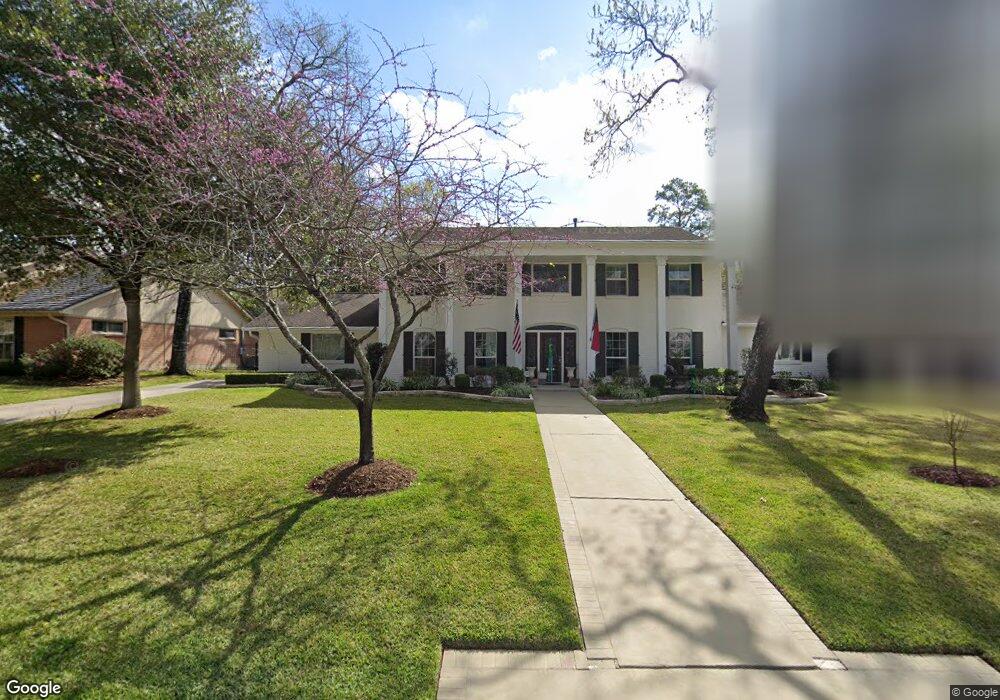
110 Warrenton Dr Houston, TX 77024
Memorial NeighborhoodEstimated Value: $1,538,000 - $1,876,000
5
Beds
3
Baths
4,031
Sq Ft
$430/Sq Ft
Est. Value
About This Home
This home is located at 110 Warrenton Dr, Houston, TX 77024 and is currently estimated at $1,733,937, approximately $430 per square foot. 110 Warrenton Dr is a home located in Harris County with nearby schools including Frostwood Elementary School, Memorial Middle, and Memorial High School.
Ownership History
Date
Name
Owned For
Owner Type
Purchase Details
Closed on
Apr 4, 2012
Sold by
Wolfe Patricia Lynn and Atkinson Patricia L
Bought by
Atkinson Patricia L
Current Estimated Value
Home Financials for this Owner
Home Financials are based on the most recent Mortgage that was taken out on this home.
Original Mortgage
$300,000
Outstanding Balance
$40,716
Interest Rate
3.97%
Mortgage Type
Credit Line Revolving
Estimated Equity
$1,693,221
Purchase Details
Closed on
Sep 23, 2003
Sold by
Wolfe David Louis
Bought by
Wolfe Patricia Lynn
Home Financials for this Owner
Home Financials are based on the most recent Mortgage that was taken out on this home.
Original Mortgage
$165,050
Interest Rate
6.22%
Mortgage Type
Purchase Money Mortgage
Create a Home Valuation Report for This Property
The Home Valuation Report is an in-depth analysis detailing your home's value as well as a comparison with similar homes in the area
Home Values in the Area
Average Home Value in this Area
Purchase History
| Date | Buyer | Sale Price | Title Company |
|---|---|---|---|
| Atkinson Patricia L | -- | None Available | |
| Wolfe Patricia Lynn | -- | -- |
Source: Public Records
Mortgage History
| Date | Status | Borrower | Loan Amount |
|---|---|---|---|
| Open | Atkinson Patricia L | $300,000 | |
| Previous Owner | Wolfe Patricia Lynn | $165,050 |
Source: Public Records
Tax History Compared to Growth
Tax History
| Year | Tax Paid | Tax Assessment Tax Assessment Total Assessment is a certain percentage of the fair market value that is determined by local assessors to be the total taxable value of land and additions on the property. | Land | Improvement |
|---|---|---|---|---|
| 2025 | $19,267 | $1,902,000 | $806,650 | $1,095,350 |
| 2024 | $19,267 | $1,610,500 | $682,550 | $927,950 |
| 2023 | $19,267 | $1,492,267 | $682,550 | $809,717 |
| 2022 | $29,575 | $1,440,000 | $682,550 | $757,450 |
| 2021 | $28,077 | $1,150,000 | $682,550 | $467,450 |
| 2020 | $28,354 | $1,131,617 | $682,550 | $449,067 |
| 2019 | $35,343 | $1,350,000 | $682,550 | $667,450 |
| 2018 | $12,088 | $1,235,000 | $682,550 | $552,450 |
| 2017 | $32,309 | $1,235,000 | $682,550 | $552,450 |
| 2016 | $31,176 | $1,340,000 | $682,550 | $657,450 |
| 2015 | $20,761 | $1,422,300 | $682,550 | $739,750 |
| 2014 | $20,761 | $984,873 | $496,400 | $488,473 |
Source: Public Records
Map
Nearby Homes
- 10 Warrenton Dr
- 3 Plantation Rd
- 8 Woodstone St
- 1 Woodstone St
- 6 Gessner Rd
- 170 Haversham Dr
- 150 Gessner Rd Unit 5A
- 0 Gessner Rd
- 234 Plantation Rd
- 45 Bayou Pointe Dr
- 10010 Bordley Dr
- 9620 Doliver Dr
- 9632 Bayou Brook St
- 10034 Bordley Dr
- 30 E Rivercrest Dr
- 201 Vanderpool Ln Unit 103
- 201 Vanderpool Ln Unit 65
- 201 Vanderpool Ln Unit 64
- 12327 Tunbridge Ln
- 9618 Bayou Brook St
- 114 Warrenton Dr
- 106 Warrenton Dr
- 115 Plantation Rd
- 119 Plantation Rd
- 111 Plantation Rd
- 111 Warrenton Dr
- 118 Warrenton Dr
- 123 Plantation Rd
- 123 Plantation Rd
- 107 Warrenton Dr
- 107 Plantation Rd
- 102 Warrenton Dr
- 115 Warrenton Dr
- 103 Warrenton Dr
- 103 Warrenton Dr Unit A
- 127 Plantation Rd
- 122 Warrenton Dr
- 103 Plantation Rd
- 118 Plantation Rd
- 114 Plantation Rd