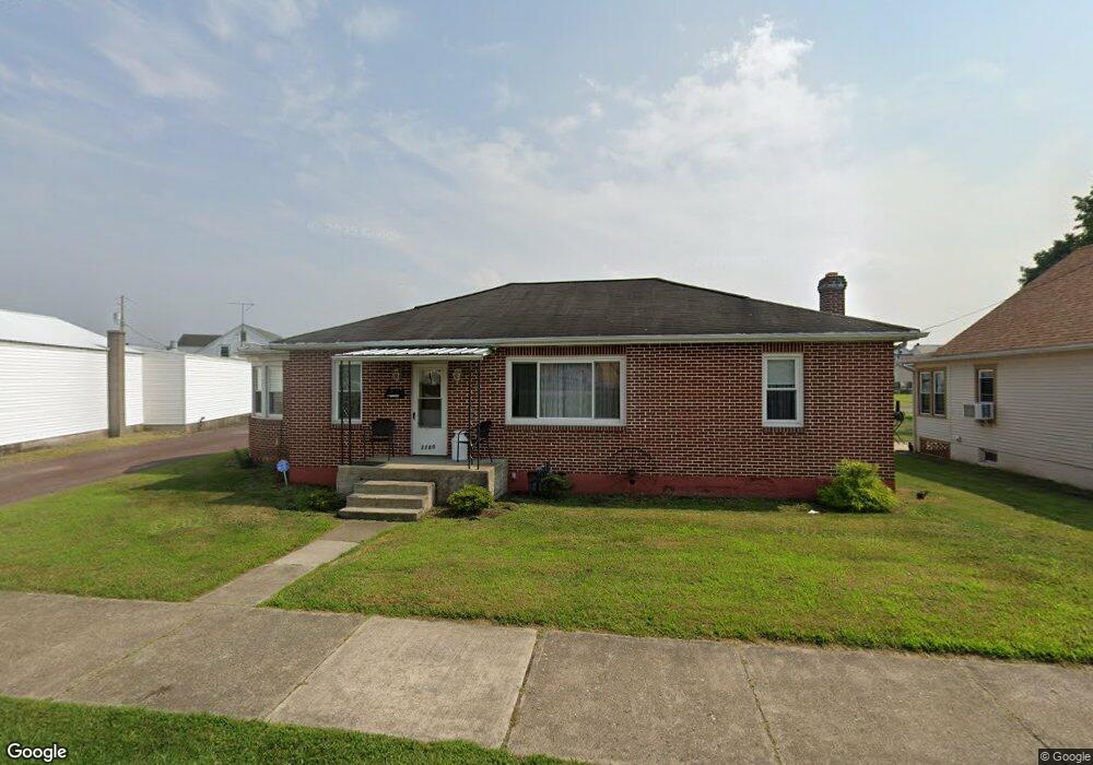
1100 2nd Ave Berwick, PA 18603
Estimated Value: $116,000 - $200,000
--
Bed
--
Bath
1,260
Sq Ft
$125/Sq Ft
Est. Value
About This Home
This home is located at 1100 2nd Ave, Berwick, PA 18603 and is currently estimated at $157,069, approximately $124 per square foot. 1100 2nd Ave is a home located in Columbia County with nearby schools including Berwick Area High School, Holy Family Consolidated School, and New Story School.
Ownership History
Date
Name
Owned For
Owner Type
Purchase Details
Closed on
Oct 25, 2005
Sold by
Miller Michael and Hubbard Leigh
Bought by
Miller Michael and Miller Leigh
Current Estimated Value
Home Financials for this Owner
Home Financials are based on the most recent Mortgage that was taken out on this home.
Original Mortgage
$103,500
Outstanding Balance
$55,840
Interest Rate
5.79%
Mortgage Type
New Conventional
Estimated Equity
$101,229
Create a Home Valuation Report for This Property
The Home Valuation Report is an in-depth analysis detailing your home's value as well as a comparison with similar homes in the area
Home Values in the Area
Average Home Value in this Area
Purchase History
| Date | Buyer | Sale Price | Title Company |
|---|---|---|---|
| Miller Michael | -- | None Available |
Source: Public Records
Mortgage History
| Date | Status | Borrower | Loan Amount |
|---|---|---|---|
| Open | Miller Michael | $103,500 |
Source: Public Records
Tax History Compared to Growth
Tax History
| Year | Tax Paid | Tax Assessment Tax Assessment Total Assessment is a certain percentage of the fair market value that is determined by local assessors to be the total taxable value of land and additions on the property. | Land | Improvement |
|---|---|---|---|---|
| 2025 | $2,226 | $24,828 | $0 | $0 |
| 2024 | $2,201 | $24,828 | $4,416 | $20,412 |
| 2023 | $2,052 | $24,828 | $4,416 | $20,412 |
| 2022 | $1,984 | $24,828 | $4,416 | $20,412 |
| 2021 | $1,940 | $24,828 | $4,416 | $20,412 |
| 2020 | $1,896 | $24,828 | $4,416 | $20,412 |
| 2019 | $1,867 | $24,828 | $4,416 | $20,412 |
| 2018 | $1,793 | $24,828 | $4,416 | $20,412 |
| 2017 | $1,799 | $24,828 | $4,416 | $20,412 |
| 2016 | -- | $24,828 | $4,416 | $20,412 |
| 2015 | -- | $24,828 | $4,416 | $20,412 |
| 2014 | -- | $24,828 | $4,416 | $20,412 |
Source: Public Records
Map
Nearby Homes
- 721 Lasalle St
- 1180 1st Ave
- 1185 Ferris Ave
- 530 Monroe St
- 605 Sycamore St
- 1129 Freas Ave
- LOT #13 3rd Ave
- 613 Elm St
- 1200 5th Ave
- 108 110 Blair St
- 1306 Orange St
- 334 Washington St
- 1335 Freas Ave
- 825 N Mercer St
- 330 Lasalle St
- 405 N Mercer St
- 1145 6th Ave
- 10041006 W Front St
- 1239,1241 W Front St
- 1333 7th Ave