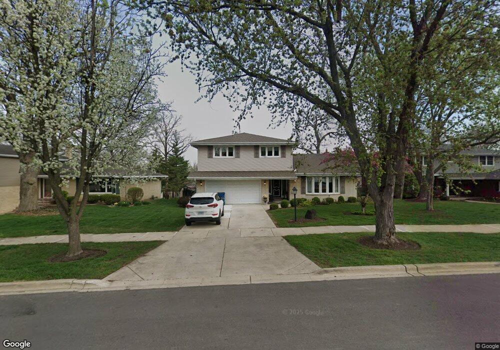
1100 39th St Downers Grove, IL 60515
Estimated Value: $639,000 - $772,000
4
Beds
3
Baths
2,367
Sq Ft
$286/Sq Ft
Est. Value
About This Home
This home is located at 1100 39th St, Downers Grove, IL 60515 and is currently estimated at $677,569, approximately $286 per square foot. 1100 39th St is a home located in DuPage County with nearby schools including Highland Elementary School, Herrick Middle School, and Downer Grove North High School.
Ownership History
Date
Name
Owned For
Owner Type
Purchase Details
Closed on
Mar 19, 2004
Sold by
Buerger Mary Ann
Bought by
Papoutis Peter A and Papoutsis Valerie
Current Estimated Value
Home Financials for this Owner
Home Financials are based on the most recent Mortgage that was taken out on this home.
Original Mortgage
$220,000
Outstanding Balance
$102,674
Interest Rate
5.65%
Mortgage Type
Purchase Money Mortgage
Estimated Equity
$574,895
Create a Home Valuation Report for This Property
The Home Valuation Report is an in-depth analysis detailing your home's value as well as a comparison with similar homes in the area
Home Values in the Area
Average Home Value in this Area
Purchase History
| Date | Buyer | Sale Price | Title Company |
|---|---|---|---|
| Papoutis Peter A | $376,000 | Ticor |
Source: Public Records
Mortgage History
| Date | Status | Borrower | Loan Amount |
|---|---|---|---|
| Open | Papoutis Peter A | $220,000 |
Source: Public Records
Tax History Compared to Growth
Tax History
| Year | Tax Paid | Tax Assessment Tax Assessment Total Assessment is a certain percentage of the fair market value that is determined by local assessors to be the total taxable value of land and additions on the property. | Land | Improvement |
|---|---|---|---|---|
| 2024 | $10,037 | $183,071 | $42,056 | $141,015 |
| 2023 | $9,601 | $169,290 | $38,890 | $130,400 |
| 2022 | $9,235 | $162,730 | $37,380 | $125,350 |
| 2021 | $8,522 | $158,680 | $36,450 | $122,230 |
| 2020 | $8,346 | $155,200 | $35,650 | $119,550 |
| 2019 | $8,005 | $147,550 | $33,890 | $113,660 |
| 2018 | $7,814 | $142,520 | $32,730 | $109,790 |
| 2017 | $7,489 | $135,810 | $31,190 | $104,620 |
| 2016 | $7,241 | $127,940 | $29,380 | $98,560 |
| 2015 | $7,089 | $119,190 | $27,370 | $91,820 |
| 2014 | $7,277 | $118,710 | $38,140 | $80,570 |
| 2013 | $7,271 | $120,390 | $38,680 | $81,710 |
Source: Public Records
Map
Nearby Homes
- 4043 Saratoga Ave Unit D221
- 1136 Barneswood Dr
- 3913 Saratoga Ave Unit G306
- 4133 Saratoga Ave Unit B220
- 3939 Saratoga Ave Unit 214
- 4224 Saratoga Ave Unit 105
- 4250 Saratoga Ave Unit 305
- 4224 Saratoga Ave Unit 110
- 3919 Washington St
- 1101 Barberry Ct
- 4133 Lindley St
- 4220 Forest Ave
- 4217 Main St
- 1542 Herbert St
- 4214 Venard Rd
- 1219 Ogden Ave
- 3730 Sterling Rd
- 4014 Morton Ave
- 1148 Mistwood Ln Unit D
- 1014 Braemoor Dr Unit B
- 1110 39th St
- 1090 39th St
- 1120 39th St
- 1080 39th St
- 1091 Candlewood Dr
- 3870 Forest Ave
- 1081 Candlewood Dr
- 1130 39th St
- 1101 Candlewood Dr
- 3871 Forest Ave
- 1070 39th St
- 1113 Candlewood Dr
- 1111 39th St
- 1071 Candlewood Dr
- 1071 39th St
- 1125 Candlewood Dr
- 1140 39th St
- 1121 39th St
- 1060 39th St
- 1061 Candlewood Dr