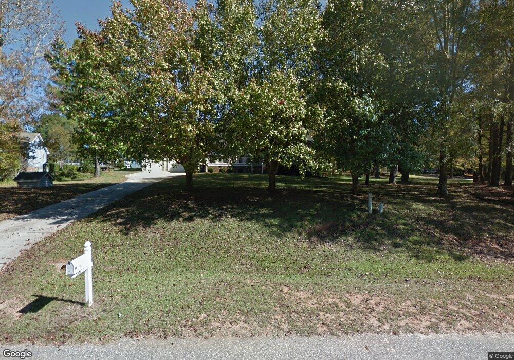
1100 Bennent Dr Clayton, NC 27520
Cleveland NeighborhoodEstimated Value: $297,000 - $326,588
3
Beds
2
Baths
1,263
Sq Ft
$244/Sq Ft
Est. Value
About This Home
This home is located at 1100 Bennent Dr, Clayton, NC 27520 and is currently estimated at $307,647, approximately $243 per square foot. 1100 Bennent Dr is a home located in Johnston County with nearby schools including Polenta Elementary School, Swift Creek Middle, and Cleveland High School.
Ownership History
Date
Name
Owned For
Owner Type
Purchase Details
Closed on
Apr 30, 2013
Sold by
Harrell Donna Melisa
Bought by
Harrell Donald and Harrell Peggy Ann
Current Estimated Value
Home Financials for this Owner
Home Financials are based on the most recent Mortgage that was taken out on this home.
Original Mortgage
$124,109
Outstanding Balance
$87,030
Interest Rate
3.25%
Mortgage Type
FHA
Estimated Equity
$220,617
Purchase Details
Closed on
May 3, 2004
Sold by
Harrell Donna Melisa
Bought by
Mitchell Kenneth H
Create a Home Valuation Report for This Property
The Home Valuation Report is an in-depth analysis detailing your home's value as well as a comparison with similar homes in the area
Home Values in the Area
Average Home Value in this Area
Purchase History
| Date | Buyer | Sale Price | Title Company |
|---|---|---|---|
| Harrell Donald | $126,000 | Investors Title Insurance Co | |
| Mitchell Kenneth H | $128,000 | -- |
Source: Public Records
Mortgage History
| Date | Status | Borrower | Loan Amount |
|---|---|---|---|
| Open | Harrell Donald | $124,109 |
Source: Public Records
Tax History Compared to Growth
Tax History
| Year | Tax Paid | Tax Assessment Tax Assessment Total Assessment is a certain percentage of the fair market value that is determined by local assessors to be the total taxable value of land and additions on the property. | Land | Improvement |
|---|---|---|---|---|
| 2025 | $1,944 | $306,170 | $70,000 | $236,170 |
| 2024 | $1,456 | $179,780 | $42,500 | $137,280 |
| 2023 | $1,407 | $179,780 | $42,500 | $137,280 |
| 2022 | $1,479 | $179,780 | $42,500 | $137,280 |
| 2021 | $1,479 | $179,780 | $42,500 | $137,280 |
| 2020 | $1,497 | $179,780 | $42,500 | $137,280 |
| 2019 | $1,497 | $179,780 | $42,500 | $137,280 |
| 2018 | $1,166 | $136,810 | $30,500 | $106,310 |
| 2017 | $1,166 | $136,810 | $30,500 | $106,310 |
| 2016 | $1,166 | $136,810 | $30,500 | $106,310 |
| 2015 | $1,135 | $133,190 | $30,500 | $102,690 |
| 2014 | $1,135 | $133,190 | $30,500 | $102,690 |
Source: Public Records
Map
Nearby Homes
- 119 Sommerset Dr
- 13 Knotty Pine Ln
- 420 Colson Ridge Dr
- 0 Monroe Rd
- 100 Bryant Dr
- 109 Bryant Dr
- 53 Jonalker Ct
- 73 Gemith Ct
- 116 Gemith Ct
- 21 Woodcreek Ln
- 99 Barton Bay Ln
- 130 Castaway Ct
- 44 Nassau Ct
- 172 Pedernales Dr
- 15 Independence Dr
- 84 Scarlet Oak Run
- 48 Long Grass Dr
- 46 Hillmont Dr
- 180 Long Grass Dr
- 1352 Smith Rd
- 1104 Bennent Dr
- 1101 Bennent Dr
- 1113 Bennent Dr
- 1108 Bennent Dr
- 2 Sommerset Dr
- 9 Sommerset Dr
- 13 Sommerset Dr
- 5 Sommerset Dr
- 1993 Indian Camp Rd
- 17 Sommerset Dr
- 1112 Bennent Dr
- 1 Sommerset Dr
- 21 Sommerset Dr
- 24 Sommerset Dr
- 1841 Indian Camp Rd
- 1869 Indian Camp Rd
- 25 Sommerset Dr
- 1821 Indian Camp Rd
- 116 River Oak Dr
- 112 River Oak Dr
