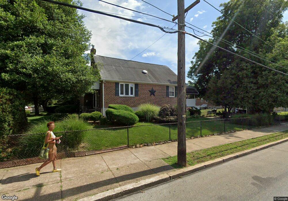
1100 Duncan Ave Lansdowne, PA 19050
Estimated Value: $255,000 - $284,000
3
Beds
3
Baths
1,541
Sq Ft
$172/Sq Ft
Est. Value
About This Home
This home is located at 1100 Duncan Ave, Lansdowne, PA 19050 and is currently estimated at $264,871, approximately $171 per square foot. 1100 Duncan Ave is a home located in Delaware County with nearby schools including Bell Avenue Elementary School, Penn Wood Middle School, and Penn Wood High School - Cypress Street Campus.
Ownership History
Date
Name
Owned For
Owner Type
Purchase Details
Closed on
Nov 16, 2004
Sold by
Reavis Gene C and Reavis Lillian
Bought by
Jones Eloise Jay
Current Estimated Value
Home Financials for this Owner
Home Financials are based on the most recent Mortgage that was taken out on this home.
Original Mortgage
$133,000
Outstanding Balance
$79,366
Interest Rate
8.85%
Mortgage Type
Fannie Mae Freddie Mac
Estimated Equity
$185,505
Purchase Details
Closed on
Feb 27, 2003
Sold by
Reavis Gene C and Will Of Earl D Reavis
Bought by
Reavis Gene C and Reavis Lillian
Create a Home Valuation Report for This Property
The Home Valuation Report is an in-depth analysis detailing your home's value as well as a comparison with similar homes in the area
Home Values in the Area
Average Home Value in this Area
Purchase History
| Date | Buyer | Sale Price | Title Company |
|---|---|---|---|
| Jones Eloise Jay | $140,000 | -- | |
| Reavis Gene C | -- | -- |
Source: Public Records
Mortgage History
| Date | Status | Borrower | Loan Amount |
|---|---|---|---|
| Open | Jones Eloise Jay | $133,000 |
Source: Public Records
Tax History Compared to Growth
Tax History
| Year | Tax Paid | Tax Assessment Tax Assessment Total Assessment is a certain percentage of the fair market value that is determined by local assessors to be the total taxable value of land and additions on the property. | Land | Improvement |
|---|---|---|---|---|
| 2025 | $5,429 | $127,150 | $39,940 | $87,210 |
| 2024 | $5,429 | $127,150 | $39,940 | $87,210 |
| 2023 | $4,931 | $127,150 | $39,940 | $87,210 |
| 2022 | $4,702 | $127,150 | $39,940 | $87,210 |
| 2021 | $7,110 | $127,150 | $39,940 | $87,210 |
| 2020 | $5,124 | $82,050 | $23,060 | $58,990 |
| 2019 | $5,034 | $82,050 | $23,060 | $58,990 |
| 2018 | $4,964 | $82,050 | $0 | $0 |
| 2017 | $4,860 | $82,050 | $0 | $0 |
| 2016 | $450 | $82,050 | $0 | $0 |
| 2015 | $450 | $82,050 | $0 | $0 |
| 2014 | $450 | $82,050 | $0 | $0 |
Source: Public Records
Map
Nearby Homes
- 1049 Yeadon Ave
- 6951 Chester Ave
- 923 Bell Ave
- 939 Serrill Ave
- 921 Serrill Ave
- 6835 Chester Ave
- 908 Yeadon Ave
- 210 Londonderry Ln
- 6718 Cobbs Creek Pkwy
- 808 Serrill Ave
- 908 Cedar Ave
- 7036 Greenway Ave
- 225 Wright Ave
- 133 N 3rd St
- 214 N 6th St
- 323 Berbro St
- 205 N Front St
- 200 N 6th St
- 306 Berbro St
- 252 N 9th St
- 1102 Duncan Ave
- 1104 Duncan Ave
- 605 Chester Ave
- 1101 Bell Ave
- 1103 Bell Ave
- 1054 Duncan Ave
- 1105 Bell Ave
- 1047 Bell Ave Unit REAR (R)
- 1047 Bell Ave
- 1052 Duncan Ave
- 1106 Duncan Ave
- 1101 Duncan Ave
- 1103 Duncan Ave
- 1045 Bell Ave
- 1050 Duncan Ave
- 1107 Bell Ave
- 1105 Duncan Ave
- 1043 Bell Ave
- 1055 Duncan Ave
- 1048 Duncan Ave