Estimated Value: $924,632
Studio
--
Bath
1,000
Sq Ft
$925/Sq Ft
Est. Value
About This Home
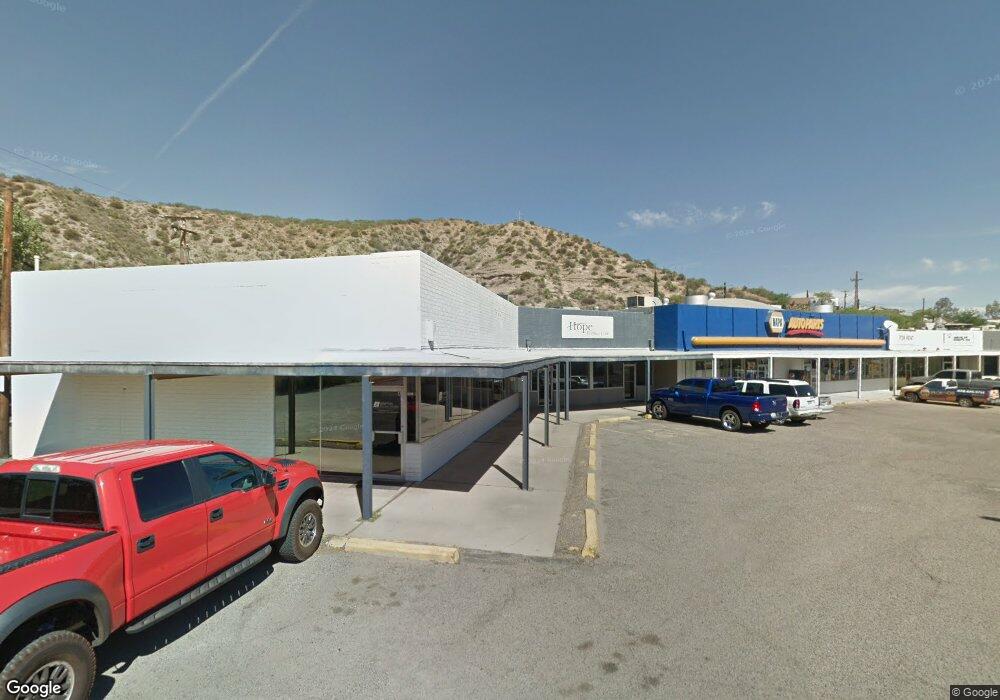
This home is located at 1100 N Broad St Unit F, Globe, AZ 85501 and is currently estimated at $924,632, approximately $924 per square foot. 1100 N Broad St Unit F is a home located in Gila County with nearby schools including Copper Rim Elementary School, High Desert Middle School, and Globe High School.
Ownership History
Date
Name
Owned For
Owner Type
Purchase Details
Closed on
Apr 5, 2022
Sold by
Globe Center Llc
Bought by
1100 Center Llc
Current Estimated Value
Home Financials for this Owner
Home Financials are based on the most recent Mortgage that was taken out on this home.
Original Mortgage
$500,000
Outstanding Balance
$463,793
Interest Rate
3.92%
Mortgage Type
Seller Take Back
Estimated Equity
$460,839
Purchase Details
Closed on
Jan 22, 2008
Sold by
The Kasie Co and Smith Reginald Garcia
Bought by
Globe Center Llc
Home Financials for this Owner
Home Financials are based on the most recent Mortgage that was taken out on this home.
Original Mortgage
$500,000
Interest Rate
6.09%
Mortgage Type
Seller Take Back
Create a Home Valuation Report for This Property
The Home Valuation Report is an in-depth analysis detailing your home's value as well as a comparison with similar homes in the area
Home Values in the Area
Average Home Value in this Area
Purchase History
| Date | Buyer | Sale Price | Title Company |
|---|---|---|---|
| 1100 Center Llc | $900,000 | Chicago Title | |
| Globe Center Llc | $1,045,000 | Pioneer Title Agency |
Source: Public Records
Mortgage History
| Date | Status | Borrower | Loan Amount |
|---|---|---|---|
| Open | 1100 Center Llc | $500,000 | |
| Previous Owner | Globe Center Llc | $500,000 |
Source: Public Records
Tax History
| Year | Tax Paid | Tax Assessment Tax Assessment Total Assessment is a certain percentage of the fair market value that is determined by local assessors to be the total taxable value of land and additions on the property. | Land | Improvement |
|---|---|---|---|---|
| 2026 | $10,464 | $138,202 | $2,837 | $135,365 |
| 2025 | $10,464 | -- | -- | -- |
| 2024 | $10,344 | $114,100 | $4,348 | $109,752 |
| 2023 | $10,344 | $103,399 | $8,888 | $94,511 |
| 2022 | $10,439 | $97,684 | $8,888 | $88,796 |
| 2021 | $10,963 | $97,684 | $8,888 | $88,796 |
| 2020 | $10,258 | $0 | $0 | $0 |
| 2019 | $10,112 | $0 | $0 | $0 |
| 2018 | $10,700 | $0 | $0 | $0 |
| 2017 | $10,994 | $0 | $0 | $0 |
| 2016 | $9,850 | $0 | $0 | $0 |
| 2015 | $9,819 | $0 | $0 | $0 |
Source: Public Records
Map
Nearby Homes
- 00 Highway 60
- 129 E Haskins Rd
- 267 E North St
- 518 E North St
- 1021 High
- 840 N Devereaux St
- 610 N Broad St
- 523 E Copper Hills Rd
- 396 N Broad St
- 415 N Hill St
- 360 W Bailey St
- 0000 Bailey -- Unit 1
- 300 N Broad St
- 339 N Devereaux St
- 254 N Broad St
- 501 E Mesquite St
- 543 E Mesquite St
- 196 E Cedar St
- 258 S Sutherland St
- 0 Cottonwood Unit 1806700
- 0 W Beruatti St -- Unit 52
- 1258 W Beruatti St
- 1232 W Beruatti St
- 1253 N Quartz Loop
- 1226 W Beruatti St
- 1247 N Quartz Loop
- 1214 W Beruatti St
- 1245 N Quartz Loop
- 1259 N Quartz Loop
- 230 W Lane St
- 1240 N Quartz Loop
- 196 W Lane St
- 1224 W Beruatti St Unit 1
- 1224 W Beruatti St Unit 61
- 180 W La Mesa Terrace
- 112 E Murphy St
- 220 Lane St
- 190 W La Mesa Terrace
- 1105 N Broad St
- 169 Lane St
Your Personal Tour Guide
Ask me questions while you tour the home.