Estimated Value: $761,000 - $822,000
4
Beds
4
Baths
3,956
Sq Ft
$201/Sq Ft
Est. Value
About This Home
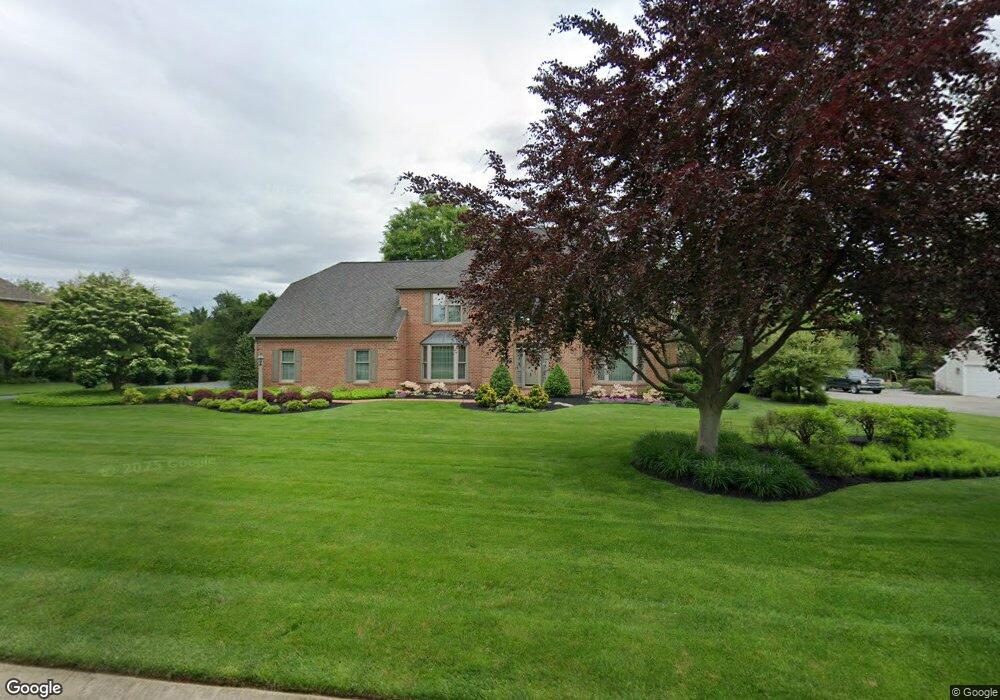
This home is located at 1100 Oakdale Dr, York, PA 17403 and is currently estimated at $795,740, approximately $201 per square foot. 1100 Oakdale Dr is a home located in York County with nearby schools including York Suburban Middle School, York Suburban Senior High School, and Lincoln Charter School.
Ownership History
Date
Name
Owned For
Owner Type
Purchase Details
Closed on
Sep 8, 2000
Sold by
Hershner Brian J and Hershner Linda J
Bought by
Ahlbrandt Duane E and Ahlbrandt Judith A
Current Estimated Value
Home Financials for this Owner
Home Financials are based on the most recent Mortgage that was taken out on this home.
Original Mortgage
$332,500
Outstanding Balance
$121,184
Interest Rate
8.1%
Estimated Equity
$674,556
Purchase Details
Closed on
Jul 6, 1989
Bought by
Hershner Brian J and Hershner Linda J
Create a Home Valuation Report for This Property
The Home Valuation Report is an in-depth analysis detailing your home's value as well as a comparison with similar homes in the area
Home Values in the Area
Average Home Value in this Area
Purchase History
| Date | Buyer | Sale Price | Title Company |
|---|---|---|---|
| Ahlbrandt Duane E | $432,500 | -- | |
| Hershner Brian J | $70,000 | -- |
Source: Public Records
Mortgage History
| Date | Status | Borrower | Loan Amount |
|---|---|---|---|
| Open | Ahlbrandt Duane E | $332,500 |
Source: Public Records
Tax History Compared to Growth
Tax History
| Year | Tax Paid | Tax Assessment Tax Assessment Total Assessment is a certain percentage of the fair market value that is determined by local assessors to be the total taxable value of land and additions on the property. | Land | Improvement |
|---|---|---|---|---|
| 2025 | $15,528 | $410,130 | $94,890 | $315,240 |
| 2024 | $15,124 | $410,130 | $94,890 | $315,240 |
| 2023 | $14,662 | $410,130 | $94,890 | $315,240 |
| 2022 | $14,267 | $410,130 | $94,890 | $315,240 |
| 2021 | $13,708 | $410,130 | $94,890 | $315,240 |
| 2020 | $13,612 | $410,130 | $94,890 | $315,240 |
| 2019 | $13,271 | $410,130 | $94,890 | $315,240 |
| 2018 | $12,991 | $410,130 | $94,890 | $315,240 |
| 2017 | $12,818 | $410,130 | $94,890 | $315,240 |
| 2016 | $0 | $410,130 | $94,890 | $315,240 |
| 2015 | -- | $410,130 | $94,890 | $315,240 |
| 2014 | -- | $410,130 | $94,890 | $315,240 |
Source: Public Records
Map
Nearby Homes
- 1165 Wyndsong Dr
- 1920 Rosewood Ln
- Lot #1 Rosewood Unit HAWTHORNE
- 925 Summit Cir N
- 102 Maribel Ln
- 275 Wyntre Brooke Dr
- 215 Wyntre Brooke Dr Unit 1
- 1190 Country Club Rd
- 2340 Croll School Rd
- 2350 Sutton Rd
- 1359 Ben Hogan Way
- 1000 Country Club Rd Unit B-2
- 1000 Country Club Rd Unit C5
- 1000 Country Club Rd Unit A13
- 1000 Country Club Rd Unit 8
- 1164 Rosecroft Ln
- 1138 Rosecroft Ln
- 1016 Rosecroft Ln Unit 8
- 1133 Rosecroft Ln
- 1028 Rosecroft Ln
- 1050 Oakdale Dr
- 1140 Oakdale Dr
- 1085 Wyndward Ct
- 1185 Wyndsong Dr
- 1665 Wyndham Dr
- 1685 Wyndham Dr
- 1645 Wyndham Dr
- 1840 Witness Rd
- 1695 Wyndham Dr
- 1800 Witness Rd
- 1625 S Wyndham Dr
- 1625 Wyndham Dr
- 1880 Witness Rd
- 1090 Wyndward Ct
- 1145 Wyndsong Dr
- 1050 Wyndward Ct
- 1670 Wyndham Dr
- 1190 Wyndsong Dr
- 1605 Wyndham Dr
- 1650 Wyndham Dr