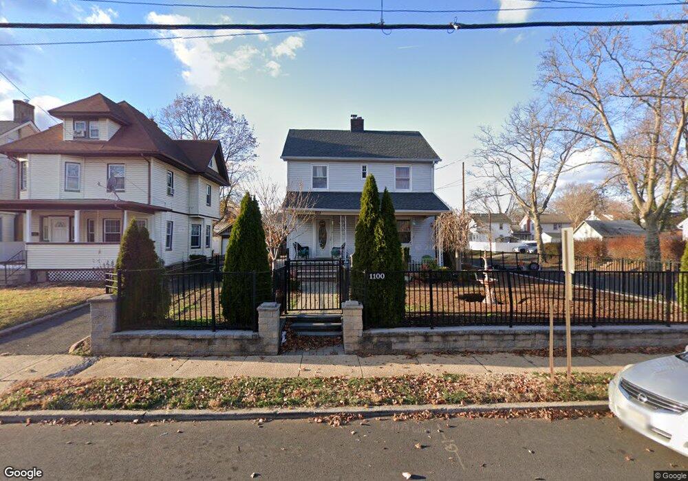
1100 W 6th St Unit 2 Plainfield, NJ 07063
Estimated Value: $388,960 - $532,000
--
Bed
--
Bath
1,442
Sq Ft
$307/Sq Ft
Est. Value
About This Home
This home is located at 1100 W 6th St Unit 2, Plainfield, NJ 07063 and is currently estimated at $443,240, approximately $307 per square foot. 1100 W 6th St Unit 2 is a home located in Union County with nearby schools including Clinton School, Hubbard Middle School, and Plainfield High School.
Ownership History
Date
Name
Owned For
Owner Type
Purchase Details
Closed on
Jan 7, 2013
Sold by
Beneficial Financial I Inc
Bought by
Lopez Walter O and Gonzalez Alba S
Current Estimated Value
Purchase Details
Closed on
Aug 27, 2012
Sold by
Walker Olivia
Bought by
Beneficial Financial I Inc
Create a Home Valuation Report for This Property
The Home Valuation Report is an in-depth analysis detailing your home's value as well as a comparison with similar homes in the area
Home Values in the Area
Average Home Value in this Area
Purchase History
| Date | Buyer | Sale Price | Title Company |
|---|---|---|---|
| Lopez Walter O | $70,000 | First American Title Ins Co | |
| Beneficial Financial I Inc | -- | -- |
Source: Public Records
Tax History Compared to Growth
Tax History
| Year | Tax Paid | Tax Assessment Tax Assessment Total Assessment is a certain percentage of the fair market value that is determined by local assessors to be the total taxable value of land and additions on the property. | Land | Improvement |
|---|---|---|---|---|
| 2025 | $7,230 | $82,800 | $33,300 | $49,500 |
| 2024 | $7,159 | $82,800 | $33,300 | $49,500 |
| 2023 | $7,159 | $82,800 | $33,300 | $49,500 |
| 2022 | $7,004 | $82,800 | $33,300 | $49,500 |
| 2021 | $6,943 | $82,800 | $33,300 | $49,500 |
| 2020 | $6,923 | $82,800 | $33,300 | $49,500 |
| 2019 | $6,923 | $82,800 | $33,300 | $49,500 |
| 2018 | $6,778 | $82,800 | $33,300 | $49,500 |
| 2017 | $6,612 | $82,800 | $33,300 | $49,500 |
| 2016 | $6,477 | $82,800 | $33,300 | $49,500 |
| 2015 | $6,286 | $82,800 | $33,300 | $49,500 |
| 2014 | -- | $82,800 | $33,300 | $49,500 |
Source: Public Records
Map
Nearby Homes
- 338 Manson Place Unit 40
- 333 Mcdowell St Unit 35
- 950 W 6th St Unit 52
- 355 Bergen St
- 318-20 Manson Place
- 1227 W 6th St
- 954 W 4th St
- 312 Monroe Ave Unit 14
- 318 Halsey St Unit 20
- 325-29 Stebbins Place Unit 4
- 223 Monroe Ave
- 667 S 2nd St
- 1222 W 3rd St Unit 24
- 809-11 W 4th St
- 1637 S 2nd St
- 4 Rauer Ct
- 1408 W 5th St
- 951 W Front St
- 905 Stelle Ave Unit 7
- 829 S 2nd St
- 1100-2 W 6th St
- 1104 W 6th St
- 1106 W 6th St
- 1044 W 6th St Unit 46
- 1044-46 W 6th St
- 1108 W 6th St Unit 10
- 1101 W 5th St Unit 3
- 1105 W 5th St Unit 7
- 1040 W 6th St Unit 42
- 1051-53 W 6th St
- 1109 W 5th St Unit 11
- 1051 W 6th St Unit 53
- 1101 W 6th St Unit 3
- 1041 W 5th St
- 1112 W 6th St Unit 14
- 1047 W 6th St Unit 49
- 1105 W 6th St
- 1036 W 6th St Unit 38
- 1043 W 6th St Unit 45
- 1037 W 5th St Unit 39